Sanarudravaram

Last updated
Sanarudravaram
Village
Location map India Andhra Pradesh EN.svg
Red pog.svg
Sanarudravaram
Location in Andhra Pradesh, India
India location map.svg
Red pog.svg
Sanarudravaram
Sanarudravaram (India)
Coordinates: 16°30′N81°16′E / 16.500°N 81.267°E / 16.500; 81.267 Coordinates: 16°30′N81°16′E / 16.500°N 81.267°E / 16.500; 81.267
Country India
State Andhra Pradesh
District Krishna
Government
  Type Democratic
  Body Panchayatraj
Area [1]
  Total 13.84 km2 (5.34 sq mi)
Population (2011) [1]
  Total 4,110
  Density 300/km2 (770/sq mi)
Languages
  Official Telugu
Time zone IST (UTC+5:30)

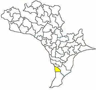
Sanarudravaram is a village in Kalidindi mandal, located in Krishna district of the Indian state of Andhra Pradesh. [1]

Kalidindi Village in Andhra Pradesh, India

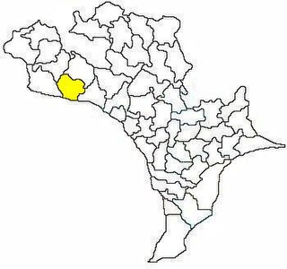
Kalidindi is a village in Krishna district of the Indian state of Andhra Pradesh. Kalidindi is also famous for aqua agriculture with latest techniques.

Krishna district District of Andhra Pradesh in India

Krishna district is an administrative district in the Coastal Andhra region of the Indian state of Andhra Pradesh. Machilipatnam is the administrative headquarters and Vijayawada is the most populated city in the district. It has an area of 8,727 km2 (3,370 sq mi) and had a population of 45,29,009 as per 2011 census of India. It is bounded by West Godavari on the east, Bay of Bengal on the South, Guntur and Suryapet districts in the west and a portion of it also borders with the state of Telangana. Krishna District is formed from District of Rajahmundry in 1859, Guntur district was separated from Krishna in 1904 to form Krishna district which was further divided in 1925, to Krishna and West Godavari districts.Krishna district is the most developed district in Andhra Pradesh.

India Country in South Asia

India, also known as the Republic of India, is a country in South Asia. It is the seventh largest country by area and with more than 1.3 billion people, it is the second most populous country and the most populous democracy in the world. Bounded by the Indian Ocean on the south, the Arabian Sea on the southwest, and the Bay of Bengal on the southeast, it shares land borders with Pakistan to the west; China, Nepal, and Bhutan to the northeast; and Bangladesh and Myanmar to the east. In the Indian Ocean, India is in the vicinity of Sri Lanka and the Maldives, while its Andaman and Nicobar Islands share a maritime border with Thailand and Indonesia.

Geography

Pothumarru is located at 16°31'46"N 81°18'46"E.

Related Research Articles

Barkhera city in Uttar Pradesh, India

Barkhera is a town and a nagar panchayat in Pilibhit district in the state of Uttar Pradesh, India.

Mahaban Town in Uttar Pradesh, India

Mahaban is a town and a nagar panchayat in Mathura district in the Indian state of Uttar Pradesh. Poet Raskhan's tomb is situated here.

Ranavav city in Gujarat, India

Ranavav is a city and a municipality in Porbandar district in the Indian state of Gujarat.

Vuyyuru Town in Andhra Pradesh, India

Vuyyuru is a town in Krishna district of the Indian state of Andhra Pradesh.It is a Nagar panchayat and the headquarters of Vuyyuru Mandal under Nuzvid revenue division.

Gampalagudem Village in Andhra Pradesh, India

Gampalagudem is a village in Krishna district of the Indian state of Andhra Pradesh. It is the headquarters of Gampalagudem mandal administered under Nuzvid revenue division. The village is located on the banks of Kattaleru River, at a distance of 145 km (90 mi) from the district headquarters, Machilipatnam and 74 kilometres (46 mi) from Vijayawada.

Kankipadu Census Town in Andhra Pradesh, India

Kankipadu is a census town in Krishna district of the Indian state of Andhra Pradesh. It is also the mandal headquarters of Kankipadu mandal in Vijayawada revenue division. The town is located on the banks of the Paleru River which is a tributary of the Krishna River.

Agiripalli Village in Andhra Pradesh, India

Agiripalli is a village and Mandal Head Quarters, in Krishna district of the Indian state of Andhra Pradesh. It is located in Agiripalli mandal Agiripalli is famous for Laxmi Narsimha Swamy Temple.

Challapalli Village in Andhra Pradesh, India

Challapalli, officially known as Challapalle, is a village in Krishna district of the Indian state of Andhra Pradesh. It is located in Challapalli mandal of Machilipatnam revenue division. Challapalli is one of the villages in the mandal to be a part of Andhra Pradesh Capital Region.

Chatrai Village in Andhra Pradesh, India

Chatrai is a village in Krishna district of the Indian state of Andhra Pradesh. It is located in Chatrai mandal of Nuzvid revenue division.

Kaikaluru Mandal in Andhra Pradesh, India

Kaikalur is a Mandal in Krishna district of the Indian state of Andhra Pradesh. Kaikalur is home to Kolleru Lake, one of the largest freshwater lakes in India.Covering about 90100 hectares and providing tourist destination.

Mylavaram Town in Andhra Pradesh, India

Mylavaram is a Town in Krishna district of the Indian state of Andhra Pradesh. It is located in Mylavaram mandal of Vijayawada revenue division.

Nandigama Town in Andhra Pradesh, India

Nandigama is a town in Krishna district of the Indian state of Andhra Pradesh. It is a Municipality and also the headquarters of Nandigama mandal in Vijayawada revenue division.

Ibrahimpatnam, Krishna district Census Town in Andhra Pradesh, India

Ibrahimpatnam is a census town in Krishna district of the Indian state of Andhra Pradesh. It is also the mandal headquarters of Ibrahimpatnam mandal. Dr Narla Tata Rao Thermal Power Station, one of the major Thermal power stations of the state is located near the town. Railway Wagon Workshop at Rayanapadu is also located very near to Ibrahimpatnam at a distance of 4 km.

Krishna Kittur Village makeme in Karnataka, India

Krishna-kittur is a village in the southern state of Karnataka, India. It is located in the Athani taluka of Belgaum district in Karnataka.

Chandarlapadu mandal Mandal in Andhra Pradesh, India

Chandarlapadu mandal is one of the 50 mandals in Krishna District of the Indian state of Andhra Pradesh. It is under the administration of Vijayawada revenue division and headquarters located at Chandarlapadu. The mandal is situated on the banks of Krishna River, bounded by Jaggayyapeta, Nandigama, Kanchikacherla mandals.

Pothumarru Village in Andhra Pradesh, India

Pothumarru is a village in Kalidindi mandal, located in Krishna district of the Indian state of Andhra Pradesh.

Vuyyuru mandal Mandal in Andhra Pradesh, India

Vuyyuru mandal is one of the 50 mandals in Krishna district of the Indian state of Andhra Pradesh. It is under the administration of Nuzvid revenue division and the headquarters are located at Vuyyuru town. The mandal is bounded by Kankipadu, Unguturu, Thotlavalluru, Pedaparupudi and Pamidimukkala mandals.

Avanigadda mandal Mandal in Andhra Pradesh, India

Avanigadda mandal is one of the 50 mandals in Krishna district of the Indian state of Andhra Pradesh. It is under the administration of Machilipatnam revenue division and the headquarters are located at Avanigadda. The mandal is bounded by Mopidevi, Koduru and Nagayalanka mandals.

Kanchikacherla mandal Mandal in Andhra Pradesh, India

Kanchikacherla mandal is one of the 50 mandals in Krishna district of the Indian state of Andhra Pradesh. It is under the administration of Vijayawada revenue division and the headquarters are located at Kanchikacherla. The mandal is bounded Veerullapadu, Chanderlapadu and Ibrahimpatnam mandals. A portion of it lies on the banks of Krishna river, separating it from Guntur district and also Munneru river separates it from Nandigama mandal.

References

  1. 1 2 3 "District Census Handbook - Krishna" (PDF). Census of India. p. 16,352. Retrieved 14 February 2016.