
Windermere is a residential neighborhood in northeastern Seattle, Washington, named after Windermere in England's Lake District. It is bounded on the north by Magnuson Park, part of Sand Point; on the northwest by Sand Point Way N.E., beyond which is Hawthorne Hills; on the southwest by Ivanhoe Place N.E., beyond which is Laurelhurst; and on the southeast by Lake Washington. The area has been a part of Seattle since 1910.
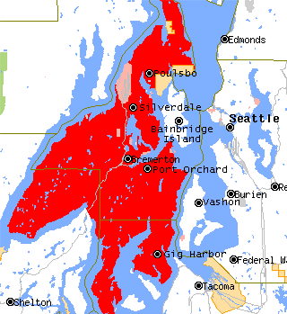
The Kitsap Peninsula lies west of Seattle across Puget Sound, in Washington state in the Pacific Northwest. Hood Canal separates the peninsula from the Olympic Peninsula on its west side. The peninsula, a.k.a. "Kitsap", encompasses all of Kitsap County except Bainbridge and Blake Islands, as well as the northeastern part of Mason County and the northwestern part of Pierce County. The highest point on the Kitsap Peninsula is Gold Mountain. The U.S. Navy's Puget Sound Naval Shipyard, and Naval Base Kitsap are on the peninsula. Its main city is Bremerton.
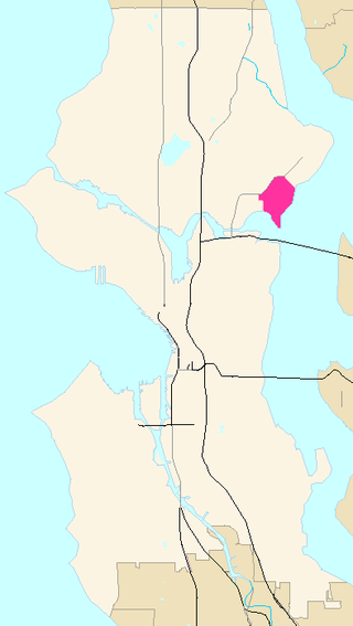
Laurelhurst is a residential neighborhood in northeastern Seattle, Washington, US. It is bounded on the northeast by Ivanhoe Place N.E., beyond which is Windermere; on the northwest by Sand Point Way N.E. and N.E. 45th Street, beyond which are Hawthorne Hills, Ravenna, and University Village; on the west by Mary Gates Memorial Drive N.E., beyond which is the East Campus of the University of Washington; on the southwest by Union Bay; and on the east by Lake Washington. Seattle Children's Hospital is located in its northwest corner. Once a seasonal campground of the Duwamish people, the neighborhood has been a part of Seattle since its annexation in 1910.

Sand Point is a neighborhood in Seattle, Washington, United States, named after and consisting mostly of the Sand Point peninsula that juts into Lake Washington, which is itself largely given over to Magnuson Park. Its southern boundary can be said to be N.E. 65th Street, beyond which are Windermere and Hawthorne Hills; its northern boundary, N.E. 95th Street, beyond which is Lake City. The western limit of the neighborhood, beyond which are View Ridge and Wedgwood, is not fixed and can be said to be anywhere up the hill that extends west from Sand Point Way N.E. as far as 35th Avenue N.E. It is also the former home of Seattle Naval Air Station.
Houghton is one of the lakeside neighborhoods of the city of Kirkland, Washington. Consisting mostly of upscale, single-family homes, Houghton overlooks Lake Washington and is one of the wealthier districts of the Eastside suburbs of Seattle. The village was named for Willard Houghton, a local lumberman. Houghton incorporated in 1948. In 1950, Census records showed there were 1,065 people living in the town of Houghton. The city of Houghton was annexed by Kirkland in 1968 and became the first community in Washington with a neighborhood council.

Baker Beach is a public beach on the peninsula of San Francisco, California, United States The beach lies on the shore of the Pacific Ocean in the northwest of the city. It is roughly a 0.5 mi (800 m) long, beginning just south of Golden Gate Point, extending southward toward the Seacliff peninsula, the Palace of the Legion of Honor and the Sutro Baths. The northern section of Baker Beach is "frequented by clothing-optional sunbathers," and as such it is considered a nude beach.
Liberty Bay is a narrow inlet extending about 4 miles in a northerly direction from the northwest part of Port Orchard, adjacent to the Kitsap Peninsula in Western Washington.

The Key Peninsula lies along Puget Sound to the south of Kitsap Peninsula in the U.S. state of Washington. It is part of Pierce County and is bordered to the west by Case Inlet and to the east by Carr Inlet. The peninsula is approximately 16 miles (26 km) long and has two Washington State Parks.

The Long Beach Peninsula is an arm of land on the southern coast of the state of Washington in the United States. Entirely within Pacific County, it is bounded on the west by the Pacific Ocean, the south by the Columbia River, and the east by Willapa Bay. Leadbetter Point State Park and Willapa National Wildlife Refuge are at the northern end of the peninsula and Cape Disappointment is at the southern end, with Pacific Pines State Park located in between.
Hawthorne Hills is a residential neighborhood in Seattle, Washington. It is officially split between the neighborhoods of Bryant and Windermere, but is generally recognized as a distinct neighborhood. The northern boundary is Northeast 65th Street. The southern and eastern boundary is Sand Point Way. The western boundary is 40th Avenue Northeast. Hawthorne Hills is bounded on the north by View Ridge, on the east by Windermere, on the south by Laurelhurst, and on the west by Bryant. There is a sign for the neighborhood along Sand Point Way.
North Beach / Blue Ridge is a neighborhood in the city of Seattle, in the U.S. state of Washington.
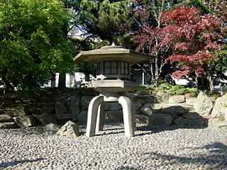
Kobe Terrace is a 1-acre (4,000 m2) public park in the International District neighborhood of Seattle, Washington. It incorporates the Danny Woo International District Community Garden. Named after Kobe, Seattle's sister city in Japan, it occupies most of the land bounded on the west by 6th Avenue S., on the north by S. Washington Street, on the east by Interstate 5, and on the south by S. Main Street.
Eagledale Park is a 7-acre (28,000 m2) park located in the neighborhood of Eagledale on Bainbridge Island in the state of Washington, U.S.. Like several other parks on Bainbridge Island, Eagledale Park comprises land that was once a military installation. Today the park features tennis courts, an off-leash dog park, a picnic shelter, a children's play area, a sand volleyball court and a pottery studio.
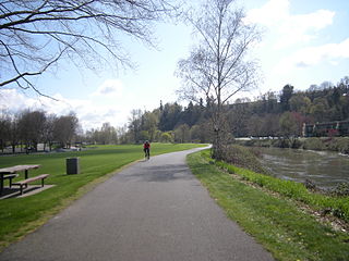
Fort Dent is a historic fort and present-day park in Tukwila, Washington.

Quarry Lakes Regional Recreation Area is a regional park located in Fremont, California that is part of the East Bay Regional Parks system. Before being converted into a park, the site was used as a gravel quarry. When water purchased by the public for groundwater recharge of the Niles Cone flooded the gravel pits, the gravel harvesters began to daily pump the seeping water down Alameda Creek into San Francisco Bay. The Alameda County Water District acquired the quarry after the pumping was declared to be an illegal waste in 1976.
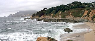
Montara State Marine Reserve (SMR) and Pillar Point State Marine Conservation Area (SMCA) are two adjoining marine protected areas that extend offshore from Montara to Pillar Point in San Mateo County on California’s north central coast. The combined area of these marine protected areas is 18.42 square miles (47.7 km2), with 11.76 square miles (30.5 km2) in the SMR and 6.66 in the SMCA. Montara SMR prohibits the take of all living marine resources. Pillar Point SMCA prohibits the take of all living marine resources, except the recreational and commercial take of pelagic finfish by trolling or seine, the commercial or recreational take of Dungeness crab by trap and the commercial or recreational take or market squid by hand-held dip net or round haul net.
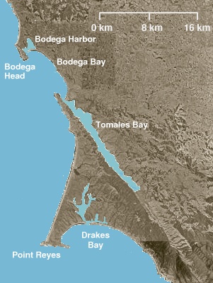
Point Reyes State Marine Reserve (SMR) and Point Reyes State Marine Conservation Area (SMCA) are two adjoining marine protected areas that extend offshore of Point Reyes Headlands and within Drakes Bay in Marin County on California's north central coast. The combined area of these marine protected areas is 21.49 square miles (55.7 km2), with 9.38 in the SMR, and 12.11 in the adjacent SMCA. Point Reyes SMR prohibits the take of all living marine resources. Point Reyes SMCA prohibits the take of all living marine resources, except the recreational and commercial take of Dungeness crab by pot and salmon by trolling.
Rocky Point is a census-designated place (CDP) in Kitsap County, Washington, United States.
Puget is an unincorporated community in Thurston County, in the U.S. state of Washington. The area is located on the Johnson Point peninsula overlooking Nisqually Reach.

Straight Shot is a 2007 public art work at the Sand Point calibration baseline in Magnuson Park, Seattle. It was created by Seattle artist Perri Lynch, and funded by the City of Seattle's 1% for Art program, Trimble and the Washington Surveyors Association. The baseline at Sand Point predates the development of Magnuson Park, and was originally at the western edge of the Navy's Naval Air Station Seattle runway at the location. The artwork was created in part to illustrate the importance of the baseline to surveyors and to preserve the baseline – "in peril of being destroyed" – as a part of the park. The work has been nicknamed "Linehenge" by surveyors.


