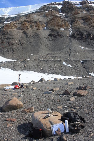
The Homerun Range is a northwest-trending range, 28 nautical miles long and 2 to 7 nautical miles wide, east of Everett Range at the heads of the Ebbe Glacier and Tucker Glacier in Victoria Land, Antarctica.

The Usarp Mountains are a major mountain range in North Victoria Land, Antarctica. They are west of the Rennick Glacier and trend north to south for about 190 kilometres (118 mi). The mountains are bounded to the north by Pryor Glacier and the Wilson Hills. They are west of the Bowers Mountains.

The Prince Charles Mountains are a major group of mountains in Mac. Robertson Land in Antarctica, including the Athos Range, the Porthos Range, and the Aramis Range. The highest peak is Mount Menzies, with a height of 3,228 m (10,591 ft). Other prominent peaks are Mount Izabelle and Mount Stinear. These mountains, together with other scattered peaks, form an arc about 420 km (260 mi) long, extending from the vicinity of Mount Starlight in the north to Goodspeed Nunataks in the south.
The Betekhtin Range is a mountain range about 14 nautical miles long, forming the southern arm of the Humboldt Mountains in Queen Maud Land, Antarctica.
Simpson Glacier is a glacier, 6 nautical miles, in the Admiralty Mountains, Antarctica. It flows northward to the coast between Nelson Cliff and Mount Cherry-Garrard where it forms the Simpson Glacier Tongue.
The Inland Forts are a line of peaks extending between Northwest Mountain and Saint Pauls Mountain, in the Asgard Range of Victoria Land, Antarctica. The peaks were discovered by Ervon r. Koenig and named by the British National Antarctic Expedition, 1901–04.
The Land Glacier is a broad, heavily crevassed glacier, about 35 nautical miles long, descending into Land Bay in Marie Byrd Land, Antarctica. It was discovered by the United States Antarctic Service (1939–41) and named for Rear Admiral Emory S. Land, Chairman of the United States Maritime Commission.
The Worcester Range is a high coastal range, about 30 nautical miles long, in Antarctica. It stands between Skelton Glacier and Mulock Glacier on the western side of the Ross Ice Shelf. It is southwest of the Royal Society Range and north of the Conway Range of the Cook Mountains.
Rennick Glacier is broad glacier, nearly 200 nautical miles long, which is one of the largest in Antarctica. It rises on the polar plateau westward of Mesa Range and is 20 to 30 nautical miles wide, narrowing to 10 nautical miles near the coast. It takes its name from Rennick Bay where the glacier reaches the sea.

Robertson Bay is a large, roughly triangular bay that indents the north coast of Victoria Land between Cape Barrow and Cape Adare. Discovered in 1841 by Captain James Clark Ross, Royal Navy, who named it for Dr. John Robertson, surgeon on HMS Terror.
The Latady Mountains are a group of mountains rising west of Gardner Inlet and between Wetmore Glacier and Ketchum Glacier, in southeastern Palmer Land, Antarctica.
Sverre Peak is a small peak 0.5 nautical miles (0.9 km) off the north end of Pettersen Ridge in the Conrad Mountains of Queen Maud Land. Discovered and photographed by the German Antarctic Expedition, 1938–39. Mapped by Norway from air photos and surveys by the Norwegian Antarctic Expedition, 1956–60, and named for Sverre Pettersen, steward with Norwegian Antarctic Expedition, 1957–58.
The Grosvenor Mountains are a group of widely scattered mountains and nunataks rising above the Antarctic polar plateau east of the head of Mill Glacier, extending from Mount Pratt in the north to the Mount Raymond area in the south, and from Otway Massif in the northwest to Larkman Nunatak in the southeast.
Pitkevitch Glacier is a glacier, 20 nautical miles long, flowing north from the Admiralty Mountains along the west side of DuBridge Range in Antarctica. The glacier reaches the sea just east of Atkinson Cliffs, where it forms Anderson Icefalls. A portion of the terminus merges northwestward with Fendley Glacier.
The Eidshaugane Peaks are a group of peaks 1 nautical mile north of Eidsgavlen Cliff in the Humboldt Mountains of Queen Maud Land, Antarctica.
Molar Massif is a large mountain massif immediately east of the Lanterman Range in the Bowers Mountains of Antarctica. It was mapped by the United States Geological Survey (USGS) from ground surveys and United States Navy air photos, 1960–1964. The descriptive name was applied by the United States Advisory Committee on Antarctic Names (US-ACAN) because, when viewed in plan, the outline of the massif resembles a molar tooth.

The Morozumi Range is a mountain range in the Usarp Mountains of North Victoria Land, Antarctica. It extends northwest–southeast for 25 miles (40 km), with its northern elevations overlooking the convergence of Gressitt Glacier and Rennick Glacier.
The Marshall Mountains are a group of mountains overlooking Beardmore Glacier in the Queen Alexandra Range, Antarctica. They are bounded on the north by Berwick Glacier, and on the south by Swinford Glacier.

Read Mountains is a group of rocky summits, the highest being Holmes Summit at 1,875 metres (6,152 ft), lying east of Glen Glacier in the south-central part of the Shackleton Range.
![]() This article incorporates public domain material from "Sandnesstaven Peak". Geographic Names Information System . United States Geological Survey.
This article incorporates public domain material from "Sandnesstaven Peak". Geographic Names Information System . United States Geological Survey. 


