Sandy Point, United States Virgin Islands | |
|---|---|
Village | |
| Country | |
| Island | Saint Croix |
| Time zone | UTC-4 (AST) |
Sandy Point is a settlement on the island of Saint Croix in the United States Virgin Islands.
Sandy Point, United States Virgin Islands | |
|---|---|
Village | |
| Country | |
| Island | Saint Croix |
| Time zone | UTC-4 (AST) |
Sandy Point is a settlement on the island of Saint Croix in the United States Virgin Islands.

The United States Virgin Islands, officially the Virgin Islands of the United States, are a group of Caribbean islands and an unincorporated and organized territory of the United States. The islands are geographically part of the Virgin Islands archipelago and are located in the Leeward Islands of the Lesser Antilles to the east of Puerto Rico and west of the British Virgin Islands.

The United States Virgin Islands are a group of several dozen islands and cays located in the Caribbean, about 1,100 miles (1,770 km) southeast of Florida, 600 miles (966 km) north of Venezuela, 40 miles (64 km) east of Puerto Rico, and immediately west and south of the British Virgin Islands.

Saint Croix is an island in the Caribbean Sea, and a county and constituent district of the United States Virgin Islands (USVI), an unincorporated territory of the United States.
Kingshill is a settlement on the island of Saint Croix in the United States Virgin Islands. Kingshill is home to the University of the Virgin Islands campus in St. Croix. The St. Croix campus opened in 1964.

Cruz Bay, U.S. Virgin Islands is the main town on the island of Saint John in the United States Virgin Islands. According to the 2000 census, Cruz Bay had a population of 2,743.
The area code (340) is the local telephone area code of U.S. Virgin Islands. The (340) area code was created during a split from the original (809) area code, which began permissive dialing on 1 June 1997 and ended 30 June 1998.

Trunk Bay is a body of water and a beach on St. John in the United States Virgin Islands. Trunk Bay is part of the Virgin Islands National Park. Trunk Bay is named for the Leatherback turtle, which is endemic to the U.S.V.I. and is locally known as trunks. The beach area is divided into two halves, the main Trunk Bay beach and swim area and Burgesman Cove which is located on the west end of Trunk Bay near Jumby Bay. Its amenities include a snack bar, showers and restrooms, a lifeguard, and an underwater trail for snorkeling its coral reef. Trunk Bay has consistently been voted one of the top beaches in the world.

Cinnamon Bay is a body of water and a beach on St. John island, within Virgin Islands National Park, in the United States Virgin Islands.
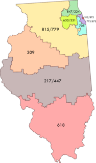
Area code 309 is a telephone area code serving the west-central portion of the U.S. state of Illinois. Cities in this area code include Bloomington, Canton, East Moline, East Peoria, Galesburg, Kewanee, Macomb, Minonk, Moline, Morton, Normal, Pekin, Peoria, Rock Island, and Silvis, in addition to many smaller communities within the western part of central Illinois.

Western Cove is located on Bar Haven Island in Placentia Bay. It is formed between Newfoundland, Labrador, and Bar Haven.
Waterlemon Cay is a small cay surrounded by a fringing reef located in Leinster Bay on Saint John, U.S. Virgin Islands. It is named after the water lemon.

Eureka is an unincorporated community in Luce Township, Spencer County, in the U.S. state of Indiana.
Bolongo is a settlement on the island of Saint Thomas in the United States Virgin Islands.
Lameshur is a former plantation on the island of Saint John in the United States Virgin Islands. It is inside Virgin Islands National Park and home to the Virgin Islands Environmental Resource Station (VIERS). The Tektite program placed two underwater habitats in Great Lameshur Bay and the Tektite Underwater Habitat Museum is located in the VIERS camp. The road to Lameshur is unmaintained and 4 wheel drive vehicles are often required. The University of the Virgin Islands has a research station and dock in Lameshur on Yawzi Point.
Sion Farm is a settlement on the island of Saint Croix in the United States Virgin Islands.
Smithfield is a settlement on the island of Saint Croix in the United States Virgin Islands.
Upper Bethlehem is a settlement on the island of Saint Croix in the United States Virgin Islands.
Coria Cove is the 1 km wide cove indenting for 1.15 km the east coast of Liège Island in the Palmer Archipelago, Antarctica. The cove is centred at 64°01′07″S61°52′50″W, which is 7.2 km southwest of Neyt Point. British mapping in 1978.
Travisville is an unincorporated community in Harrison Township, Wells County, in the U.S. state of Indiana.
Coordinates: 17°41′31″N64°52′50″W / 17.69194°N 64.88056°W
| | This Saint Croix, United States Virgin Islands location article is a stub. You can help Wikipedia by expanding it. |