Related Research Articles

Pawnee County is a county in the U.S. state of Nebraska. As of the 2010 United States Census, the population was 2,773. Its county seat is Pawnee City.

Stafford County is a county located in the U.S. state of Kansas. As of the 2020 census, the county population was 4,072. Its county seat is St. John. The county is named in honor of Lewis Stafford, captain of Company E, First Kansas Infantry, who was killed at the Battle of Young's Point in Madison Parish, Louisiana on June 7, 1863.
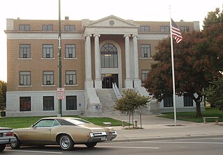
Rush County is a county located in the U.S. state of Kansas. As of the 2020 census, the county population was 2,956. The largest city and county seat is La Crosse.
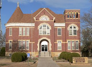
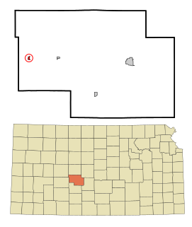
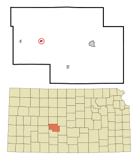
Pawnee County is a county located in the U.S. state of Kansas. As of the 2020 census, the county population was 6,253. The largest city and county seat is Larned.

Ness County is a county located in the U.S. state of Kansas. As of the 2020 census, the county population was 2,687. The largest city and county seat is Ness City. The county was named for Corporal Noah V. Ness of the 7th Kansas Cavalry.

Hodgeman County is a county located in the U.S. state of Kansas. As of the 2020 census, the county population was 1,723. Its county seat and most populous city is Jetmore.
Burdett is a city in Pawnee County, Kansas, United States. As of the 2020 census, the population of the city was 228.

Garfield is a city in Pawnee County, Kansas, United States. As of the 2020 census, the population of the city was 151.

Larned is a city in and the county seat of Pawnee County, Kansas, United States. As of the 2020 census, the population of the city was 3,769.
Rozel is a city in Pawnee County, Kansas, United States. As of the 2020 census, the population of the city was 102.

Wakenda is an unincorporated community in Carroll County, in the U.S. state of Missouri.

Nekoma is an unincorporated community in Rush County, Kansas, United States. It lies along K-96 southwest of the city of La Crosse.
Rose is an unincorporated community in Rock County, Nebraska, United States, located on the east side of U.S. Route 183. As of 2015, the hamlet consisted of two houses and a post office.

Pawnee Station is an unincorporated community in Bourbon County, Kansas, United States.
Antonino is an unincorporated community in Lookout Township, Ellis County, Kansas, United States.
Ash Valley is an unincorporated community in Pawnee County, Kansas, United States.
Frizell is an unincorporated community in Pawnee County, Kansas, United States.
Schaffer is an unincorporated community in Rush County, Kansas, United States.
Swanwick is an unincorporated community in Ray County, in the U.S. state of Missouri and part of the Kansas City metropolitan area.
Zook was a town located in Pawnee County, Kansas. The town was started by the Mennonite John Zook, who came to Larned, Kansas, in the 1880s and then moved his family to the location that would become Zook, a mile east of what is now Highway 19 in southeastern Pawnee County.
References
- ↑ "Pawnee County". Blue Skyways. Kansas State Library. Retrieved 22 June 2014.
- ↑ "Kansas Post Offices, 1828-1961". Kansas Historical Society. Archived from the original on October 9, 2013. Retrieved 22 June 2014.
