
Claflin is a city in Barton County, Kansas, United States. As of the 2020 census, the population of the city was 562.

Pawnee Rock is a city in Barton County, Kansas, United States. As of the 2020 census, the population of the city was 193.

Leon is a city in Butler County, Kansas, United States. As of the 2020 census, the population of the city was 669.

Hepler is a city in Crawford County, Kansas, United States. As of the 2020 census, the population of the city was 90.
Mulberry is a city in Crawford County, Kansas, United States. As of the 2020 census, the population of the city was 409.

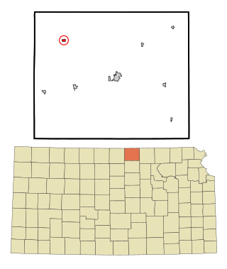
Norcatur is a city in Decatur County, Kansas, United States. As of the 2020 census, the population of the city was 159.

Gove City, more commonly known as Gove, is a city in and the county seat of Gove County, Kansas, United States. As of the 2020 census, the population of the city was 80.

Jetmore is a city in and the county seat of Hodgeman County, Kansas, United States. As of the 2020 census, the population of the city was 770.

Edgerton is a city in Johnson County, Kansas, United States, and part of the Kansas City metropolitan area. As of the 2020 census, the population of the city was 1,748. It is home to a large BNSF intermodal train facility named Logistics Park Kansas City.

Kingman is a city in and the county seat of Kingman County, Kansas, United States. As of the 2020 census, the population of the city was 3,105.

Basehor is a city in Leavenworth County, Kansas, United States which is included statistically in the Kansas City metropolitan area. As of the 2020 census, the population of the city was 6,896.

Meade is a city in and the county seat of Meade County, Kansas, United States. As of the 2020 census, the population of the city was 1,505.

Ness City is a city in and the county seat of Ness County, Kansas, United States. As of the 2020 census, the population of the city was 1,329. Ness City is famous for its four-story Old Ness County Bank Building located downtown and nicknamed Skyscraper of the Plains.

Lyndon is a city in and the county seat of Osage County, Kansas, United States. As of the 2020 census, the population of the city was 1,037.

Garfield is a city in Pawnee County, Kansas, United States. As of the 2020 census, the population of the city was 151.

Larned is a city in and the county seat of Pawnee County, Kansas, United States. As of the 2020 census, the population of the city was 3,769.

Belleville is a city in and the county seat of Republic County, Kansas, United States. As of the 2020 census, the population of the city was 2,007.
Republic is a city in Republic County, Kansas, United States. As of the 2020 census, the population of the city was 82.

Andale is a city in Sedgwick County, Kansas, United States. As of the 2020 census, the population of the city was 941.

Alma is a city in and the county seat of Wabaunsee County, Kansas, United States. As of the 2020 census, the population of the city was 802.


