Sankt Oswald ob Eibiswald | |
|---|---|
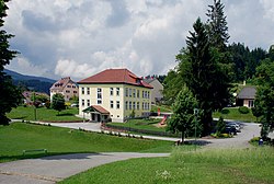 View of Sankt Oswald ob Eibiswald | |
 Coat of arms | |
 Sankt Oswald ob Eibiswald Location within Austria | |
| Coordinates: 46°42′30″N15°08′48″E / 46.70833°N 15.14667°E | |
| Country | Austria |
| State | Styria |
| District | Deutschlandsberg |
| Area | |
• Total | 22.43 km2 (8.66 sq mi) |
| Elevation | 747 m (2,451 ft) |
| Population (2014-01-01) | |
• Total | 562 |
| • Density | 25/km2 (65/sq mi) |
| Time zone | UTC+1 (CET) |
| • Summer (DST) | UTC+2 (CEST) |
| Postal code | 8553 |
| Area code | 03468 |
| Vehicle registration | DL |
| Website | www.oswald-o-e.at |
Sankt Oswald ob Eibiswald was a municipality in Austria which merged in January 2015 into Eibiswald in the Deutschlandsberg District in the Austrian state of Styria.