This article needs additional citations for verification .(July 2013) |
Sansa is a village in Aurangabad district, Bihar, India,. [1] The village is situated on the road joining Daudnagar to Haspura.
This article needs additional citations for verification .(July 2013) |
Sansa is a village in Aurangabad district, Bihar, India,. [1] The village is situated on the road joining Daudnagar to Haspura.
B.L. Indo Anglian Public School, Aurangabad, on NH-98 25 km from Daudnagar

Kaser is a village in the town of Ramapo, Rockland County, New York, United States. The village is completely surrounded by the hamlet of Monsey. As of the 2020 United States census, the village population was 5,491.

Magadh University is an institution of higher education in Bihar, India. It is recognized by the University Grants Commission (UGC).
Troitsk is the name of several inhabited localities in Russia.

Gangapur is a town and a municipal council in Aurangabad district in the state of Maharashtra, India.

Rafiganj is a town and a notified area in Aurangabad district in the Indian state of Bihar. It is the district's second-largest town in population after Aurangabad, and also the second-largest town in area. Rafiganj is located 25 km away from the District Administration.

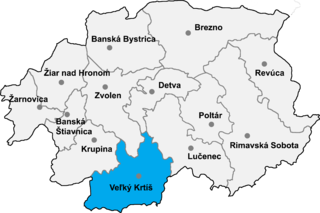
Kleňany is a village and municipality in the Veľký Krtíš District of the Banská Bystrica Region of southern Slovakia.

Baghanis is a village in the Tavush Province of Armenia.

Bronczany is a village in the administrative district of Gmina Juchnowiec Kościelny, within Białystok County, Podlaskie Voivodeship, in north-eastern Poland. It lies approximately 6 kilometres (4 mi) north of Juchnowiec Kościelny and 7 km (4 mi) south-west of the regional capital Białystok.

Podładzin is a village in the administrative district of Gmina Pajęczno, within Pajęczno County, Łódź Voivodeship, in central Poland. It lies approximately 6 kilometres (4 mi) south-east of Pajęczno and 79 km (49 mi) south of the regional capital Łódź.

National Highway 139 is a National Highway in India within the states of Bihar and Jharkhand. NH-139 links Rajhara, to Patna, the state capital of Bihar. This 207-kilometre-long (129 mi) highway passes through Arwal, Daudnagar and Aurangabad.

Obra is a small town 15 km away from the district headquarters on NH-98 (Garwa-Patna). As of 2018 Obra has a population of 14,786. In the Obra block there are 20 panchayats each averaging 6 villages. The geographic block is demarcated in the east and south by Daudnagar, Rafiganj, Aurangabad and in the west by Rohtas district. Situated on the confluence of Punpun and Adri river, the rolling topography of the town is typical, spread on the plain of the Son river bed known for its very fertile land.
Raigu is a village in Väike-Maarja Parish, Lääne-Viru County, in northeastern Estonia.
Barera is a village in Allahabad, Uttar Pradesh, India. It is located on the outskirts of Bijnor near New Delhi.
After 1960, Maharashtra Industrial Development Corporation (MIDC) began acquiring land and setting up industrial estates. Land was acquired near Shendra village on Aurangabad - Jalna highway in the 1990s.
Surkhi is a small village in Obra Block in Aurangabad District in Bihar, India. Surkhi is under Sonahuli Panchayat.
Gölbelen, Çıldır is a village in the District of Çıldır, Ardahan Province, Turkey.
Bhalu Khaira is a village and a notified area in Aurangabad district in the Indian state of Bihar.

Dindir is a village in Aurangabad District of Bihar, India. It is located 48 km north from District headquarter Aurangabad, 7 km east from Haspura and 94 km south from Patna. Area wise it is the largest village of district Aurangabad and is designated as ideal village. Dindir Pin code is 824120 and postal head office is Haspura.

Shamshernagar is a large village in the Daudnagar subdivision and block in Aurangabad district, located in Bihar, India. The town falls under the jurisdiction of the Magadh division. Situated on the bank of the Sone River, the National Highway 139 passes through the village. The Indrapuri Barrage canal is a local waterway. Shamshernagar is densely populated. It has adequate infrastructure, including a middle school, an intermediate high school, an additional Primary Health Centre, and a Regional Rural Bank (MBGB). Shamshernagar is an electrified village. and possesses a water tank for its water supply. It shares a border between Aurangabad and Arwal districts. Buses, auto-rickshaws and e-rickshaws provide regional transportation.
Coordinates: 24°04′N79°07′E / 24.067°N 79.117°E