
Priorat is a comarca (county) in Catalonia, Spain. The central part of the comarca, "Priorat històric," produces the highly-regarded wines that are certified under the DOQ Priorat. Wines from elsewhere in the comarca are certified as DO Montsant although this region also has a small segment of the neighboring comarca, Ribera d'Ebre as well.
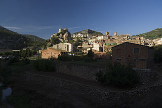
Pratdip is a municipality in the comarca of Baix Camp, in the province of Tarragona, Catalonia, Spain.

The Statistical Institute of Catalonia is the official body responsible for collecting and publishing statistics in the autonomous community of Catalonia, Spain. The institute comes under the Department of the Economy and Finances of the Generalitat de Catalunya.

Lleida Pirineus is an important railway station serving the city of Lleida in Catalonia, Spain. It is located between the neighbourhoods of Pardinyes and Rambla de Ferran. The first train services in Lleida date of 1860, but the station wasn't built until 1927, and it did not adopt its current official name until 2003, when it underwent an ambitious reform. As a transport hub connecting the interior of Spain with the Corredor Mediterráneo, it serves both broad gauge and standard gauge trains, operated by both Adif-Renfe and Ferrocarrils de la Generalitat de Catalunya. It is the terminus of several regional railway services centered in Aragon and Catalonia. It's also one of the stations on the Madrid–Barcelona high-speed rail line, and it was its north-eastern terminus until 2008.

Tuc de Molières is a mountain located between Catalonia and Aragon, in Spain. Located in the Pyrenees, it has an elevation of 3,011 metres above sea level.
Turó de Morou is a mountain of Catalonia, Spain. It has an elevation of 1,303 metres above sea level.
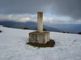
Turó del Samont is a mountain of Catalonia, Spain. It has an elevation of 1,272 metres above sea level.

Sant Jeroni is a mountain of Catalonia, Spain. It has an elevation of 1,236 metres above sea level.
Turó de Bellver is a mountain of Catalonia, Spain. It has an elevation of 1,041 metres above sea level.
Puig Castellar (Balenyà) is a mountain of Catalonia, Spain. It has an elevation of 1,017 metres above sea level.
Punta de la Barrina is a mountain of Catalonia, Spain. It has an elevation of 1,013 metres above sea level.
Turó de Sant Elies is a mountain of Catalonia, Spain. It has an elevation of 1,003 m (3,291 ft) above sea level.

La Miranda is a mountain of the Catalan Pre-Coastal Range in the autonomous community of Catalonia in Spain. It has an elevation of 918 metres above sea level.
Puig Cornador is a mountain of Catalonia, Spain. It has an elevation of 859 metres above sea level.
Turó del Galutxo is a mountain of Catalonia, Spain. It has an elevation of 851 metres above sea level.

Turó de la Creu de Gurb is a mountain of Catalonia, Spain. It has an elevation of 841 metres above sea level.
Puig-l'agulla is a mountain of Catalonia, Spain. It has an elevation of 810 metres above sea level.
Turó Gros is a mountain of Catalonia, Spain. It has an elevation of 766 metres above sea level.
Puig Cornador is a mountain of Catalonia, Spain. It has an elevation of 621 metres above sea level.

The Catalan Transversal Range is a system of minor mountain ranges at the eastern end of the Pre-Pyrenees, between the Osona and Garrotxa comarques. The existence of the Catalan Transversal Range has made communications in the northern areas of Catalonia difficult in the past, especially between Northeastern Catalonia and Western Catalonia, a problem that has been partly solved with the development of the Eix Transversal.


