Related Research Articles

Coatepec Harinas is one of 125 municipalities in the State of Mexico, Mexico. The municipal seat is the town of Coatepec Harinas. The original name is "Coauhtepetl" which means 'serpent hill' in Náhuatl. Around 1825 because of a boom in flour production, the name "Harinas" was added.

Atlatlahucan is a city in the Mexican state of Morelos. The name means Place of red or brown water, and today the water is stored in a type of cistern called a jagüey. To the north is the State of Mexico, south is Cuautla, east is Yecapixtla, and west are Tlayacapan and Yautepec. It stands at 18°56′N98°54′W, at a mean height of 1,656 metres above sea level. The municipality covers 71 km2.

Santa Isabel Ishuatán is a municipality in the Sonsonate department of El Salvador.
San Salvador Atenco is the municipal seat of Atenco, in the Mexican state of Mexico. The name "Atenco" comes from a Nahuatl phrase meaning "place on the edge of water".
San Martin del Estado is a small village of the state of Oaxaca, Mexico. With a population of approximately 1,000 people (cite) it is hidden in the midst of the Sierra Madre of Oaxaca. Most of the people from this village have migrated to the United States in cities like Santa Maria, Farmersville, Oceanside, and Oxnard, California, as well as Mesa, Arizona.

Tepexpan is the largest town in the Acolman municipality in the State of Mexico, Mexico. The population was 48,103 as of the 2005 Mexican census.

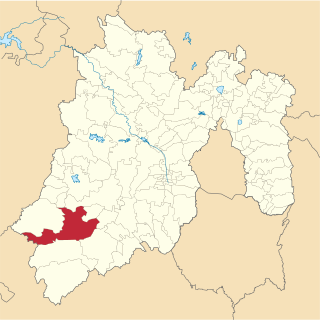
Ixtapan de la Sal is a town and municipality located in the State of Mexico, Mexico. It is 60 km south of Toluca, the state's capital,, and 120 km south of Mexico City by the Federal Road 55. The word Ixtapan comes from Nahuatl. There are two theories as to the origin of the name. The first one states that it is composed of iztal, which means salt, and pan, which means over or in. The second one states that it comes from iztac which means white; atl which means water; and pan which means in white waters. The phrase de la Sal is Spanish for of salt.
Ixtapan del Oro is a town and municipality in the State of Mexico, in Mexico. The name “Ixtapan” comes from Nahuatl and means 'in the place of little salt'. "del Oro" is Spanish, meaning 'of the gold'. This name was added in 1894 when some veins of gold were found here.
Tejupilco is a municipality in the State of Mexico, Mexico, located approximately 100 kilometres (62 mi) southwest of the state capital Toluca, along Federal Highway 34. Its municipal seat is Tejupilco de Hidalgo. The municipality has a total area of about 1,327 km2 (512 sq mi), with a contrasting topography ranging from deep ravines and canyons to high ridges; the highest elevation within the municipality reaches some 1,117 metres (3,660 ft) asl. The 2005 census recorded a population of 62,547 inhabitants.
730 AM is a Mexican and Canadian clear-channel frequency. XEX Mexico City and CKAC Montreal are the Class A stations on 730 kHz. The following radio stations broadcast on AM frequency 730 kHz:
Pilcaya is one of the 81 municipalities of Guerrero, in south-western Mexico. The municipal seat lies at Pilcaya. The municipality covers an area of 62.1 km².
Pilcaya is a town and municipal seat of the Municipality of Pilcaya in the state of Guerrero, Mexico, located 153 kilometres (95 mi) from Mexico City, 105 kilometres (65 mi) from Cuernavaca, 84 kilometres (52 mi) from Toluca, 68 kilometres (42 mi) from Taxco and 5 kilometres (3 mi) from Ixtapan de la Sal. The name "Pilcaya" is from the Nahuatl word pilcacyan, place of a hanging object.
San Miguel Santa Flor is a town and municipality in Oaxaca in south-western Mexico. The municipality covers an area of 38.27 km². It is part of Cuicatlán District in the north of the Cañada Region. It received its name as its first settlers cultivated many flowers.
Banderilla is a municipality located in the central zone of the State of Veracruz, Mexico, about 9 km from the state capital, Xalapa. It has a surface area of 22.21 km². It is located at 19°35′N96°56′W. Tradition has it that the name alludes to a small flag (banderilla) that thieves would hoist on the summit of the hill of La Martinica as a signal to their accomplices that a valuable goods were being moved along the royal highway.
Santa Isabel Cholula is a town and municipality in Puebla in south-eastern Mexico.
Tepexi de Rodríguez (municipality) is a town and municipality in Puebla in south-eastern Mexico.
Zacapala (municipality) is a town and municipality in Puebla in south-eastern Mexico.

Benito Juárez Municipality is a municipality in Tlaxcala in south-eastern Mexico. This municipality was founded in 1995. It used to be a town of the municipality of Sanctórum de Lázaro Cárdenas.
Santa Isabel Xiloxoxtla is a municipality in Tlaxcala in south-eastern Mexico.

Noville Peninsula is a high ice-covered peninsula about 30 nautical miles (60 km) long, between Peale and Murphy Inlets on the north side of Thurston Island in Antarctica. Delineated from aerial photographs made by U.S. Navy Operation Highjump in December 1946. Named for George O. Noville, executive officer of Byrd Antarctic Expedition, 1933–35.
References
- ↑ "SANTA ISABEL IXTAPAN" . Retrieved 2008-12-12.
- ↑ Anaya Rodriguez, Edgar (December 2003). "En la tierra del mamut". Mexico Desconocido (in Spanish). 322. Archived from the original on 2013-01-12. Retrieved 2008-11-25.
Coordinates: 19°35′N98°56′W / 19.583°N 98.933°W
| | This article about a location in the state of Mexico is a stub. You can help Wikipedia by expanding it. |