
Juan Bautista de Anza Bezerra Nieto was an expeditionary leader, military officer, and politician primarily in California and New Mexico under the Spanish Empire. He is credited as one of the founding fathers of Spanish California and served as an official within New Spain as Governor of the Province of New Mexico.

Chino is a city in the western end of San Bernardino County, California, United States, with Los Angeles County to its west and Orange County to its south in the Southern California region. Chino is adjacent to Chino Hills, California. Chino's surroundings have long been a center of agriculture and dairy farming, providing milk products in Southern California and much of the southwestern United States. Chino's agricultural history dates back to the Spanish land grant forming Rancho Santa Ana del Chino. The area specialized in fruit orchards, row crops, and dairy.

Gilroy is a city in Northern California's Santa Clara County, south of Morgan Hill and north of San Benito County. Gilroy is the southernmost city in the San Francisco Bay Area, with a population of 56,766 as of the 2019 U.S. Census Projections.

Aptos is an unincorporated town in Santa Cruz County, California. The town is made up of several small villages, which together form Aptos: Aptos Hills-Larkin Valley, Aptos Village, Cabrillo, Seacliff, Rio del Mar, and Seascape. Together, they have a combined population of 24,402.

Candelaria, officially the Municipality of Candelaria, is a 1st class municipality in the province of Quezon, Philippines. According to the 2020 census, it has a population of 137,881 people.
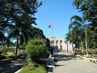
Apalit, officially the Municipality of Apalit, is a 1st class municipality in the province of Pampanga, Philippines. According to the 2020 census, it has a population of 117,160 people.

Misiones is a department located in the southern region of Paraguay. Its capital is San Juan Bautista. The eighth of Paraguay's 17 departments, it was created in 1906, then known as the San Ignacio Department, and was not given its present name until 1945. Its current name reflects its status as home to several Jesuit Reductions, or missions.

Nebo School District is a public school district that serves the southern part of Utah County.

Santa Teresa is a district of San Jose, California, United States, located in South San Jose. Founded in 1834, Santa Teresa was originally established as Rancho Santa Teresa by the Bernal family, a prominent Californio clan. Today, Santa Teresa is largely a residential area, but also home to numerous Silicon Valley tech campuses.
Capistrano Unified School District (CUSD) is the second largest school district in Orange County, California, United States. It is the 8th largest district in the state and the 78th largest in the country. The district currently has 54,036 students and administers 33 elementary schools, two K-8 schools, ten middle schools, six comprehensive high schools, five charter schools, and multiple alternative education programs.
Guadalupe School District is a school district in Guadalupe, California, in northwestern Santa Barbara County. The district is composed of two schools, Mary Buren School (K-5) and Kermit McKenzie Junior High School (6-8) and there are 1157 students enrolled in this school district.
Midland Independent School District is a public school district in Midland, Texas. Midland ISD contains 40 campuses, two 6A high schools, 24 elementary schools, and two early education centers.

Santa Monica–Malibu Unified School District is a school district located in Santa Monica, California. The district serves the cities of Santa Monica and Malibu. It has ten elementary schools, two middle schools, three high schools, an adult high school, and an alternative school.
The Guam Department of Education (GDOE), formerly the Guam Public School System, is a school district that serves the United States territory of Guam. The school district can be thought of as analogous to the school districts of other cities and communities in the United States, but in some manners, it can also be thought of as analogous to the state education agencies of other states and territories.
Santa Rosa Independent School District is a public school district based in Santa Rosa, Texas. Their rivals are La Feria. Their mascot is the Warrior and their school colors are black and gold.

San Juan Bautista Tuxtepec, or simply referred to as Tuxtepec, is the head of the municipality by the same name and is the second most populous city of the Mexican state of Oaxaca. It is part of the Tuxtepec District of the Papaloapan Region. As of the 2020 census, the city is home to a population of 103,609 and 159,452 in the municipality, though census data are often under reported for various reasons. The municipality resides in the region called La Cuenca, is located 36 feet above sea level, and occupies an area of approximately 580 square miles (1,500 km2). The city itself is surrounded by the Papaloapan River, and lies a few kilometers south of the Cerro de Oro Dam on its tributary the Santo Domingo River. The municipality is bordered by the state of Veracruz in the north, the municipalities of Loma Bonita to the east and San José Chiltepec to the south. It is almost 100 miles (160 km) to the port of Veracruz, 130 miles (210 km) to Oaxaca City, the state capital, and 310 miles (500 km) to Mexico City.

Ramos Mejía is a Town in La Matanza Partido, Buenos Aires Province, Argentina. The town has an area of 11.9 km2 (4.6 sq mi) and a population of 98,547. The city is one of the largest commercial districts in the Western Zone of Greater Buenos Aires.
The Eastside Union School District is a school district that serves the eastern part of the city of Lancaster, California (USA).

San Juan Bautista Cuicatlán is a town and municipality in Oaxaca in south-western Mexico. The municipality covers an area of 543.5 km². It is part of Cuicatlán District in the north of the Cañada Region.

Tuxtepec District is located in the north of the Papaloapan Region of the State of Oaxaca, Mexico.