Sante River

Last updated
Sante River
Country United States
Physical characteristics
Main source Michigan

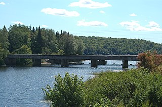
The Sante River is an 8.7-mile-long (14.0 km) [1] stream on the Upper Peninsula of Michigan in the United States. Via the North Branch Otter River, Otter River, Sturgeon River and Portage River, its waters flow to Lake Superior.

Michigan State of the United States of America

Michigan is a state in the Great Lakes and Midwestern regions of the United States. The state's name, Michigan, originates from the Ojibwe word mishigamaa, meaning "large water" or "large lake". With a population of about 10 million, Michigan is the tenth most populous of the 50 United States, with the 11th most extensive total area, and is the largest state by total area east of the Mississippi River. Its capital is Lansing, and its largest city is Detroit. Metro Detroit is among the nation's most populous and largest metropolitan economies.

United States federal republic in North America

The United States of America (USA), commonly known as the United States or America, is a country composed of 50 states, a federal district, five major self-governing territories, and various possessions. At 3.8 million square miles, the United States is the world's third or fourth largest country by total area and is slightly smaller than the entire continent of Europe's 3.9 million square miles. With a population of over 327 million people, the U.S. is the third most populous country. The capital is Washington, D.C., and the largest city by population is New York City. Forty-eight states and the capital's federal district are contiguous in North America between Canada and Mexico. The State of Alaska is in the northwest corner of North America, bordered by Canada to the east and across the Bering Strait from Russia to the west. The State of Hawaii is an archipelago in the mid-Pacific Ocean. The U.S. territories are scattered about the Pacific Ocean and the Caribbean Sea, stretching across nine official time zones. The extremely diverse geography, climate, and wildlife of the United States make it one of the world's 17 megadiverse countries.

The Otter River is a 10.0-mile-long (16.1 km) river in Houghton County, Michigan, in the United States. It was home to the last known population of Michigan Grayling. No grayling have been seen or caught in the river since 1938.

See also

Related Research Articles

Otter Lake (Michigan) list of lakes that share the same name

Otter Lake is the name of several lakes and one village in the U.S. state of Michigan.

Brule River tributary of the Menominee River in Michigan and Wisconsin, United States

The Brule River is a 52.3-mile-long (84.2 km) river in the U.S. states of Michigan and Wisconsin. Nearly the entire course forms a portion of the boundary between the two states.

Yates Township, McLean County, Illinois Township in Illinois, United States

Yates Township is located in McLean County, Illinois. As of the 2010 census, its population was 287 and it contained 121 housing units. Yates Township formed as Union Township from Chenoa Township on June 5, 1862. Union was changed to Yates sometime prior to 1920.

The Mitchigan River is a 14.9-mile-long (24.0 km) stream in the Upper Peninsula of the U.S. state of Michigan. It flows into the Fence River at 46°17′27″N88°09′58″W in northeast Iron County in Mansfield Township. The Fence River is a tributary of the Michigamme River, which is itself a tributary the Menominee River, flowing to Lake Michigan. The Mitchigan River has its source in the southeast corner of Baraga County at 46°24′58″N88°08′05″W. It flows mostly southward along the boundary between Iron and Marquette counties, crossing briefly into western Marquette County.

The Iron River is a 17.1-mile-long (27.5 km) river in Iron County, Michigan, in the United States. It flows from northwest to southeast through the city of Iron River to the Brule River. It is part of the Menominee River watershed, flowing to Lake Michigan.

The Little Misery River is a 7.0-mile-long (11.3 km) river on the Keweenaw Peninsula of the U.S. state of Michigan. It flows into the Misery River at 46°59′50″N88°58′52″W, shortly before it flows into Lake Superior.

The Misery River is a 24.2-mile-long (38.9 km) river on the Keweenaw Peninsula of the U.S. state of Michigan.

The Murphy River is a 6.6-mile-long (10.6 km) river in Baraga County on the Upper Peninsula of Michigan in the United States. It is a tributary of Worm Lake, the outlet of which is the Rock River, which flows to the Sturgeon River and eventually to Lake Superior.

The Net River is a 14.9-mile-long (24.0 km) river in Michigan in the United States. Its headwaters rise in Baraga County and flow southwest into Iron County, where the main stem forms and flows to the Paint River above Crystal Falls.

The Perch River is a 25.4-mile-long (40.9 km) tributary of the Sturgeon River in Iron County and Baraga County on the Upper Peninsula of Michigan in the United States. The Perch River begins at the outlet of Perch Lake in Bates Township and flows north through Ottawa National Forest to the Sturgeon River.

Peshekee River river in the United States of America

The Peshekee River is a 31.1-mile-long (50.1 km) river on the Upper Peninsula of Michigan in the United States. It is a tributary of Lake Michigamme, and its waters flow via the Michigamme River and the Menominee River to Lake Michigan.

The Spruce River is a 9.9-mile-long (15.9 km) tributary of the Michigamme River on the Upper Peninsula of Michigan in the United States. Via the Michigamme River and the Menominee River, it is a tributary of Lake Michigan.

The Silver River is a 24.9-mile-long (40.1 km) river in the U.S. state of Michigan. It rises from the outflow of Fisher Lake at 46°39′18″N88°14′06″W and flows in an arc to the northwest and then bending to northeast before emptying into Huron Bay of Lake Superior at 46°48′58″N88°17′45″W.

The Silver River is a 31.3-mile-long (50.4 km) stream in the Upper Peninsula in the U.S. state of Michigan.

The Ravine River is a 16.2-mile-long (26.1 km) stream on the Upper Peninsula of Michigan in the United States.

The Spurr River is a short stream in the Upper Peninsula of the U.S. state of Michigan. It rises from the outflow of Beaufort Lake at 46°32′47″N88°11′14″W and flows 3.9 miles (6.3 km) east-southeast into Lake Michigamme at 46°31′43″N88°07′54″W.

The Pike River is an 11.6-mile-long (18.7 km) stream in Houghton County in the U.S. state of Michigan.

The Rock River is a 6.1-mile-long (9.8 km) stream in Baraga County on the Upper Peninsula of Michigan in the United States. It rises at the outlet of Worm Lake, east of Covington, and flows northwest to the Sturgeon River, which continues west, then north to Portage Lake and Lake Superior. The Rock River descends 350 feet (110 m) over its 6-mile (10 km) course, for an average rate of 58 feet per mile.

References

  1. U.S. Geological Survey. National Hydrography Dataset high-resolution flowline data. The National Map, accessed January 3, 2012

Coordinates: 46°57′08″N88°38′54″W / 46.95222°N 88.64833°W / 46.95222; -88.64833

Geographic coordinate system Coordinate system

A geographic coordinate system is a coordinate system that enables every location on Earth to be specified by a set of numbers, letters or symbols. The coordinates are often chosen such that one of the numbers represents a vertical position and two or three of the numbers represent a horizontal position; alternatively, a geographic position may be expressed in a combined three-dimensional Cartesian vector. A common choice of coordinates is latitude, longitude and elevation. To specify a location on a plane requires a map projection.