
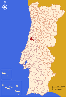
Leça da Palmeira is a former civil parish in the municipality of Matosinhos in the Greater Porto area, Portugal. In 2013, the parish merged into the new parish Matosinhos e Leça da Palmeira. It has 5.97 km² and had 17.215 inhabitants in the 2001 census.
Soure is a town and municipality of the Coimbra District, in Portugal. The population in 2011 was 19,245, in an area of 265.06 km². It has a castle.

Cadaval is a municipality in Lisbon District in Portugal. The population in 2011 was 14,228, in an area of 174.89 km².

Figueiró dos Vinhos is a city in Leiria District - Portugal. The population in 2011 was 6,169, in an area of 173.44 km².

The Comunidade Intermunicipal da Lezíria do Tejo is an administrative division in Portugal. It was established as an Associação de Municípios in 1987, converted into a Comunidade Urbana in 2003, and converted into a Comunidade Intermunicipal in November 2008. It is also a NUTS3 subregion of the Alentejo Region. The seat of the intermunicipal community is the city of Santarém. Lezíria do Tejo comprises municipalities of the former districts of Santarém and Lisbon. Lezíria do Tejo belongs to the Lisboa e Vale do Tejo Region for planning. The population in 2011 was 247,453, in an area of 4,275 km².
Cedofeita is a former civil parish in the municipality of Porto, Portugal. In 2013, the parish merged into the new parish Cedofeita, Santo Ildefonso, Sé, Miragaia, São Nicolau e Vitória. The population in 2011 was 22,077, in an area of 2.71 km².
Foz do Douro is a former civil parish in the municipality of Porto, Portugal. In 2013, the parish merged into the new parish Aldoar, Foz do Douro e Nevogilde. The population in 2011 was 10,997, in an area of 1.88 km². It became a parish in 1836. It is located in the western part of Porto, next to the mouth of the Douro river and the Atlantic Ocean. It is one of the most affluent areas of city Porto, and known for being inhabited by the upper classes.

Massarelos is a former civil parish in the municipality of Porto, Portugal. In 2013, the parish merged into the new parish Lordelo do Ouro e Massarelos. The population in 2011 was 6,789, in an area of 1.94 km².

Santo Ildefonso is a former civil parish in the municipality of Porto, Portugal. In 2013, the parish merged into the new parish Cedofeita, Santo Ildefonso, Sé, Miragaia, São Nicolau e Vitória. The population in 2011 was 9,029, in an area of 1.24 km².

São Nicolau is a former civil parish in the municipality of Porto, Portugal. In 2013, the parish merged into the new parish Cedofeita, Santo Ildefonso, Sé, Miragaia, São Nicolau e Vitória. The population in 2011 was 1,906, in an area of 0.25 km².
Miragaia is a former civil parish in the municipality of Porto, Portugal. In 2013, the parish merged into the new parish Cedofeita, Santo Ildefonso, Sé, Miragaia, São Nicolau e Vitória. The population in 2011 was 2,067, in an area of 0.43 km2.

Amorim is a suburban area in Póvoa de Varzim, Portugal. It is an ancient ecclesiastical parish and former civil parish. It is bordered by Aver-o-Mar to the west and by Terroso to the east. In the census of 2001, it had a population of 2,856 inhabitants and a total area of 5.65 km². In 2013, it was amalgamated in the civil parish known as União das Freguesias de Aver-o-Mar, Amorim e Terroso.
Huete is a municipality in Cuenca, Castile-La Mancha, Spain. It has a population of 2,097.

Mafamude is a former civil parish in the municipality of Vila Nova de Gaia, Portugal. In 2013, the parish merged into the new parish Mafamude e Vilar do Paraíso. The population in 2011 was 38,544, in an area of 5.28 km². It is an urban parish in the city of Gaia.

Pedroso is a former civil parish in the municipality of Vila Nova de Gaia, Portugal. In 2013, the parish merged into the new parish Pedroso e Seixezelo. The population in 2011 was 18,714, in an area of 19.43 km².
São Mamede de Infesta, or simply São Mamede, is a former civil parish in the municipality of Matosinhos in the Greater Porto area, Portugal. In 2013, the parish merged into the new parish São Mamede de Infesta e Senhora da Hora. It has a population of approximately 28,000 inhabitants and is located just north of the city of Porto.
Santiago is a former civil parish in the municipality of Tavira, Portugal. In 2013, the parish merged into the new parish Tavira.

Püha is a village in Saaremaa Parish, Saare County in western Estonia.
Huntstown is a ghost town in Putnam County, in the U.S. state of Ohio.


