
Freguesia, usually translated as "parish" or "civil parish", is the third-level administrative subdivision of Portugal, as defined by the 1976 Constitution. It is also a local administrative unit in the former Portuguese overseas territories of Cape Verde and Macau. In the past, was also an administrative division of the other Portuguese overseas territories. The parroquia in the Spanish autonomous communities of Galicia and Asturias is similar to a freguesia.

Camarate is a former civil parish in the municipality of Loures, Lisbon District, Portugal. In 2013, the parish merged into the new parish Camarate, Unhos e Apelação. With a population of 23,000 inhabitants in 2001, the parish of Camarate extends into an area of 5.52 km².
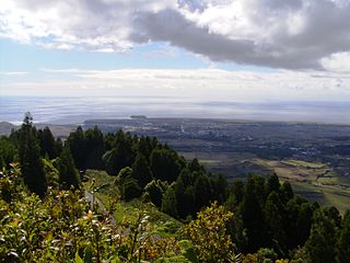
Vila do Porto is the single municipality, the name of the main town and one of the civil parishes on the island of Santa Maria, in the Portuguese archipelago of Azores. Its nearest neighbor, administratively, is the municipality of Povoação on the southern coast of São Miguel, and it is physically southwest of the islets of the Formigas. The population in 2011 was 5,552, in an area of 96.89 km².

Almada, Cova da Piedade, Pragal e Cacilhas is a civil parish in the municipality of Almada, in the Portuguese district of Setúbal. It was formed in 2013 from the merger of the former parishes of Almada, Cova da Piedade, Pragal and Cacilhas, and covers an area of 6.15 square kilometres (66,200,000 sq ft). In 2011 there were 49,661 inhabitants in the reconstituted parish.

Macedo de Cavaleiros is a municipality in northeastern Portugal, in Bragança District. The population in 2011 was 15,776, in an area of 699.14 km².

Santo Espírito is a Portuguese civil parish, located in the municipality of Vila do Porto, in the autonomous region of Azores. The population in 2011 was 588, in an area of 26.68 km².
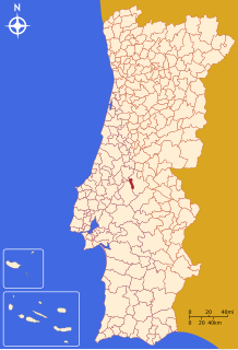
Constância is a municipality in Santarém District in Portugal. The population in 2011 was 4,056, in an area of 80.37 km².
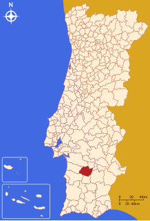
Ferreira do Alentejo is a town and a municipality in Beja District in Portugal. The population in 2011 was 8,255, in an area of 648.25 km².
Arrentela is a former civil parish in the municipality (concelho) of Seixal, Lisbon Metropolitan Area, Portugal. In 2013, the parish merged into the new parish Seixal, Arrentela e Aldeia de Paio Pires. The population in 2011 was 28,886, in an area of 10.17 km². It is situated on the south side of the estuary of the river Tagus.

Santo António dos Olivais, commonly shortened to Olivais, is an urban civil parish in the municipality of Coimbra in Portugal, making up the eastern part of the historic city of Coimbra, east of University Hill. The population in 2011 was 38,936, in an area of 19.27 km². It is the most populated parish in the Municipality of Coimbra, and among the most densely inhabited in the country outside of Lisbon and Porto metropolitan areas. Created in 1836, the parish was named for Anthony of Padua, who joined the local branch of the Order of Friars Minor; Anthony took his name from Saint Anthony the Great, to whom the local Franciscan hermitage was dedicated.
Celeirós is a civil parish in the Trás-os-Montes municipality of Sabrosa. The population in 2011 was 222, in an area of 5.25 km².
Fontes is a civil parish in the municipality of Santa Marta de Penaguião, in the northern Douro region of Portugal. The population in 2011 was 835, in an area of 15.67 km².

Loures is a city and a municipality in the central Portuguese Grande Lisboa Subregion. It is situated to the north of Lisbon. It was created on 26 July 1886 by a royal decree. The population in 2011 was 199,494, in an area of 167.24 km². It borders the municipalities of Odivelas, Sintra, Mafra, Arruda dos Vinhos, Vila Franca de Xira and Lisbon. The municipality is basically divided in three areas: the rustic one, to the north, the urban one, to the south and the urban-industrial, to the east. Portela de Sacavém is the site of Portugal's largest airport.
Nossa Senhora do Bispo is a former civil parish in the municipality of Montemor-o-Novo, Portugal. In 2013, the parish merged into the new parish Nossa Senhora da Vila, Nossa Senhora do Bispo e Silveiras. It has an area of 121.83 km², and a population of approximately 5411 inhabitants in 2001 (approximately 44 inhabitants per km².
Vítor Hugo Rosário Mendes Correia is a Portuguese futsal player who plays as a defender for Olho Marinho and the Portugal national team.
Vidago, Arcossó, Selhariz e Vilarinho das Paranheiras is a civil parish in the municipality of Chaves, Portugal. It was formed in 2013 by the merger of the former parishes Vidago, Arcossó, Selhariz and Vilarinho das Paranheiras. The population in 2011 was 1,991, in an area of 24.57 km².
Loures is a civil parish in the municipality of Loures, Portugal. It is an urban parish, part of the city of Loures. The population in 2011 was 26,769, in an area of 32.82 km².

