Related Research Articles

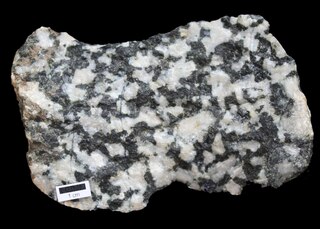
Diorite is an intrusive igneous rock formed by the slow cooling underground of magma that has a moderate content of silica and a relatively low content of alkali metals. It is intermediate in composition between low-silica (mafic) gabbro and high-silica (felsic) granite.

The Acasta Gneiss Complex, also called the Acasta Gneiss, is a body of felsic to ultramafic Archean basement rocks, gneisses, that form the northwestern edge of the Slave Craton in the Northwest Territories, Canada, about 300 km (190 mi) north of Yellowknife, Canada. This geologic complex consists largely of tonalitic and granodioritic gneisses and lesser amounts of mafic and ultramafic gneisses. It underlies and is largely concealed by thin, patchy cover of Quaternary glacial sediments over an area of about 13,000 km2 (5,000 sq mi). The Acasta Gneiss Complex contains fragments of the oldest known crust and record of more than a billion years of magmatism and metamorphism. The Acasta Gneiss Complex is exposed in a set of anticlinoriums within the foreland fold and thrust belt of the Paleoproterozoic Wopmay Orogen.

The Narryer Gneiss terrane is a geological complex in Western Australia that is composed of a tectonically interleaved and polydeformed mixture of granite, mafic intrusions and metasedimentary rocks in excess of 3.3 billion years old, with the majority of the Narryer Gneiss terrane in excess of 3.6 billion years old. The rocks have experienced multiple metamorphic events at amphibolite or granulite conditions, resulting in often complete destruction of original igneous or sedimentary (protolith) textures. Importantly, it contains the oldest known samples of the Earth's crust: samples of zircon from the Jack Hills portion of the Narryer Gneiss have been radiometrically dated at 4.4 billion years old, although the majority of zircon crystals are about 3.6-3.8 billion years old.

The Gascoyne Complex is a terrane of Proterozoic granite and metamorphic rock in the central-western part of Western Australia. The complex outcrops at the exposed western end of the Capricorn Orogen, a 1,000 km-long arcuate belt of folded, faulted and metamorphosed rocks between two Archean cratons; the Pilbara craton to the north and the Yilgarn craton to the south. The Gascoyne Complex is thought to record the collision of these two different Archean continental fragments during the Capricorn Orogeny at 1830–1780 Ma.

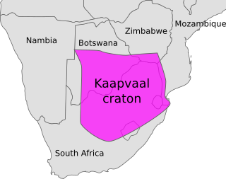
The Kaapvaal Craton, along with the Pilbara Craton of Western Australia, are the only remaining areas of pristine 3.6–2.5 Ga crust on Earth. Similarities of rock records from both these cratons, especially of the overlying late Archean sequences, suggest that they were once part of the Vaalbara supercontinent.

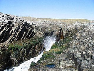
The Lizard complex, Cornwall is generally accepted to represent a preserved example of an exposed ophiolite complex in the United Kingdom. The rocks found in The Lizard area are analogous to those found in such famous areas as the Troodos Mountains, Cyprus and the Semail Ophiolite, Oman.

Granite Mountain is a 7,628-foot (2,325 m) mountain located in Yavapai County, Arizona that covers roughly 12 square miles (31 km2). It was once known as Mount Gurley, for the first governor of the Arizona Territory, John A. Gurley. Its southwest face has a sheer granite cliff approximately 500 feet high that is one of the best locations for rock climbing in the state of Arizona. It is located in the Granite Mountain Wilderness, which is managed as a part of the Prescott National Forest. The mountain stands at the northern end of the Sierra Prietas, and borders Skull Valley on the west, on the northwest by the Santa Maria Mountains, and east by the Williamson Valley.

Guernsey has a geological history stretching further back into the past than most of Europe. The majority of rock exposures on the Island may be found along the coastlines, with inland exposures scarce and usually highly weathered. There is a broad geological division between the north and south of the Island. The Southern Metamorphic Complex is elevated above the geologically younger, lower lying Northern Igneous Complex. Guernsey has experienced a complex geological evolution with multiple phases of intrusion and deformation recognisable.

The Lewisian complex or Lewisian gneiss is a suite of Precambrian metamorphic rocks that outcrop in the northwestern part of Scotland, forming part of the Hebridean Terrane and the North Atlantic Craton. These rocks are of Archaean and Paleoproterozoic age, ranging from 3.0–1.7 billion years (Ga). They form the basement on which the Stoer Group, Wester Ross Supergroup and probably the Loch Ness Supergroup sediments were deposited. The Lewisian consists mainly of granitic gneisses with a minor amount of supracrustal rocks. Rocks of the Lewisian complex were caught up in the Caledonian orogeny, appearing in the hanging walls of many of the thrust faults formed during the late stages of this tectonic event.
Uriconian rocks are volcanic rocks found in parts of Shropshire, United Kingdom. The name relates to Uriconio, the Latin name for an Iron Age hillfort on the summit of the Wrekin, a hill formed of Uriconian rock.

The Wrekin terrane is one of five inferred fault bounded terranes that make up the basement rocks of the southern United Kingdom. The other notable geological terranes in the region are the Charnwood terrane, Fenland terrane, Cymru terrane and the Monian Composite terrane. The Wrekin terrane is bounded to the west by the Welsh Borderland fault system and to the east by the Malvern lineament. The geological terrane to the west is the Cymru Terrane and to the east is Charnwood Terrane. The majority of rocks in the area are associated with the outcrops that are evident at the faulted boundaries.
The Cymru terrane is one of five inferred fault bounded terranes that make up the basement rocks of the southern United Kingdom. The other notable geological terranes are the Charnwood, Fenland, Wrekin and the Monian Composite terranes. In this article the definition of terrane is that implying rocks associated with the composition of the Precambrian basement. The Cymru terrane is bounded to the northwest by the Menai Strait Fault System and to the southeast by the Pontesford Lineament. The geological terrane to the west is the Monian Composite terrane and to the east is Wrekin terrane. The majority of rocks in the area are associated with the outcrops that are evident at the faulted boundaries.
The Arfon Group is a stratigraphically defined geological group of rocks that are present in the Cymru terrane around Bangor in North Wales, United Kingdom. The group contains volcanogenic conglomeratic sandstone, fine-grained tuffite and tuffaceous sediment.

The Rhinns complex is a deformed Palaeoproterozoic igneous complex that is considered to form the basement to the Colonsay Group of metasedimentary rocks. The largest outcrop of the complex is on the Rhinns of Islay, from where the complex gets its name. It has also been recognised in three other inliers extending to the southwest as far as Inishtrahull, off the north coast of County Donegal.

High pressure terranes along the ~1200 km long east-west trending Bangong-Nujiang suture zone (BNS) on the Tibetan Plateau have been extensively mapped and studied. Understanding the geodynamic processes in which these terranes are created is key to understanding the development and subsequent deformation of the BNS and Eurasian deformation as a whole.

The Southern Oklahoma Aulacogen is a failed rift, or failed rift arm (aulacogen), of the triple junction that became the Iapetus Ocean spreading ridges. It is a significant geological feature in the Western and Southern United States. It formed sometime in the early to mid Cambrian Period and spans the Wichita Mountains, Taovayan Valley, Anadarko Basin, and Hardeman Basin in Southwestern Oklahoma. The Southern Oklahoma Aulacogen is primarily composed of basaltic dikes, gabbros, and units of granitic rock.

The Eastern Block of the North China Craton is one of the Earth's oldest pieces of continent. It is separated from the Western Block by the Trans-North China Orogen. It is situated in northeastern China and North Korea. The Block contains rock exposures older than 2.5 billion years. It serves as an ideal place to study how the crust was formed in the past and the related tectonic settings.

The Siilinjärvi carbonatite complex is located in central Finland close to the city of Kuopio. It is named after the nearby town of Siilinjärvi, located approximately 5 km west of the southern extension of the complex. Siilinjärvi is the second largest carbonatite complex in Finland after the Sokli formation, and one of the oldest carbonatites on Earth at 2610±4 Ma. The carbonatite complex consists of a roughly 16 km long steeply dipping lenticular body surrounded by granite gneiss. The maximum width of the body is 1.5 km and the surface area is 14.7 km2. The complex was discovered in 1950 by the Geological Survey of Finland with help of local mineral collectors. The exploration drilling began in 1958 by Lohjan Kalkkitehdas Oy. Typpi Oy continued drilling between years 1964 and 1967, and Apatiitti Oy drilled from 1967 to 1968. After the drillings, the laboratory and pilot plant work were made. The mine was opened by Kemira Oyj in 1979 as an open pit. The operation was sold to Yara in 2007.

The Loch Ness Supergroup is one of the subdivisions of the Neoproterozoic sequence of sedimentary rocks in the Scottish Highlands. It is found everywhere in tectonic contact above the older Wester Ross Supergroup. It is thought to be unconformably overlain by the Cryogenian to Cambrian Dalradian Supergroup.
References
- 1 2 P. J. Brenchley, P. F. Rawson The Geology of England and Wales, 2006, 2nd Ed
- ↑ BGS Lexicon of Named Rock Units
- ↑ P. J. Patchett & J. Jocelyn U-Pb zircon ages for late Precambrian igneous rocks in South Wales., 1979, Journal of the Geological Society of London. 136 13–19