Related Research Articles

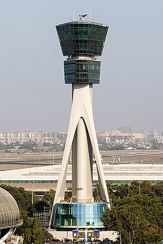
Air traffic control (ATC) is a service provided by ground-based air traffic controllers (people) who direct aircraft on the ground and through a given section of controlled airspace, and can provide advisory services to aircraft in non-controlled airspace. The primary purpose of ATC worldwide is to prevent collisions, organise and expedite the flow of traffic in the air, and provide information and other support for pilots.

Moffett Federal Airfield, also known as Moffett Field, is a joint civil-military airport located in an unincorporated part of Santa Clara County, California, United States, between northern Mountain View and northern Sunnyvale. On November 10, 2014, NASA announced that it would be leasing 1,000 acres (400 ha) of the airfield property to Google for 60 years.

An airbase, sometimes referred to as a military airbase, military airfield, military airport, air station, naval air station, air force station, or air force base, is an aerodrome or airport used as a military base by a military force for the operation of military aircraft.
Aviation is the design, development, production, operation, and use of aircraft, especially heavier-than-air aircraft. Articles related to aviation include:
A wayport is a major airport, built on the outskirts of or away from an urban area, having the primary purpose of serving connecting and origin destination flights, cargo, express mail and general aviation as part of the national airport network. Wayports have been proposed as a potential solution in the United States to deal with increasing congestion and delays at major urban airports.
Royal Air Force Manston or more simply RAF Manston is a former Royal Air Force station located in the north-east of Kent, at grid reference TR334663 on the Isle of Thanet from 1916 until 1996. The site was split between a commercial airport Kent International Airport (KIA), since closed, and a continuing military use by the Defence Fire Training and Development Centre (DFTDC), following on from a long-standing training facility for RAF firefighters at the RAF Manston base. In March 2017, RAF Manston became the HQ for the 3rd Battalion, Princess of Wales Royal Regiment (PWRR).

A naval air station is a military air base, and consists of a permanent land-based operations locations for the military aviation division of the relevant branch of a navy. These bases are typically populated by squadrons, groups or wings, their various support commands, and other tenant commands.
A flight information service (FIS) is a form of air traffic service which is available to any aircraft within a flight information region (FIR), as agreed internationally by ICAO.

Herzliya Airport (Hebrew: שְׂדֵה הַתְּעוּפָה הֶרְצְלִיָּה Arabic: مطار هرتسيليا, is an airport located in the city of Herzliya in central Israel. The airport is mainly used by flight schools and for general aviation. It has no terminals.

Predannack Airfield is an aerodrome near Mullion on The Lizard peninsula of Cornwall in the United Kingdom. The runways are operated by the Royal Navy and today it is a satellite airfield and relief landing ground for nearby RNAS Culdrose.
Munda International Airport is an international airport adjacent to the town of Munda, Western Province in Solomon Islands.
The National Airspace System (NAS) is the airspace, navigation facilities and airports of the United States along with their associated information, services, rules, regulations, policies, procedures, personnel and equipment. It includes components shared jointly with the military. It is one of the most complex aviation systems in the world, and services air travel in the United States and over large portions of the world's oceans.

Naval Air Station Fort Lauderdale was an airfield of the United States Navy just outside Fort Lauderdale, Florida.

An outlying landing field (OLF) is an satellite airfield, associated with a seaborne component of the United States military. When associated with the United States Navy, they are known as naval outlying landing fields (NOLFs) or naval auxiliary landing fields (NALFs); when associated with United States Marine Corps, they are known as Marine Corps outlying fields (MCOFs) or Marine Corps auxiliary landing fields (MCALFs).

Naval Auxiliary Landing Field Fentress is a military use airport located in Chesapeake, Virginia. This military airport is owned by the U.S. Navy and is under the operational control of Naval Air Station Oceana, Virginia. The airfield primarily supports day and night Field Carrier Landing Practice (FCLP) operations by US Navy and US Marine Corps F/A-18 Hornet, and US Navy F/A-18 Super Hornet, E-2 Hawkeye and C-2 Greyhound aircraft based in Virginia and the Carolinas.
Naval Outlying Landing Field Barin is a United States Navy airfield located in Foley, a city in Baldwin County, Alabama, United States.
Landing area is an official designation of specialized Earth surface region by the international standard publication describing airfields and airports to aviators, the Aeronautical Information Publication. As such, it is directly translated into dozens of languages, wherever an AIP publication exists, which is one for every aviation-regulating country of the world. It is the most salient description of the logistics real estate which enable planes or helicopters or other aircraft to come and go. It also has other meanings, which extend beyond aviation concepts and airport terminology, all of them military in kind.

Naval Air Station Livermore has nearby airfield landing strips to support the training of US Navy pilots during World War 2. The airfield are called Naval Outlying Landing Field (NOLFs). For the war many new trained pilots were needed. The Naval Outlying Landing Fields provided a place for pilots to practice landing and take off without other air traffic. The remotes sites offered flight training without distractions. Most of the new pilots departed to the Pacific War after training. The Outlying Landing Fields had little or no support facilities. Naval Air Station Livermore opened in 1942 and closed in 1951. The Outlying field closed in 1945, having completed the role of training over 4000 new pilots. To open the needed Outlying Landing Fields quickly, the Navy took over local crop dusting and barnstorming airfields.

Sweetwater Dam Naval Outlying Landing Field was a airfield near Naval Auxiliary Air Station Brown Field and Naval Air Station North Island used to support the training of US Navy pilots during World War 2. The runway built in 1944 was located in what is now a neighborhood 8 mile east of San Diego, California. The Navy support airfields are called Naval Outlying Landing Field (NOLF). For the war, many new trained pilots were needed. The Naval Outlying Landing Field provided a place for pilots to practice landing and take off without other air traffic. Sweetwater Dam site offered flight training without distractions. Most of the new pilots departed to the Pacific War after training. The Sweetwater Dam Outlying Landing Field had no support facilities. After the war the Outlying field closed in 1946, having completed the role of training new pilots. Sweetwater Dam Naval Outlying Landing Field and Sweetwater Carrier Landing Strip. The Landing Field had a single 3,000-foot east/west asphalt runway. The Navy leased 135.45 acres of grassland from Rancho de la Nación for the Landing Field. In 1949 the runway became a private civil airport, the Sweetwater Dam Airport also called the Paradise Mesa Airstrip. The Airport is named after the nearby Sweetwater Dam that makes the Sweetwater Reservoir. The Airport closed in 1951 and the runway became home to the Paradise Mesa Drag strip. The Carlsbad, California's Oilers Club help start the drag strip with the first meet on March 11, 1951. At its peak, 25 clubs were using the strip. The drag strip closed in 1959. Houses were built on the site, now called Paradise Hills and no trace of the runway can be found today. Part of the site is also the Daniel Boone Elementary School.
References
- ↑ Wragg, David W. (1973). A Dictionary of Aviation (first ed.). Osprey. p. 234. ISBN 9780850451634.
- ↑ "Chapter 15. Airspace" (PDF). faa.gov. Retrieved 30 March 2023.
- ↑ "Satellite terminal | airport | Britannica". www.britannica.com.
- ↑ "Satellite airport".
- ↑ "Class C Airspace". Paramount Business Jets.