Related Research Articles

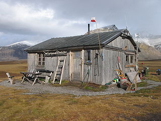
Longyearbyen is the world's northernmost settlement with a population greater than 1,000 and the largest inhabited area of Svalbard, Norway. It stretches along the foot of the left bank of the Longyear Valley and on the shore of Adventfjorden, the short estuary leading into Isfjorden on the west coast of Spitsbergen, the island's broadest inlet. As of 2002 Longyearbyen Community Council became an official Norwegian municipality. It is the seat of the Governor of Svalbard. The town's mayor is Arild Olsen.

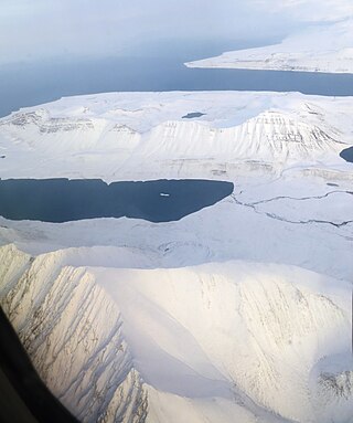
Adventfjorden is a 7 km long and 4 km wide bay running south-eastwards from the southern side of Isfjorden, on the west coast of Spitsbergen in Svalbard. The name represents a corruption of Adventure Bay - probably named after the Hull-built whaleship Adventure, which operated in Isfjorden in 1656. The fjord was originally known as Klass Billen Bay. At the head of Adventfjorden is Adventdalen.
James I Land is a land area on the northwestern part of Spitsbergen, Svalbard. It is named after King James I of England and Scotland. The 30 kilometer long glacier Sveabreen divides James I Land from Oscar II Land.

The Longyear River is a river which runs through the Longyear Valley, passing through the town of Longyearbyen and draining into Adventfjorden on the island of Spitsbergen in Svalbard, Norway. It is named for the American industrialist John Munroe Longyear.
Sassendalen is a valley at Spitsbergen, Svalbard. The valley is among the largest valleys of Svalbard, and continues westwards into Sassenfjorden. Part of the valley divides Sabine Land and Nordenskiöld Land. The river Sassenelva runs through the valley.
Colesbukta is a bay at the southern side of Isfjorden, in Nordenskiöld Land at Spitsbergen, Svalbard. The bay is about 4.5 kilometer wide. A railway for coal transport was earlier operated between Grumantbyen and shipment facilities in Colesbukta. The valley Colesdalen debouches into Colesbukta.
Colesdalen is a valley in Nordenskiöld Land at Spitsbergen, Svalbard. The valley debouches into the bay Colesbukta, at the southern side of Isfjorden.
Agardhdalen is a valley between Sabine Land and Heer Land at Spitsbergen, Svalbard. It forms a continuation of the bay Agardhbukta, at the western side of Storfjorden. The valley is named after botanist Jacob Georg Agardh. The river Agardhelva flows from Sveigbreen and Elfenbeinbreen, through Agardhdalen, with outlet into Agardhbukta.
Nordaustpynten is a headland at Kongsøya of the Kong Karls Land, Svalbard, the most northeastern point of the island.
Petuniabukta is a bay in Dickson Land at Spitsbergen, Svalbard. It constitutes the northern branch of Billefjorden. The bay is named after the Scottish vessel SS Petunia. Northwest of the bay is the valley of Hørbyedalen and the glacier of Hørbyebreen.

Linnédalen is a valley in Nordenskiöld Land at Spitsbergen, Svalbard. It is named after Swedish botanist Carl Linnaeus. The valley has a length of about ten kilometers, and is located east of the mountain ridge of Linnéfjella. In the lower part of the valley is the lake of Linnévatnet, which is among the largest lakes of Spitsbergen.
Linnéfjella is a mountain ridge in Nordenskiöld Land at Spitsbergen, Svalbard. It is named after Swedish botanist Carl Linnaeus. The ridge contains the mountains of Solryggen, Aagaardtoppen, Griegfjellet and Griegaksla. East of the ridge is the valley of Linnédalen.
Heimarka is a plain at Barentsøya, Svalbard. It is located between the glacier of Besselsbreen and the valley of Grimdalen. The lake of Veslemjøsa is situated in the field.
Grimdalen is a valley at Barentsøya, Svalbard. It extends from Barentsjøkulen to Ginevra Bay, at the eastern side of Grimheia. The river of Grima flows through the valley.
Davisdalen is a valley in Nathorst Land at Spitsbergen, Svalbard. It is named after American geomorphologist William Morris Davis. The valley has a length of about 5.5 kilometers, extending from the mountain ridge of Mjellegga southwards down to Davisodden, at the northern side of Van Keulenfjorden. A tributary valley to Davisdalen is Wittrockdalen.
De Geerdalen is a valley in Nordenskiöld Land at Spitsbergen, Svalbard. It is named after Swedish geologist and Arctic explorer Gerard De Geer. The mountain pass of Kreklingpasset divides De Geerdalen from Helvetiadalen. The river of De Geerelva flows through the valley, and debouches into Sassenfjorden at Elveneset.
Tschermakfjellet is a mountain in Dickson Land at Spitsbergen, Svalbard. It has a height of 422 m.a.s.l., and is located between the valley of Sauriedalen and Kongressfjellet. The mountain is named after Austrian mineralogist Gustav Tschermak von Seysenegg.
Kongressfjellet is a mountain in Dickson Land at Spitsbergen, Svalbard. It has a height of 605 m.a.s.l., and is located between the valleys of Idodalen (north) and Sauriedalen (east), and the mountain of Tschermakfjellet (south).
Idodalen is a valley in Dickson Land at Spitsbergen, Svalbard. It has a length of about 5.5 kilometers, and is located between the mountains of Kongressfjellet and Heimenfjellet. The valley is named after the constructed language of Ido. The river of Idoelva flows through the valley.

Krefftberget is a mountain group at Barentsøya, Svalbard. It is named after Australian zoologist Gerard Krefft, and is situated at the southern part of the island.
References
- ↑ "Sauriedalen (Svalbard)". Norwegian Polar Institute . Retrieved 29 July 2015.
- ↑ "Saurieberget (Svalbard)". Norwegian Polar Institute . Retrieved 29 July 2015.
78°32′N15°28′E / 78.53°N 15.46°E
| | This Spitsbergen location article is a stub. You can help Wikipedia by expanding it. |