Related Research Articles
Castle Dore is an Iron Age hill fort (ringfort) near Fowey in Cornwall, United Kingdom located at grid reference SX103548. It was probably occupied from the 5th or 4th centuries BC until the 1st century BC. It consists of two ditches surrounding a circular area 79 metres (259 ft) in diameter. Excavated in the 1930s, it was one of the most intensively investigated Iron Age hillforts in Cornwall.

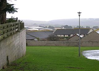
Mount Hawke is a village in Cornwall, United Kingdom. It is situated approximately eight miles (13 km) west-northwest of Truro, five miles (8.0 km) north-northeast of Redruth, and two and a half miles (4.0 km) south of St Agnes.

Harlyn is a small village on the north coast of Cornwall, England, United Kingdom. It is situated inland from Harlyn Bay three miles from Padstow and about one mile from St. Merryn.

Gunwalloe is a coastal civil parish in Cornwall, England, United Kingdom. It is situated on the Lizard Peninsula three miles (4.8 km) south of Helston and partly contains The Loe, the largest natural freshwater lake in Cornwall. The parish population including Berepper at the 2011 census was 219. The hamlets in the parish are Chyanvounder, Berepper and Chyvarloe. To the east are the Halzephron cliffs and further east the parish church.
St Clether is a civil parish and village in Cornwall, England, United Kingdom. The village is situated on the east flank of Bodmin Moor approximately eight miles (13 km) west of Launceston in the valley of the River Inny. The population of the civil parish at the 2011 census was 156.

Manaccan is a civil parish and village on the Lizard peninsula in south Cornwall, England, United Kingdom. The village is about five miles (8 km) south-southwest of Falmouth.
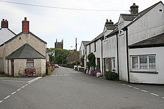
St Newlyn East is a civil parish and village in Cornwall, England, United Kingdom. The village is approximately three miles (5 km) south of Newquay. The name St Newlyn East is locally abbreviated to Newlyn East and according to an anonymous historian writing in The Cornishman in 1880 it was only in recent years that Saint had been added to the parish name.
Crows-an-Wra is a hamlet in West Cornwall, England, United Kingdom. It is situated in the civil parish of St Buryan approximately four miles (6 km) northeast of Land's End.

The Museum of Witchcraft and Magic, formerly known as the Museum of Witchcraft, is a museum dedicated to European witchcraft and magic located in the village of Boscastle in Cornwall, south-west England. It houses exhibits devoted to folk magic, ceremonial magic, Freemasonry, and Wicca, with its collection of such objects having been described as the largest in the world.
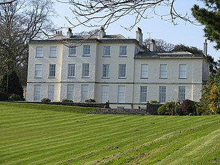
The Heligan estate was the ancestral home of the Tremayne family near Mevagissey in Cornwall, England. Purchased by Sampson Tremayne in 1659, the present house was built in 1692 and extended in the early 19th century. The family let the house after World War I, and by the end of World War II the house and gardens had fallen into disrepair. The house and outbuilding were converted into flats in the 1970s and the garden was considered lost, but it was rescued during a televised project in 1996. The Lost Gardens of Heligan are now open to the public as a tourist attraction.

The St Austell River properly known as the River Vinnick, but historically called The White River, is a 12 kilometres (7.5 mi) long river located in south Cornwall, England, United Kingdom. 50.337°N 4.793°W. The river has also been known as the "red river" due to tin streaming and mining activity upstream.
Bottoms is a hamlet in west Cornwall, England, UK. It is located within the civil parish of St Levan, 5 miles (8.0 km) south-west of the town of Penzance. The hamlet of Trebehor lies further west. It contains St Levan CP School, St Levan's community primary school.

Calloose is a hamlet near Leedstown in west Cornwall, England, UK.
Herniss is a hamlet in the civil parish of Mabe in west Cornwall, England. Herniss is on the A394 main road. It is in the civil parish of Stithians

Hersham is a hamlet south of Kilkhampton in Cornwall, England. Hersham is near Grimscott. According to the Post Office the population at 2011 census was included in the civil parish of Launcells
Mount Ambrose is a northeastern suburb of Redruth in west Cornwall, England, UK. It falls within Redruth Central division on Cornwall Council, and is the home of Mount Ambrose Cricket Club.

Penhallick is a hamlet near Pool in Cornwall, England, UK. Penhallick House was built in 1892 by Richard Cowlin the local miller and grocer who owned Cowlin Mill. The mill was converted in the 1980s by Kerrier Groundwork and was offices for Cornwall Council. The mill building is currently for sale with potential change of use to residential.

Penhalvean is a hamlet in the civil parish of Stithians in west Cornwall, England, UK.

Hawk's Tor is a hill and tor on Bodmin Moor in Cornwall, England, UK. Its summit is 307 metres (1,007 ft) above sea level.

Trengune is a hamlet in Cornwall, England, United Kingdom. It is part of the civil parish of Warbstow and is located 1.5 miles north and 1 mile west of the village. The River Ottery passes through Trengune. The earliest record of Trengune was in 1356; the meaning is "farm at the downs".
References
- ↑ Maps (Map). Google Maps.
|access-date=requires|url=(help) - ↑ Philip's Street Atlas Cornwall. London: Philip's, 2003; p. 69
- ↑ "Grisly British witch pits were used in rituals until 1970s, archaeologists discover". The Australian . News Corp Australia. 29 December 2014. Retrieved 5 January 2015.
Coordinates: 50°15′58″N5°09′02″W / 50.2661°N 5.15055°W
| This article about a location in the former district of Carrick, Cornwall is a stub. You can help Wikipedia by expanding it. |