Located off Hardwood Point, Scarecrow Island is situated in the center of a region rich in fish. A 2002 study conducted the U.S. Fish and Wildlife Service documented the occurrence of seven species of fish in the immediate vicinity of the island, with round whitefish, trout-perch, and lake chub predominating.
Like many other islands in the Great Lakes, Scarecrow Island is a relict of the Wisconsin glacial period. A melting Ice Age glacier dumped a large quantity of rocks and gravel onto a gouged-out surface that became part of the bed of Lake Huron.
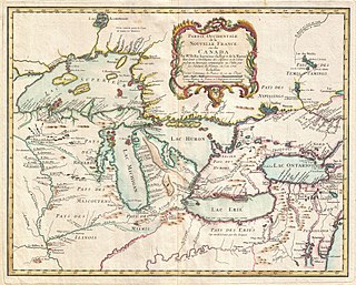
Lake Huron is one of the five Great Lakes of North America. It is shared on the north and east by the Canadian province of Ontario and on the south and west by the U.S. state of Michigan. The name of the lake is derived from early French explorers who named it for the indigenous people they knew as Huron (Wyandot) inhabiting the region. Hydrologically, Lake Huron comprises the eastern portion of Lake Michigan–Huron, having the same surface elevation as Lake Michigan, to which it is connected by the 5-mile-wide (8.0 km), 20-fathom-deep Straits of Mackinac. Combined, Lake Michigan–Huron is the largest freshwater lake by area in the world. The Huronian glaciation was named from evidence collected from the Lake Huron region. The northern parts of the lake include the North Channel and Georgian Bay. Saginaw Bay is located in the southwest corner of the lake. The main inlet is the St. Marys River from Lake Superior, and the main outlet is through the St. Clair River toward Lake Erie. Lake Huron has a fairly large drainage basin covering parts of Michigan and Ontario. Water flows through Lake Huron faster than the other Great Lakes with a retention time of only 22 years.
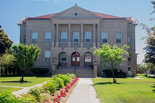
Alpena County is a county in the U.S. state of Michigan. As of the 2020 census, the population was 28,907. The county seat is Alpena. It is considered to be part of Northern Michigan.
Alpena is the only city and the county seat of Alpena County, Michigan. The population was 10,197 at the 2020 census, making it the third most populated city in the Northern Michigan region, after Traverse City and Cadillac. The city is surrounded by Alpena Township, but the two are administered autonomously. It is the core city of the Alpena micropolitan statistical area, which encompasses all of Alpena County and had a total population of 28,907 at the 2020 census.
The Shiawassee National Wildlife Refuge is a 9,870.35 acres (39.9439 km2) National Wildlife Refuge in Saginaw County managed by the United States Fish and Wildlife Service. It is located in the central portion of the lower peninsula of the U.S. state of Michigan, approximately 25 miles (40 km) south of the Saginaw Bay in Lake Huron and five miles (8 km) south of the city of Saginaw in the county's Spaulding and James townships. It was established in 1953 to provide habitat for migratory waterfowl.
Thunder Bay is a bay in the U.S. state of Michigan on Lake Huron. The bay extends from North Point at 45°01′19″N83°15′58″W to South Point at 44°53′00″N83°18′51″W.
Thunder Bay National Marine Sanctuary and Underwater Preserve is a United States National Marine Sanctuary on Lake Huron's Thunder Bay, within the northeastern region of the U.S. state of Michigan. It protects an estimated 116 historically significant shipwrecks ranging from nineteenth-century wooden side-wheeler paddle steamers to twentieth-century steel-hulled steamers. There are a great many wrecks in the sanctuary, and their preservation and protection is a concern for United States Government policymakers. The landward boundary of the sanctuary extends from the western boundary of Presque Isle County to the southern boundary of Alcona County. The sanctuary extends east from the lakeshore to the international border. Alpena is the largest city in the area.
Northern Michigan, also known as Northern Lower Michigan, is a region of the U.S. state of Michigan. A popular tourist destination, it is home to several small- to medium-sized cities, extensive state and national forests, lakes and rivers, and a large portion of Great Lakes shoreline. The region has a significant seasonal population much like other regions that depend on tourism as their main industry. Northern Lower Michigan is distinct from the more northerly Upper Peninsula and Isle Royale, which are also located in "northern" Michigan. In the northernmost 21 counties in the Lower Peninsula of Michigan, the total population of the region is 506,658 people.
The protected areas of Michigan come in an array of different types and levels of protection. Michigan has five units of the National Park Service system. There are 14 federal wilderness areas; the majority of these are also tribal-designated wildernesses. It has one of the largest state forest systems as well having four national forests. The state maintains a large state park system and there are also regional parks, and county, township and city parks. Still other parks on land and in the Great Lakes are maintained by other governmental bodies. Private protected areas also exist in the state, mainly lands owned by land conservancies.
Gull Island is the name of a dozen small islands in the U.S. state of Michigan.
The Michigan Islands National Wildlife Refuge is a designation for nine Michigan islands in the North American Great Lakes. Owned by the United States federal government, they were set aside for ecosystem protection purposes by President Franklin D. Roosevelt 1943.
The Thunder Bay River is a 75.4-mile-long (121.3 km) river in the U.S. state of Michigan. It drains much of Alpena County and Montmorency County, and a small portion of Oscoda County, into Thunder Bay, a bay of Lake Huron, on the eastern side of northern Michigan. The mouth of the river is in the heart of downtown Alpena and is guarded by the Alpena Light Station.
Thunder Bay Island is a 215-acre (87 ha) island in Lake Huron. The island is one of eight constituent islands of the Michigan Islands National Wildlife Refuge. The island is part of Alpena Township in Alpena County. It marks the entrance to Thunder Bay, the harbor of Alpena, Michigan and the location of the Thunder Bay National Marine Sanctuary.
The Alpena Light, also known as the Thunder Bay River Lighthouse or Alpena Breakwater Light, is a lighthouse on Lake Huron near Alpena, Michigan. Standing on the north breakwater of Alpena Harbor, the light marks the entrance to the Thunder Bay River from Thunder Bay. The current lighthouse, built in 1914, replaced earlier wooden structures which had been in use since 1877 and 1888. The current light is a weather-protected structure on a steel frame. It was added to the National Register of Historic Places in 2006, and the state inventory list the same year.
Huron Island Light is a lighthouse on Lake Superior near Big Bay, Michigan. It was listed on the National Register of Historic Places as Huron Islands Lighthouse in 1975. It is on one of the Huron Islands WildernessArchived 2011-06-11 at the Wayback Machine.
Thunder Bay Island Light, located on Thunder Bay Island's southeast tip, is one of the oldest operating lighthouses in Michigan. The third operating U.S. lighthouse in Lake Huron was built here in 1831, but it disintegrated almost at once and was rebuilt in 1832 of local limestone. This 40-foot (12 m) 1830s light tower was raised 10 feet (3.0 m)) to a height of 50 feet (15 m) in 1857, and sheathed with brick. A fourth order Fresnel lens was installed. This 1857 light tower is the current Thunder Bay Island Light, although the tower has been further altered and is currently 63 feet (19 m) high.
The Besser Museum for Northeast Michigan is a community museum serving Alpena County and surrounding counties in the U.S. state of Michigan. Alpena is a port city on Lake Huron. The museum defines its role broadly — to preserve, protect and present history and culture closely connected with the heritage of Northern Michigan and the Great Lakes. The museum includes a small publicly-owned planetarium.
Black River Island is an island in Lake Huron. It is part of a series of shoals around the mouth of Black River and is 3⁄4 mile (1.2 km) northeast of it. The island is included within the unincorporated community of Black River in Alcona Township, Michigan.
Middle Island is an island in Lake Huron, located in Alpena Township, Alpena County, Michigan. The island is positioned little over a mile and a half from the community of Lakewood on the mainland. The Middle Island Light, listed on the National Register of Historic Places and built in 1905, lies on the eastern edge of the island. It used to be home to a Life-Saving Station. The light house was automated in 1961, and regular staffing ceased. The island is within the boundaries of the Thunder Bay National Marine Sanctuary. It preserves the lighthouse along with the shipwreck Portsmouth (1867).
This page is based on this Wikipedia article Text is available under the CC BY-SA 4.0 license; additional terms may apply. Images, videos and audio are available under their respective licenses.