The Eifelkreis Bitburg-Prüm is a district in Rhineland-Palatinate, Germany. It is bounded by Luxembourg, Belgium and the districts of Euskirchen, Vulkaneifel, Bernkastel-Wittlich and Trier-Saarburg.
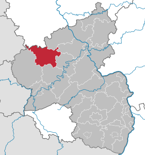
Vulkaneifel is a district (Kreis) in the northwest of the state Rhineland-Palatinate, Germany. It is the least densely populated district in the state and the fourth most sparsely populated district in Germany. The administrative centre of the district is in Daun. Neighboring districts are Euskirchen, Ahrweiler, Mayen-Koblenz, Cochem-Zell, Bernkastel-Wittlich, and Bitburg-Prüm.

The Ford Eifel is a car manufactured by Ford Germany between 1935 and 1940. It initially complemented and then replaced the Ford Köln. It was itself replaced by the Ford Taunus.
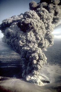
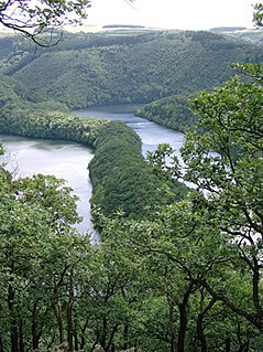
A maar is a broad, low-relief volcanic crater caused by a phreatomagmatic eruption. A maar characteristically fills with water to form a relatively shallow crater lake which may also be called a maar. The name comes from a Moselle Franconian dialect word used for the circular lakes of the Daun area of Germany. Maars are shallow, flat-floored craters that scientists interpret as having formed above diatremes as a result of a violent expansion of magmatic gas or steam; deep erosion of a maar presumably would expose a diatreme. Maars range in size from 60 to 8,000 m across and from 10 to 200 m deep; most maars commonly fill with water to form natural lakes. Most maars have low rims composed of a mixture of loose fragments of volcanic rocks and rocks torn from the walls of the diatreme.

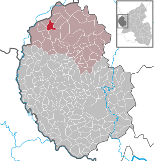
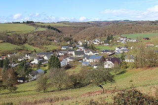
Oberkail is a municipality in the rural area of Eifel in Rhineland-Palatinate in the administrative district Bitburg-Prüm and is part of Verbandsgemeinde Bitburger Land.

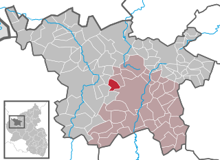
Daun is a town in the Vulkaneifel district in Rhineland-Palatinate, Germany. It is the district seat and also the seat of the Verbandsgemeinde of Daun.

The Manderscheid family was the most powerful family in the Eifel region of Germany for a considerable period of time in the 15th century. In 1457, Dietrich III von Manderscheid was made a Reichsgraf by the Emperor. When Dietrich died on 20 February 1498, he had appointed his sons Johann, Konrad and Wilhelm as new rulers — the family property had been distributed in 1488. Each of the sons founded a powerful lineage: Johann started the Manderscheid-Blankenheim-Gerolstein line, William the Manderscheid-Kail line, and Konrad (Cuno) the Manderscheid-Schleiden line. Augusta von Manderscheid-Blankenheim was the last countess. She was married to a member of the Bohemian nobility, the count of Sternberg.
Bleialf is a municipality in the district of Bitburg-Prüm, in Rhineland-Palatinate, western Germany.

Sülm is a municipality in the district of Bitburg-Prüm, in Rhineland-Palatinate, western Germany.
Utscheid is a municipality in the district of Bitburg-Prüm, in Rhineland-Palatinate, western Germany.

Boos is a municipality in the county of Mayen-Koblenz in Rhineland-Palatinate, western Germany.
The North Eifel, the northern part of the Eifel, a low mountain range in Germany and East Belgium, comprises the following six sub-regions:
The South Eifel refers to that part of the Eifel mountain region around the Bitburg-Prüm district in the German state of Rhineland-Palatinate.
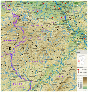
The Schnee Eifel is a heavily wooded landscape in Germany's Central Uplands that forms part of the western Eifel in the area of the German-Belgian border. The name may have been derived in the 19th century from the Schneifel chain of hills which had nothing to do with snow (Schnee), but with the name for a forest swathe (Schneise).

The Volcanic Eifel or Vulkan Eifel is a region in the Eifel Mountains in Germany, that is defined to a large extent by its volcanic geological history. Characteristic of this volcanic field are its typical explosion crater lakes or maars, and numerous other signs of volcanic activity such as volcanic tuffs, lava streams and volcanic craters like the Laacher See. The Volcanic Eifel is still volcanically active today. One sign of this activity is the escaping gases, for example, in the Laacher See.

The High Eifel forms part of the Eifel Mountains in the German state of Rhineland-Palatinate.
The German-Belgian High Fens – Eifel Nature Park, often called the North Eifel Nature Park, is a cross-border nature park with elements in the German federal states of North Rhine-Westphalia and Rhineland-Palatinate as well as the Belgian province of Liège. It has a total area of 2,485 km2 (959 sq mi).
The Eifel National Park is the 14th national park in Germany and the first in North Rhine-Westphalia.
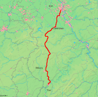
The Hürth-Kalscheuren–Ehrang railway is a non-electrified line in the German states of North Rhine-Westphalia and Rhineland-Palatinate running from Hürth-Kalscheuren via Euskirchen and Gerolstein to Trier-Ehrang through the Eifel hills.