Related Research Articles

Johnston Atoll is an unincorporated territory of the United States, currently administered by the United States Fish and Wildlife Service (USFWS). Johnston Atoll is a National Wildlife Refuge and part of the Pacific Remote Islands Marine National Monument. It is closed to public entry, and limited access for management needs is only granted by Letter of Authorization from the United States Air Force and a Special Use Permit from the U.S. Fish and Wildlife Service.

Kure Atoll or Ocean Island is an atoll in the Pacific Ocean 48 nautical miles west-northwest of Midway Atoll in the Northwestern Hawaiian Islands at 28°25′N178°20′W. A coral ring six miles across encloses a lagoon several meters deep. The only land of significant size is called Green Island and is a habitat for hundreds of thousands of seabirds. A short, unused and unmaintained runway and a portion of one building, both from a former United States Coast Guard LORAN station, are located on the island. Politically, it is part of Hawaii, although separated from the rest of the state by Midway, which is a separate unorganized territory. Green Island, in addition to being the nesting grounds for tens of thousands of seabirds, has recorded several vagrant terrestrial birds, including snow bunting, eyebrowed thrush, brambling, olive-backed pipit, black kite, Steller's sea eagle and Chinese sparrowhawk. It is currently managed as a Wildlife Bird Sanctuary by the State of Hawaii's Department of Land and Natural Resource–Division of Forestry and Wildlife as one of the co-trustees of Papahānaumokuākea Marine National Monument with support from the Kure Atoll Conservancy.

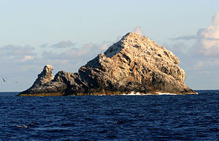
The Gardner Pinnacles are two barren rock outcrops surrounded by a reef and located in the Northwestern Hawaiian Islands at 24°59′56″N167°59′58″W.

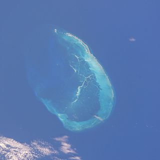
The French Frigate Shoals is the largest atoll in the Northwestern Hawaiian Islands. Its name commemorates French explorer Jean-François de La Pérouse, who nearly lost two frigates when attempting to navigate the shoals. It consists of a 20-mile-long (32 km) crescent-shaped reef, twelve sandbars, and the 120-foot-high (37 m) La Perouse Pinnacle, the only remnant of its volcanic origins. The total land area of the islets is 61.508 acres (24.891 ha). Total coral reef area of the shoals is over 232,000 acres (94,000 ha). Tern Island, with an area of 26.014 acres (10.527 ha), has a landing strip and permanent habitations for a small number of people. It is maintained as a field station in the Hawaiian Islands National Wildlife Refuge by the United States Fish and Wildlife Service. The French Frigate Shoals are about 487 nautical miles northwest of Honolulu.

The Northwestern Hawaiian Islands or Leeward Hawaiian Islands are the small islands and atolls in the Hawaiian island chain located northwest of the islands of Kauai and Niihau. Politically, they are all part of Honolulu County in the U.S. state of Hawaii, except Midway Atoll, which is a territory distinct from the State of Hawaii, and grouped as one of the United States Minor Outlying Islands. The United States Census Bureau defines this area, except Midway, as Census Tract 114.98 of Honolulu County. Its total land area is 3.1075 square miles (8.048 km2). All the islands except Nihoa are north of the Tropic of Cancer, making them the only islands in Hawaii that lie outside the tropics.

Dougherty is the name of a phantom island that was believed to be located in the extreme south of the Pacific Ocean, roughly halfway between Cape Horn and New Zealand. It is named for Captain Dougherty of the James Stewart, an English whaler, who in 1841 reported discovering it at 59°20′S120°20′W. He described it as 5–6 miles long with a high bluff to the northeast and covered in snow. Dougherty's discovery was confirmed by Captain Keates of the Louise in 1860, giving its coordinates as 59°20′S120°18′W, and by Captain Stannard of the Cingalese in 1886, giving the location as 59°21′S119°7′W.

The Prince Charles Mountains are a major group of mountains in Mac. Robertson Land in Antarctica, including the Athos Range, the Porthos Range, and the Aramis Range. The highest peak is Mount Menzies, with a height of 3,228 m (10,591 ft). Other prominent peaks are Mount Izabelle and Mount Stinear. These mountains, together with other scattered peaks, form an arc about 420 km (260 mi) long, extending from the vicinity of Mount Starlight in the north to Goodspeed Nunataks in the south.

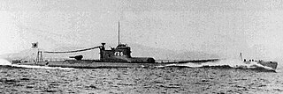
I-26 was an Imperial Japanese Navy B1 type submarine commissioned in 1941. She saw service in the during World War II, patrolling off the West Coast of North America Canada United States West Coast, the east coast of Australia, and Fiji and in the Indian Ocean and taking part in Operation K, preparatory operations for the Aleutian Islands campaign, and the Guadalcanal campaign, the Marianas campaign, and the Battle of Leyte Gulf. She sank the first U.S. merchant ship sunk by a Japanese submarine during the war, damaged the aircraft carrier USS Saratoga (CV-3), sank the light cruiser USS Juneau (CLAA-52), and was the third-highest-scoring Japanese submarine of World War II in terms of shipping tonnage sunk. Her bombardment of Vancouver Island in 1942 was the first foreign attack on Canadian soil since 1870. In 1944, I-26′s crew committed war crimes in attacking the survivors of a ship she sank. She was sunk in October 1944 during her ninth war patrol.

The Pacific Remote Islands Marine National Monument is a group of unorganized, mostly unincorporated United States Pacific Island territories managed by the United States Fish and Wildlife Service of the United States Department of the Interior and the National Oceanic and Atmospheric Administration (NOAA) of the United States Department of Commerce. These remote refuges are "the most widespread collection of marine- and terrestrial-life protected areas on the planet under a single country's jurisdiction". They protect many endemic species including corals, fish, shellfish, marine mammals, seabirds, water birds, land birds, insects, and vegetation not found elsewhere.

Murchison Promontory, a cape (promontory) in the northern Canadian Arctic, is the northernmost mainland point of the Americas and of Canada. Located 1,087 nautical miles from the North Pole, it is 64 km (40 mi) farther north than Point Barrow, Alaska, the northernmost point of all U.S. territory.
Extension Reef is a reef which encompasses a large number of small islands and rocks, extending 10 miles (16 km) southwest from the south end of Rabot Island, in the Biscoe Islands. It was first charted and named by the British Graham Land Expedition, 1934–37, under John Rymill.

Howland Island and Baker Island are two uninhabited U.S. atolls in the Equatorial Pacific that are located close to one another. Both islands are wildlife refuges, the larger of which is Howland Island. They are both part of the larger political territory of the United States Minor Outlying Islands and they are also both part of the larger geographic grouping of the Phoenix Islands. Each is a National Wildlife Refuge managed by a division of Interior, the U.S. Fish and Wildlife Service. On January 6, 2009, U.S. President George W. Bush included both islands to the Pacific Remote Islands Marine National Monument.
Uversnatten Rock is a small rock eminence 1 nautical mile (1.9 km) west of Huldreslottet Mountain, at the south end of Borg Massif in Queen Maud Land. Mapped by Norwegian cartographers from surveys and air photos by Norwegian-British-Swedish Antarctic Expedition (NBSAE) (1949–52) and named Uversnatten.
Gavlpiggen Peak is a low, isolated peak 2 nautical miles (4 km) southwest of Klakknabben Peak, just north of the Kirwan Escarpment in Queen Maud Land, Antarctica. It was mapped by Norwegian cartographers from surveys and air photos by the Norwegian–British–Swedish Antarctic Expedition (1949–52) and from additional air photos (1958–59), and named Gavlpiggen.
Mount Schumacher is a mountain, 1,230 m, standing 6 nautical miles (11 km) southwest of Nils Jorgen Peaks on the west side of Ahlmann Ridge in Queen Maud Land. Mapped by Norwegian cartographers from surveys and air photos by Norwegian-British-Swedish Antarctic Expedition (NBSAE) (1949–52) and air photos by the Norwegian expedition (1958–59). Named for Nils Jorgen Schumacher, senior meteorologist with the NBSAE.
Standifer Bluff is a conspicuous rock bluff, a component of the Smith Bluffs which form the northwest coast of Dustin Island, standing 10 nautical miles (18 km) west-southwest of the north tip of the island. The bluff was photographed from helicopters of the USS Burton Island and Glacier in the U.S. Navy Bellingshausen Sea Expedition, February 1960. Named by Advisory Committee on Antarctic Names (US-ACAN) for J.N. Standifer, United States Geological Survey (USGS) photographic specialist in Antarctica in the 1967–68 season.

The Laputa Nunataks are a range of nunataks and snow-covered hills with minor rock outcrops, rising from about 500 metres (1,600 ft) to over 1,000 metres (3,300 ft), and located 6 nautical miles (11 km) northwest of Adie Inlet on the east side of Graham Land, Antarctica. They were first charted by the Falkland Islands Dependencies Survey and photographed from the air by the Ronne Antarctic Research Expedition in 1947. They were named by the UK Antarctic Place-Names Committee after Laputa, the flying island in Jonathan Swift's Gulliver's Travels.
Larsen Nunatak is an island called nunatak 2 nautical miles (4 km) north of Murdoch Nunatak in the Seal Nunataks group, off the east coast of the Antarctic Peninsula. The Seal Nunataks were discovered by a Norwegian whaling expedition under C.A. Larsen in December 1893, and commemoration of Larsen was proposed by Ludwig Friederichsen in 1895. The application of this name is based upon a 1947 survey by the Falkland Islands Dependencies Survey.

I-75, later I-175, was an Imperial Japanese Navy Kaidai-type cruiser submarine of the KD6B sub-class commissioned in 1938. During World War II, she took part in the attack on Pearl Harbor, the Battle of Midway, the Guadalcanal campaign, the Aleutian Islands campaign, and the Gilbert and Marshall Islands campaign and operated off Australia, before she was sunk in 1944 during her tenth war patrol. She is best known for sinking the United States Navy escort carrier USS Liscome Bay (CVE-56) on 24 November 1943.
References
- ↑ "Arild og Bård jaktet på Schjetnans øy: - Utstyret stoppet oss, men vi gir ikke opp!", Sydhav
- ↑ Rand McNally World Atlas Pictorial Edition. Chicago: Rand McNally & Company. 1934. p. 57.