
The Tödi, is a mountain massif and with the mountain peak Piz Russein the highest mountain in the Glarus Alps and the highest summit in the canton of Glarus, Switzerland. It is located on the border between the cantons of Graubünden, to the south, and Glarus, to the north, close to the point where those two cantons meet the canton of Uri, to the west. Although not the culminating point of Graubünden, it is its highest peak outside the Bernina range.

The Bavarian Forest is a wooded, low-mountain region in Bavaria, Germany, that is about 100 kilometres long. It runs along the Czech border and is continued on the Czech side by the Bohemian Forest. Most of the Bavarian Forest lies within the province of Lower Bavaria, but the northern part lies within the Upper Palatinate. In the south it reaches the border with Upper Austria.

Saxon Switzerland is a hilly climbing area and national park in the Elbe Sandstone Mountains. It is located around the Elbe valley south-east of Dresden in Saxony, Germany, adjoining Bohemian Switzerland in the Czech Republic. Together with the Czech part, the region is known as Saxon-Bohemian Switzerland.

Monte Rosa is a mountain massif in the eastern part of the Pennine Alps, on the border between Italy and Switzerland (Valais). The highest peak of the massif, amongst several peaks of over 4,000 m (13,000 ft), is the Dufourspitze, the second highest mountain in the Alps and western Europe, after Mont Blanc. The east face of the Monte Rosa towards Italy has a height of about 2,400 metres (7,900 ft) and is the highest mountain wall of the Alps.

The Dom is a mountain of the Pennine Alps, located between Randa and Saas-Fee in the canton of Valais in Switzerland. With a height of 4,546 m (14,915 ft), it is the seventh highest summit in the Alps, overall. Based on prominence, it can be regarded as the third highest mountain in the Alps, and the second highest in Switzerland, after Monte Rosa. The Dom is the main summit of the Mischabel group, which is the highest massif lying entirely in Switzerland.

The Bastei is a rock formation rising 194 metres (636 ft) above the Elbe River in the Elbe Sandstone Mountains of Germany. Reaching a height of 305 metres (1,001 ft) above sea level, the jagged rocks of the Bastei were formed by water erosion over one million years ago. They are situated near Rathen, not far from Pirna southeast of the city of Dresden, and are the major landmark of the Saxon Switzerland National Park. They are also part of a climbing and hiking area that extends over the borders into the Bohemian Switzerland.

The Alum Cave Trail, also known as Alum Cave Bluff Trail, is a hiking trail in the Great Smoky Mountains National Park, in Sevier County, Tennessee. The trail ascends Mount Le Conte, the sixth highest mountain east of the Mississippi River, and passes by many notable landmarks, such as Arch Rock, Inspiration Point, and the Duckhawk Peaks before merging with Rainbow Falls Trail near the summit.

Notch Peak is a distinctive summit located on Sawtooth Mountain in the House Range, west of Delta, Utah, United States. The peak and the surrounding area are part of the Notch Peak Wilderness Study Area (WSA). Bristlecone pines, estimated to be 3,000 to 4,000 years old, are located on the ridges surrounding Notch Peak.
Saxon Switzerland National Park, is a national park in the German Free State of Saxony, near the Saxon capital Dresden. It covers two areas of 93.5 km2 (36.1 mi2) in the heart of the German part of the Elbe Sandstone Mountains, which is often called (the) Saxon Switzerland.

The Rennsteig is a ridge walk as well as a historical boundary path in the Thuringian Forest, Thuringian Highland and Franconian Forest in Central Germany. The long-distance trail runs for about 170 km from Eisenach and the Werra valley in the northwest to Blankenstein and the Selbitz river in the southeast.

The Wolfsberg is a 342.9 m high hill in Saxon Switzerland in the German Free State of Saxony.

Schnarcherklippen is the name of a rock formation south of the village of Schierke in the High Harz mountains of Saxony-Anhalt in central Germany. The name translates roughly to "snoring crags" or "snoring rocks".
A climbing peak may refer to a mountain or hill peak or a rock formation that has to be ascended by climbing. The term is common in Germany where it is specifically used of free-standing rock formations in the climbing regions of Saxon Switzerland, Zittau Mountains and other nearby ranges in the German Central Uplands that can only be summitted via climbing routes of at least grade I on the UIAA scale or by jumping from nearby rocks or massifs. As a general rule, they must have a topographic prominence of at least 10 metres to qualify. In Saxon Switzerland the Saxon Climbing Regulations do not require any minimum height, but define climbing peaks as
free-standing rocks that […] can only be ascending by a climb, assault (Überfall), crossing (Übertritt) or jump from nearby rocks […].

Saxon Switzerland is the largest and one of the best-known rock climbing regions in Germany, located in the Free State of Saxony. The region is largely coterminous with the natural region of the same name, Saxon Switzerland, but extends well beyond the territory of the National Park within it. It includes the western part of the Elbe Sandstone Mountains and is the oldest non-Alpine rock climbing region in Germany. Its history of climbing dates back to the first ascent in modern times of the Falkenstein by Bad Schandau gymnasts in 1864. Currently, there are over 1,100 peaks with more than 17,000 climbing routes in the Saxon Switzerland area.

The Wartturm is a rock tower in Saxon Switzerland in East Germany near the famous Bastei rocks. It stands high above the Elbe, just below the town of Rathen and dominates the view from the Bastei and Rathen looking downstream.

The Teufelsturm is a prominent rock tower and climbing rock formed of Elbe Sandstone, about forty metres high in Saxon Switzerland in northeastern Germany. It is located east of the River Elbe on the upper edge of the valley between Schmilka and Bad Schandau in the Schrammsteinen. The Teufelsturm is also referred to as the "Symbol of Saxon Climbing".
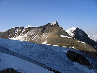
The Hinterer Bratschenkopf is a mountain in the Glockner Group on the Fusch-Kaprun ridge in the High Tauern, a high mountain range in the Austrian Central Alps. According to the listed sources it is 3,412 metres high, but the Austrian Federal Office for Metrology and Survey gives its height as 3,413 metres. The mountain lies in the Austrian state of Salzburg. It appears from the north, east and south as a gently curved firn summit, but from the west it has a mighty, 1,400-metre-high (4,600 ft) and 40 to 60° rock face. A steep, 500-metre-long (1,600 ft) knife-edge ridge bears away from the mountaintop to the north. Due to its close proximity to the Heinrich Schwaiger Haus, the summit is a popular viewing point. The peak was first climbed on 18 September 1869 by the Munich Alpinist, Karl Hofmann, the Prague businessman, Johann Stüdl, and mountain guides Thomas Groder and Josef Schnell from Kals am Großglockner.

The Großer Bärenstein is a 327 metres high table hill in the German region of Saxon Switzerland in the Free State of Saxony. Close by is the Kleiner Bärenstein which, together with the Großer Bärenstein, forms the massif known as the Bärensteine.
The Kleiner Bärenstein is a 338 metres high table hill in the German region of Saxon Switzerland in the Free State of Saxony. Close by is the Großer Bärenstein which, together with the Kleiner Bärenstein, forms the massif of the Bärensteine.

The Affensteine are a long chain of deeply fissured rocks in the Elbe Sandstone Mountains that are located east of Bad Schandau in the German region of Saxon Switzerland. They are bounded to the north by the Kirnitzsch valley, to the south by the Elb valley and in the east by the two Winterberg hills.


