
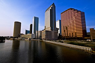
Hillsborough County is located in the west central portion of the U.S. state of Florida. In the 2020 census, the population was 1,459,762, making it the fourth-most populous county in Florida and the most populous county outside the Miami metropolitan area. A 2021 estimate has the population of Hillsborough County at 1,512,070 people with a yearly growth rate of 1.34%, which itself is greater than the populations of 12 states according to their 2019 population estimates. Its county seat and largest city is Tampa. Hillsborough County is part of the Tampa–St. Petersburg–Clearwater Metropolitan Statistical Area.

Riverview is an unincorporated census-designated place in Hillsborough County, Florida, United States. It is located south of Brandon. The population was 107,396 in the 2020 census, up from 71,050 in the 2010 census.
The Hillsborough River is a river located in the state of Florida in the United States. It arises in the Green Swamp near the juncture of Hillsborough, Pasco and Polk counties, and flows 60 miles (97 km) through Pasco and Hillsborough Counties to an outlet in the city of Tampa on Hillsborough bay. It includes 4 nature trails extending for over 7 miles (11 km), making it perfect for hikers. The name Hillsborough River first appeared on a British map in 1769. At the time, the Earl of Hillsborough was the British Secretary of State for the Colonies, and thus controlled the pensions of the surveyors working in the American colonies, which included East Florida.

Egmont Key State Park and National Wildlife Refuge is a Florida State Park located on the island of Egmont Key, at the mouth of Tampa Bay. Egmont Key lies southwest of Fort De Soto Park and can only be reached by boat or ferry. Located within Egmont Key State Park are the 1858 Egmont Key Lighthouse, maintained by the U.S. Coast Guard, and the ruins of Fort Dade, a Spanish–American War era fort that housed 300 residents. Egmont Key is located in Hillsborough County Florida on a narrow strip of the county that extends along the Tampa Port Shipping Channel.

The Alafia River is 25 miles (40 km) long, with a watershed of 335 square miles (870 km2) in Hillsborough County, Florida, United States, flowing into Tampa Bay. The watershed contains ten named lakes and ponds, and 29 named rivers, streams and canals. During the rainy season, excess water is pumped to the new C.W. Bill Young Regional Reservoir, which opened in 2005. The river is formed by two prongs. The north prong starts south of Mulberry and runs for 23.9 miles until it meets the south prong in Lithia. The south prong begins south of Bradley Junction and continues for 28.7 miles. The combined river then flows 24.7 miles west into Tampa Bay.
New Tampa is a region in Florida that encompasses both a 24-square-mile (62 km2) area within the corporate limits of the City of Tampa, as well as a larger land area that is in unincorporated Hillsborough, but retains a Tampa mailing address. The incorporated portion of "New Tampa" that lies within the city limits of Tampa is one of the largest city neighborhoods. The population has grown rapidly since being annexed by the city of Tampa in 1988. As of the 2000 census, the district had a population of 22,466. Many new master planned residential communities are planned or already under construction. Big-box stores are following the boom in population and are transforming this once rural area.
The Tampa Bypass Canal and Palm River are a 14-mile-long (23 km) flood bypass operated by the Southwest Florida Water Management District. The canal includes several concrete flood control structures and was constructed during the 1960s and 1970s. Its purpose is to redirect flood waters from large amounts of rainfall from the Hillsborough River to Tampa Bay to prevent floodwaters reaching homes and businesses. Despite its original purpose it is now used as a drinking water source for the City of Tampa. During construction of the canal the Floridan aquifer was accidentally breached.
The Southwest Florida Water Management District, is one of five regional agencies directed by Florida state law to protect and preserve water resources. Established in 1961 the agency operates and maintains several large properties and flood protection projects, sometimes with other agencies. The District's responsibilities have expanded to include managing water supply and protecting water quality and the natural systems — rivers, lakes, wetlands and associated uplands.The District's stated mission is to protect water resources, minimize flood risks and ensure the public’s water needs are met.
Temple Crest is a neighborhood and district located on the NorthEast of Tampa, Florida. The population was 8,621 at the 2000 census.

Tampa Bay Reforestation and Environmental Effort, Inc. more commonly known as "T.R.E.E. Inc.", is a grassroots nonprofit environmental organization based out of the Tampa Bay Area. It promoted the practice of volunteers raising and then planting trees along the interstates, roadways, and in parks of the greater Tampa Bay Area to beautify and preserve the environment. To date, T.R.E.E. Inc. has planted over 29,463 trees and palms.
Tampa Bay Water (TBW) is a regional wholesale drinking water utility that serves customers in the Tampa Bay, Florida region. The agency is a special district of the state created by inter-local agreement among six member governments. A nine-member board of directors composed of two elected commissioners from each member county and one elected representative from each member city oversees the policy decisions of the agency. The member governments that make up the board of directors are: The cities of New Port Richey, St. Petersburg, Florida, and Tampa, and Hillsborough County, Pasco County, and Pinellas County. These member governments provide water to over 2.5 million citizens.

Cypress Creek Preserve is a 7,400 acres (3,000 ha) park in Pasco County, Florida at 8720 Pump Station Road in Land o' Lakes, Florida. According to the Southwest Florida Water Management District (SWFWMD) the land was purchased to provide flood protection and as a public water supply. The park includes several trails covering 12 miles (19 km). Habitats include cypress and hardwood forests as well as slash pine, longleaf pine and palmetto in Florida flatwoods. Cypress Creek, a tributary of the Hillsborough River runs through the property. Butterflies, woodpeckers, wild pigs, deer, pigmy rattle snakes, armadillos, gopher tortoises, and several species of bird reside in the park. It is surrounded by a road and grazing lands in an area rapidly populating with suburban housing developments. The park can be accessed along Parkway Boulevard.
Edward Medard Park and Preserve, originally known as Pleasant Grove Reservoir Park, is located south of Plant City, Florida, on Turkey Creek Road in Hillsborough County, Florida. The 1,284-acre (5.20 km2) park just north of Durant, Florida was the site of phosphate mining in the 1960s by the American Cyanamid Company, before the land was donated. A dike and 770-acre (3.1 km2) reservoir were created in 1970 to provide flood protection along the Alafia River. The lake has a very extensive and irregular shoreline, and great variation is found in the lake bottom as well. The park is maintained by the Hillsborough County Parks and Recreation Department, and has camping, picknicking, and other facilities. Three long piers offer the ability to launch fairly large vessels, although the lake has a no-wake restriction. Additional opportunities for various sports and aquatic activities are available at the popular spot which attracts approximately 250,000 visitors a year.
According to the Natural Resources Defense Council's recent study, Florida is one of 14 states predicted to face "high risk" water shortages by the year 2050. The state's water is primarily drawn from the Floridan Aquifer as well as from the St. Johns River, the Suwannee River, and the Ocklawaha River. Florida's regional water conflicts stem primarily from the fact that the majority of the fresh water supply is found in the rural north, while the bulk of the population, and therefore water consumption, resides in the south. Metropolitan municipalities in central and south Florida have neared their aquifer extraction limit of 650 million US gallons (2,500,000 m3) per day, leading to the search for new, extra-regional sources.
McKay Bay Nature Park is a 38-acre (15 ha) park in Tampa.
Fish Hawk Creek Nature Preserve is a 3,286-acre (1,330 ha) nature preserve in Hillsborough County, Florida. The preserve is managed by Hillsborough County's Conservation and Environmental Lands Management Department and is located along the riparian corridor of FishHawk Creek, a significant tributary of the Alafia River. As a result, the acquisition and protection of the Fish Hawk Creek Nature Preserve has provided an essential link in assuring the long-term protection of a significant regional habitat corridor. Restoration projects have been initiated on the property. Habitats include pine flatwoods, sandhill, Florida scrub, and creek corridors. The preserve is bisected by FishHawk Blvd. and is identified by a north and a south section. The north section of the preserve includes a 2.2 mile hiking trail and can be accessed through Lithia Springs Regional Park in Lithia, Florida. The south portion of the preserve can be accessed through a parking area near the intersection of Boyette Rd. and Balm Rd. and includes a 2-mile hiking trail.
Alafia River Corridor Nature Preserve is a 4,700 acre area of protected lands in Hillsborough County, Florida. There are two trailheads for the preserves's hiking trails, one located at the north boundary of the Pinecrest Sports Complex on Hwy. 39 approximately one mile north of Hwy. 640 and one located on Hwy. 39 just north of Jameson Rd.
Wolf Branch Nature Preserve is a 1,400-acre (570 ha) nature preserve in Hillsborough County, Florida. The preserve is managed by Hillsborough County's Conservation and Environmental Lands Management Department Hillsborough County Conservation and Environmental Lands Management Department</ref>. It offers fishing and 2 miles (3.2 km) of hiking trails in areas of natural mangrove shoreline, upland cabbage palm hammocks, offshore sea grass beds in Tampa Bay, and tidally-influenced Wolf Branch Creek.

Greater Tampa Bay Area Council serves Scouts in West-Central Florida with the council headquarters in Tampa, Florida. Youth are served in the following nine counties: Citrus, Hardee, Hernando, Highlands, Hillsborough, Pasco, Pinellas, Polk and Sumter. Greater Tampa Bay Area Council was formed on May 1, 2016 by the merger of Gulf Ridge Council with West Central Florida Council.
Alderman's Ford Preserve, is a preserve and park in Hillsborough County, Florida, in the United States. The park has two public access points for automobiles, from Thompson Road and from Florida State Road 39 as well as numerous access points for horse, foot or canoe access only. Eight miles of equestrian trails are located along the southern portion of the park, which borders Alafia River State Park roughly along the border of Jameson Road. A three mile long hiking loop over the Alafia River, a baseball park, picknicking and canoe rental facilities can be accessed at the Highway 39 entrance.

