
Wümme is a river in northern Germany, in the states Lower Saxony and Bremen, marking the border between the two states for part of its course. It is the main headstream of the Lesum.
The Kocher is a 169 km (105 mi)-long right tributary of the Neckar in the north-eastern part of Baden-Württemberg, Germany. The name "Kocher" originates from its Celtic name "cochan" and probably means winding, meandering river. Its total drainage area is 1,960 km2 (760 sq mi). The Kocher rises in the eastern foothills of the Swabian Alb from two karst springs, the Schwarzer (black) Kocher and the Weißer (white) Kocher, that join in Unterkochen near Aalen. The Schwarzer Kocher is approximately 8 km (5.0 mi) long. Its source discharge varies between 50 l/s and 4,000 l/s with an average of 680 l/s. The 3.3 km (2.1 mi) long Weißer Kocher has an average discharge of 400 l/s.

The Else is a left tributary of the river Werre in the northeast of North Rhine-Westphalia and in southern Lower Saxony. The Else is a distributary of the river Hase and begins at a river bifurcation near Melle.

The Svatava is a river of Saxony, Germany and of the Czech Republic. It is a left tributary of the Ohře.
Weesener Bach, also called the Lutterbach, is a river of Lower Saxony, Germany, a tributary of the Örtze.
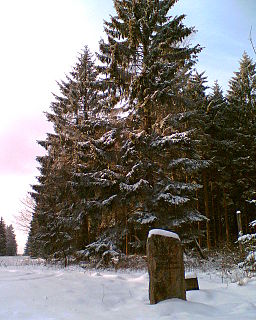
At 527.8 m (1,732 ft) above sea level, the Große Blöße is the highest hill in the Solling-Vogler Nature Park, the Solling and the Weser Uplands.

The Große Aue is an 88-kilometre-long (55 mi), southwestern, left tributary of the River Weser in northern North Rhine-Westphalia and central Lower Saxony in Germany.
Rinchnacher Ohe is a river of Bavaria, Germany. It is a right tributary of the Schwarzer Regen, the upper course of the Regen, near the town Regen.
The Kleine Röder, also called the Schwarzgraben, is a river in Saxony and Brandenburg, Germany.

Nordradde is a river of Lower Saxony, Germany. It flows into the Ems near Meppen.

Böse Sieben is a river of Saxony-Anhalt, Germany, flowing through the town Eisleben.
The Treba is a river of Saxony, Germany.
The Roter Graben is a river of Saxony, Germany. It rises northeast of Dresden in Dresden Heath. It is a left tributary of the Große Röder in Grünberg, an Ortsteil of Ottendorf-Okrilla.

Ichte, in its upper course also called Steinaer Bach, is a river of Thuringia and Lower Saxony, Germany.
Hellegrundbach is a river of Lower Saxony, Germany.

Schwarzer Graben is a river of North Rhine-Westphalia, Germany.
Schwarzer Graben may refer to:
