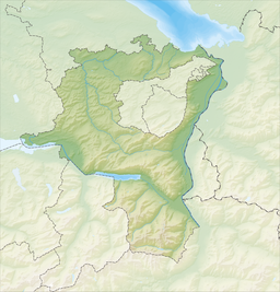
The Himalayas, or Himalaya is a mountain range in Asia, separating the plains of the Indian subcontinent from the Tibetan Plateau. The range has several peaks exceeding an elevation of 8,000 m (26,000 ft) including Mount Everest, the highest mountain on Earth. The mountain range runs for 2,400 km (1,500 mi) as an arc from west-northwest to east-southeast at the northern end of the Indian subcontinent.

The Adirondack Mountains are a massif of mountains in Northeastern New York which form a circular dome approximately 160 miles (260 km) wide and covering about 5,000 square miles (13,000 km2). The region contains more than 100 peaks, including Mount Marcy, which is the highest point in New York at 5,344 feet (1,629 m). The Adirondack High Peaks, a traditional list of 46 peaks over 4,000 feet (1,200 m), are popular hiking destinations. There are over 200 named lakes with the number of smaller lakes, ponds, and other bodies of water reaching over 3,000. Among the named lakes around the mountains are Lake George, Lake Placid, and Lake Tear of the Clouds. The region has over 1,200 miles (1,900 km) of river.

The Altai Mountains, also spelled Altay Mountains, are a mountain range in Central and East Asia, where Russia, China, Mongolia, and Kazakhstan converge, and where the rivers Irtysh and Ob have their headwaters. The massif merges with the Sayan Mountains in the northeast, and gradually becomes lower in the southeast, where it merges into the high plateau of the Gobi Desert. It spans from about 45° to 52° N and from about 84° to 99° E.

Rocky Mountain National Park is a national park of the United States located approximately 55 mi (89 km) northwest of Denver in north-central Colorado, within the Front Range of the Rocky Mountains. The park is situated between the towns of Estes Park to the east and Grand Lake to the west. The eastern and western slopes of the Continental Divide run directly through the center of the park with the headwaters of the Colorado River located in the park's northwestern region. The main features of the park include mountains, alpine lakes and a wide variety of wildlife within various climates and environments, from wooded forests to mountain tundra.

The Wasatch Range or Wasatch Mountains is a mountain range in the western United States that runs about 160 miles (260 km) from the Utah-Idaho border south to central Utah. It is the western edge of the greater Rocky Mountains, and the eastern edge of the Great Basin region. The northern extension of the Wasatch Range, the Bear River Mountains, extends just into Idaho, constituting all of the Wasatch Range in that state.
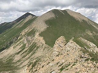
The Šar Mountains or Sharr Mountains is a mountain range in Southeast Europe, extending into several countries from southern Kosovo, to northwestern North Macedonia, to northeastern Albania. The sections in Kosovo, and in North Macedonia are national parks. Rugged and barren, the mountains are among the highest in the Balkans, with 30 peaks higher than 2,500 m (8,202 ft).
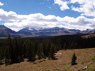
The Uinta Mountains are an east-west trending mountain range in northeastern Utah extending a short distance into northwest Colorado and slightly into southwestern Wyoming in the United States. As a subrange of the Rocky Mountains, they are unusual for being the highest range in the contiguous United States running east to west, and lie approximately 100 miles (160 km) east of Salt Lake City. The range has peaks ranging from 11,000 to 13,528 feet, with the highest point being Kings Peak, also the highest point in Utah. The Mirror Lake Highway crosses the western half of the Uintas on its way to Wyoming. Utah State Route 44 crosses the east end of the Uintas between Vernal and Manila.

Mount Blue Sky is the highest peak in the Mount Evans Wilderness in the Front Range of the Rocky Mountains of North America. The prominent 14,266.1-foot (4,348 m) fourteener is located 13.4 miles (21.6 km) southwest by south of Idaho Springs in Clear Creek County, Colorado, United States, on the drainage divide between Clear Creek in Arapaho National Forest and the North Fork South Platte River in Pike National Forest.
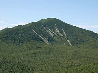
Dix Mountain is a mountain in the Dix Range of the Adirondacks in the U.S. state of New York. With an elevation of 4,857 feet (1,480 m), it is the sixth-highest peak in New York and one of the 46 Adirondack High Peaks. It is located roughly on the boundary between the towns of North Hudson and Keene in Essex County, and in the High Peaks Wilderness Area of Adirondack Park. The crest of the peak consists of a very narrow ridge, which continues to the southeast and rises to a subsidiary peak named Beckhorn, then continues south to other peaks of the Dix Range. The summit is also in an alpine zone above the treeline. The ridge offers unobstructed views of Elk Lake to the southwest, the Great Range to the northwest, and Lake Champlain and the Green Mountains to the east.

The Albertine Rift is the western branch of the East African Rift, covering parts of Uganda, the Democratic Republic of the Congo (DRC), Rwanda, Burundi and Tanzania. It extends from the northern end of Lake Albert to the southern end of Lake Tanganyika. The geographical term includes the valley and the surrounding mountains.

Mount Jo is a 2,832-foot-tall (863 m) mountain in the heart of the Adirondack Mountains of New York. It is in North Elba, New York on land owned by the Adirondack Mountain Club. The Adirondack Loj and Heart Lake are at the foot of Mount Jo. There are two trails that lead to its summit.

The Sierra Pelona, also known as the Sierra Pelona Ridge or the Sierra Pelona Mountains, is a mountain ridge in the Transverse Ranges in Southern California. Located in northwest Los Angeles County, the ridge is bordered on the north by the San Andreas Fault and lies within and is surrounded by the Angeles National Forest and a tiny section in the Los Padres National Forest
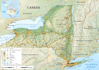
The geography of New York varies widely across the state. Most of New York is dominated by farms, forests, rivers, mountains, and lakes. New York's Adirondack Park is larger than any U.S. National Park in the contiguous United States. Niagara Falls, on the Niagara River as it flows from Lake Erie to Lake Ontario, is a popular attraction. The Hudson River begins near Lake Tear of the Clouds and flows south through the eastern part of the state without draining lakes George or Champlain. Lake George empties at its north end into Lake Champlain, whose northern end extends into Canada, where it drains into the Richelieu River and then the St. Lawrence. Four of New York City's five boroughs are on the three islands at the mouth of the Hudson River: Manhattan Island, Staten Island, and Brooklyn and Queens on Long Island.
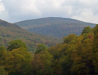
Balsam Lake Mountain is one of the Catskill Mountains, located in the Town of Hardenburgh, New York, United States. It is the westernmost of the range's 35 High Peaks. Its exact height has not been determined, but the highest contour line on topographic maps, 3,720 feet (1,130 m), is usually given as its elevation.
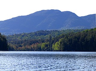
Ampersand Mountain is a 3,352 ft (1,021.7 m) mountain in Franklin County in the High Peaks Wilderness Area of the northeastern Adirondacks, west of the High Peaks proper in New York State. The trail up the mountain begins on New York State Route 3 8.1 miles (13.0 km) southwest of the village of Saranac Lake, near Middle Saranac Lake; it is a popular day hike. The mountain takes its name from nearby Ampersand Creek, so named because it twists and turns like the ampersand symbol. The summit is bare rock, with extensive views of the High Peaks to the east and the Saranac Lakes to the west. Stony Creek Mountain is located west-southwest of Ampersand Mountain. The mountain is notable as the land surrounding its hiking trail's initial ascent is generally acknowledged as unlogged old growth forest.

Pitchoff Mountain is a 3,600-foot (1,097 m) mountain opposite Cascade Mountain on NY 73 west of Keene Valley in Essex County, New York, in the US. There are two summits; the higher summit is viewless, but the northern summit, at 3,323 feet (1,013 m) offers 360 degree views of the nearby Cascade Lakes, the High Peaks of the Adirondacks, and, in clear weather, the Green Mountains of Vermont. There is a 5.2-mile (8.4 km) hiking trail that starts on Route 73 west of the Cascade Lakes, climbs 2.0 miles (3.2 km) to the blind summit, then traverses the nearly two-mile summit ridge to the northern summit before descending 1.4 miles (2.3 km) to Route 73 east of the Lakes, 2.7 miles (4.3 km) east of the starting point.
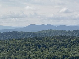
Owls Head Mountain is a 2,786-foot-tall (849 m) mountain in the Adirondack Mountains region of New York. It is located west-southwest of the hamlet of Long Lake in Hamilton County.
West Mountain is a 2,923-foot-tall (891 m) mountain located in Adirondack Mountains of New York. It is located in the northwest of the hamlet of Raquette Lake in Hamilton County. In 1920, the Conservation Commission built a 47-foot-tall (14 m) fire lookout tower on the mountain. Due to aerial detection, the tower ceased fire lookout operations at the end of the 1970 season. The tower was later removed, and portions of the tower along with the tower from Kempshall Mountain were used to build the tower that is at the Essex County Historical Museum in Elizabethtown.
Loon Lake Mountains are a pair of mountains, the tallest being 3,311-foot-tall (1,009 m), near Loon Lake in Franklin County, New York. On the summit is the Loon Lake Mountain Fire Observation Station, which was added to the National Register of Historic Places in 2015.


