
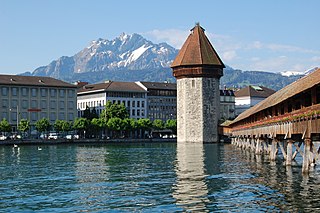
The Rhaetian Railway, abbreviated RhB, is a Swiss transport company that owns the largest network of all private railway operators in Switzerland. Headquartered in Chur, the RhB operates all the railway lines of the Swiss canton of Grisons, except for the line from Sargans to the cantonal capital, Chur, which are operated by Swiss Federal Railways (SBB CFF FFS), as well as the line from Disentis/Mustér to the Oberalp Pass and further on to Andermatt, Uri, which is operated by Matterhorn Gotthard Bahn (MGB). Inaugurated in 1888 and expanded from 1896 onwards in various sections, the RhB network is located almost entirely within Grisons, with one station across the Italian border at Tirano.

The canton of Uri is one of the 26 cantons of Switzerland and a founding member of the Swiss Confederation. It is located in Central Switzerland. The canton's territory covers the valley of the Reuss between the St. Gotthard Pass and Lake Lucerne.

Altdorf is a municipality in Switzerland. It is the capital of the Swiss canton of Uri and retains historic town privileges. It is the place where, according to the legend, William Tell shot the apple from his son's head.

The Allegheny Plateau is a large dissected plateau area of the Appalachian Mountains in western and central New York, northern and western Pennsylvania, northern and western West Virginia, and eastern Ohio. It is divided into the unglaciated Allegheny Plateau and the glaciated Allegheny Plateau.
The Reuss is a river in Switzerland. With a length of 164 kilometres (102 mi) and a drainage basin of 3,426 square kilometres (1,323 sq mi), it is the fourth largest river in Switzerland. The upper Reuss forms the main valley of the canton of Uri. The course of the lower Reuss runs from Lake Lucerne to the confluence with the Aare at Brugg and Windisch.

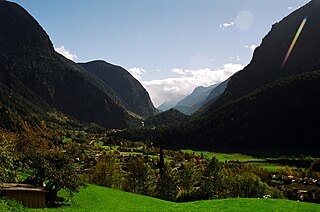
Andermatt is a mountain village and municipality in the canton of Uri in Switzerland. At an elevation of 1,437 meters (4,715 ft) above sea level, Andermatt is located at the center of the Saint-Gotthard Massif and the historical center cross of north-south and east-west traverses of Switzerland. It is some 28 km (17 mi) south of Altdorf, the capital of Uri.

Klausen Pass is a high mountain pass in the Swiss Alps connecting Altdorf in the canton of Uri with Linthal in the canton of Glarus. Somewhat unusually, the boundary between the two cantons does not lie at the summit of the pass, but some 8 kilometres (5.0 mi) down the slope towards Linthal, with the summit being in Uri.

Bürglen is a municipality in the canton of Uri in Switzerland.

The River Alport flows for 5.6 miles (9 km) in the Dark Peak of the Peak District in Derbyshire, England. Its source is on Bleaklow, 3 miles (4.8 km) east of Glossop, from which it flows south through the Grains in the Water bog, then over gritstone below the Alport Castles landslide to Alport Bridge on the A57 Snake Pass route from Sheffield to Manchester, where it joins the River Ashop. The Ashop flows into Ladybower Reservoir about 2.5 miles (4.0 km) down the valley, which discharges via the Rivers Derwent and Trent to the North Sea. The source of the Alport is close to the Pennine watershed.

Muotathal is a village and a municipality in Schwyz District in the canton of Schwyz in Switzerland. The eponymous valley, the Muotatal, is formed by the Muota, which joins Lake Lucerne at Brunnen.

Unterschächen is a municipality in the canton of Uri in Switzerland, situated in the upper Schächental.
The Ötztal is an alpine valley located in Tyrol, Austria. The Ötztaler Ache river flows through the valley in a northern direction. The Ötztal separates the Stubai Alps in the east from the Ötztal Alps in the west. The valley is 65 km (40 mi) long. The northern end of the valley is at the confluence of the Ötztaler Ache and Inn rivers, 8 km east of Imst and 50 km west of Innsbruck. The only railway station of the valley, Ötztal railway station, is located here and connects the Ötztal with the Arlberg railway (Innsbruck-Bludenz) and also a motorway interchange to the A12 (E60).

The Val Bregaglia is an alpine valley of Switzerland and Italy at the base of which runs the river Mera.

The Seeztal is a valley of the canton of St. Gallen, Switzerland, extending to the east of Lake Walen for some 10 km, formed by the river Seez. The valley appears to be a left branch off the Rhine valley at Sargans, but there is a divide at Mels. Situated in the Seeztal are the municipalities of Walenstadt, Flums and Mels.

The Schächentaler Windgällen is a mountain massif in the Schwyzer Alps, overlooking Unterschächen in the canton of Uri. The two named peaks are Höch Windgällen and Läged Windgällen. The mountain massif lies between the valley of Muotathal (north) and Schächental (south). The Schächentaler Windgällen are located a few kilometres west of Klausen Pass.

The Limmat Valley is a river valley and a region in the cantons of Zürich and Aargau in Switzerland.
The Rheinwald is a valley in the Canton of Grisons in Switzerland, the first section of the Hinterrhein valley. The river Hinterrhein flows through three valleys in the Grisons, the Rheinwald, the Schams and the Domleschg.
The Alpler Torstock is a mountain of the Glarus Alps, located north of Unterschächen in the canton of Uri. It lies west of the Schächentaler Windgällen, on the range between the valley of the Muota and the valley of Schächental.

The battle of (the) Gotthard Pass, also known as the battle of the St. Gotthard Pass or the battle of the St. Gotthard, saw an Imperial Russian army commanded by Field Marshal Alexander Suvorov supported by two Austrian brigades attack a French division under General of Division Claude Lecourbe. The same day brought clashes at the Oberalp Pass and Hospental.
