Attinghausen | |
|---|---|
 Attinghausen village | |
 Coat of arms | |
 | |
| Location of Attinghausen | |
 Attinghausen 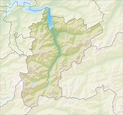 Attinghausen | |
| Coordinates: 46°51′N8°37′E / 46.850°N 8.617°E | |
| Country | Switzerland |
| Canton | Uri |
| District | n.a. |
| Area | |
• Total | 46.83 km2 (18.08 sq mi) |
| Elevation | 469 m (1,539 ft) |
| Population (December 2020) | |
• Total | 1,747 |
| • Density | 37.31/km2 (96.62/sq mi) |
| Time zone | UTC+01:00 (CET) |
| • Summer (DST) | UTC+02:00 (CEST) |
| Postal code | 6468 |
| SFOS number | 1203 |
| ISO 3166 code | CH-UR |
| Surrounded by | Altdorf, Bürglen, Engelberg (OW), Erstfeld, Isenthal, Schattdorf, Seedorf, Wassen |
| Website | www.attinghausen.ch |
Attinghausen is a village and a municipality in the canton of Uri in Switzerland.