Seelisberg

Last updated
Seelisberg
Seelisberg 1001.JPG
Wappen Seelisberg UR.svg
Location of Seelisberg
Seelisberg
Switzerland adm location map.svg
Red pog.svg
Seelisberg
Reliefkarte Uri blank.png
Red pog.svg
Seelisberg
Coordinates: 46°59′N8°35′E / 46.983°N 8.583°E / 46.983; 8.583
Country Switzerland
Canton Uri
District n.a.
Area
[1]
  Total13.29 km2 (5.13 sq mi)
Elevation
801 m (2,628 ft)
Population
 (31 December 2018) [2]
  Total661
  Density50/km2 (130/sq mi)
Time zone UTC+01:00 (Central European Time)
  Summer (DST) UTC+02:00 (Central European Summer Time)
Postal code(s)
6377
SFOS number 1215
Surrounded by Bauen, Emmetten (NW), Ingenbohl (SZ), Isenthal, Morschach (SZ), Sisikon
Website www.seelisberg.ch
SFSO statistics

Seelisberg is a municipality in the canton of Uri in Switzerland.

Contents

History

The Rütli meadow, according to legend the site of the original oath foundational to the Old Swiss Confederacy, is situated in the territory of the municipality.

The Seelisberg Conference against anti-Semitism was held in this locality in 1947. [3]

The global headquarters of the Transcendental Meditation movement headed by Maharishi Mahesh Yogi was situated in a converted hotel in Seelisberg from 1968 to 1992.

Geography

Seeli (literally "small lake") or Seelisbergsee, the lake after which "Seelisberg" is named Picswiss UR-28-26.jpg
Seeli (literally "small lake") or Seelisbergsee, the lake after which "Seelisberg" is named
Aerial view by Walter Mittelholzer (1932) ETH-BIB-Seelisberg mit Vierwaldstattersee-Inlandfluge-LBS MH01-006908.tif
Aerial view by Walter Mittelholzer (1932)

Seelisberg has an area, as of 2006, of 13.3 km2 (5.1 sq mi). Of this area, 34.3% is used for agricultural purposes, while 48.7% is forested. Of the rest of the land, 4% is settled (buildings or roads) and the remainder (13.1%) is non-productive (rivers, glaciers or mountains). [4] In the 1993 land survey, 43.5% of the total land area was heavily forested, while 0.7% is covered in small trees and shrubbery. Of the agricultural land, 0.7% is used for farming or pastures, while 23.6% is used for orchards or vine crops and 10.0% is used for alpine pastures. Of the settled areas, 2.0% is covered with buildings, 0.5% is classed as special developments, 0.2% is listed as parks and greenbelts and 1.3% is transportation infrastructure. Of the unproductive areas, 1.9% is unproductive standing water (ponds or lakes), 0.2% is unproductive flowing water (rivers), 5.7% is too rocky for vegetation, and 5.3% is other unproductive land. [5]

Demographics

Seelisberg has a population (as of 31 December 2020) of 688. [6] As of 2007, 11.1% of the population was made up of foreign nationals. Over the last 10 years the population has grown at a rate of 4.2%. Most of the population (as of 2000) speaks German (97.1%), with French being second most common (0.8%) and English being third ( 0.5%). [4] As of 2007 the gender distribution of the population was 49.9% male and 50.1% female. [7]

In the 2007 federal election the FDP party received 93.4% of the vote. [4]

In Seelisberg about 67.8% of the population (between age 25-64) have completed either non-mandatory upper secondary education or additional higher education (either university or a Fachhochschule ). [4]

Seelisberg has an unemployment rate of 0.88%. As of 2005, there were 72 people employed in the primary economic sector and about 31 businesses involved in this sector. 18 people are employed in the secondary sector and there are 7 businesses in this sector. 151 people are employed in the tertiary sector, with 29 businesses in this sector. [4]

The historical population is given in the following table: [8]

yearpopulation
1970550
1980533
1990569
2000592
2005607
2007639

Transport

Regular passenger boats of the Schifffahrtsgesellschaft des Vierwaldstättersees serve piers at Treib and Rütli on the Lake Lucerne shore of the municipality. Treib is linked to the centre of Seelisberg by the Treib–Seelisberg funicular.

Related Research Articles

<span class="mw-page-title-main">Göschenen</span> Municipality in Uri, Switzerland

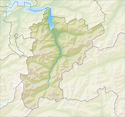
Göschenenlocally[ɡɔʊʃɛnɛn] is a village and municipality in the canton of Uri in Switzerland. It sits at the northern end of the Gotthard tunnel. The Göschenen riots (1875) saw Urner troops opening fire on Italian miners demonstrating for better working conditions and wages on the tunnel's construction site.

<span class="mw-page-title-main">Isenthal</span> Municipality in Uri, Switzerland

Isenthal is a municipality in the canton of Uri in Switzerland.

<span class="mw-page-title-main">Sisikon</span> Municipality in Uri, Switzerland

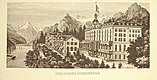
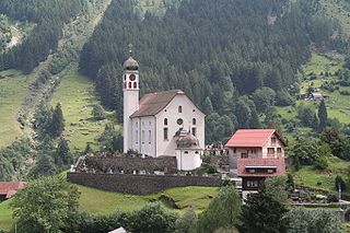
Sisikon is a municipality in the canton of Uri in Switzerland. It is situated on the shore of Lake Lucerne.

<span class="mw-page-title-main">Attinghausen</span> Municipality in Uri, Switzerland

Attinghausen is a village and a municipality in the canton of Uri in Switzerland.

<span class="mw-page-title-main">Bauen</span> Former municipality in Uri, Switzerland

Bauen is a former municipality on Lake Lucerne in the Swiss canton of Uri. On 1 January 2021 the former municipality of Bauen merged into the municipality of Seedorf.

<span class="mw-page-title-main">Bürglen, Uri</span> Municipality in Uri, Switzerland

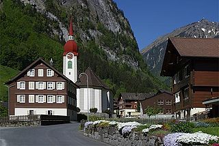
Bürglen is a municipality in the canton of Uri in Switzerland.

Graben is a municipality in the Oberaargau administrative district in the canton of Bern in Switzerland.

<span class="mw-page-title-main">Oberbipp</span> Municipality in Bern, Switzerland

Oberbipp is a municipality in the Oberaargau administrative district in the canton of Bern in Switzerland.

<span class="mw-page-title-main">Erstfeld</span> Municipality in Uri, Switzerland

Erstfeld is a municipality in the canton of Uri in Switzerland.

<span class="mw-page-title-main">Gurtnellen</span> Municipality in Uri, Switzerland

Gurtnellen is a village and a municipality in the canton of Uri in Switzerland.

<span class="mw-page-title-main">Hospental</span> Municipality in Uri, Switzerland

Hospental is a municipality in the canton of Uri in Switzerland.

<span class="mw-page-title-main">Realp</span> Municipality in Uri, Switzerland

Realp is a municipality in the canton of Uri in Switzerland.

<span class="mw-page-title-main">Schattdorf</span> Municipality in Uri, Switzerland

Schattdorf is a village and a municipality in the canton of Uri in Switzerland.

<span class="mw-page-title-main">Silenen</span> Municipality in Uri, Switzerland

Silenen is a municipality in the canton of Uri in Switzerland.

<span class="mw-page-title-main">Spiringen</span> Municipality in Uri, Switzerland

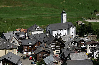
Spiringen is a village and a municipality in the canton of Uri in Switzerland. The municipality comprises two disjoint areas, separated by the municipality of Unterschächen and the Klausen Pass. The western area includes the village of Spiringen in the Schächen Valley, whilst the eastern area includes the Urner Boden alp above Linthal and the canton of Glarus.

<span class="mw-page-title-main">Unterschächen</span> Municipality in Uri, Switzerland

Unterschächen is a municipality in the canton of Uri in Switzerland, situated in the upper Schächental.

<span class="mw-page-title-main">Wassen</span> Municipality in Uri, Switzerland

Wassen is a municipality in the canton of Uri in Switzerland.

<span class="mw-page-title-main">Reiden</span> Municipality in Lucerne, Switzerland

Reiden is a municipality in the district of Willisau in the canton of Lucerne in Switzerland. On January 1, 2006 the former municipalities of Langnau bei Reiden and Richenthal were united in the new municipality of Reiden.

Arbaz is a municipality in the district of Sion in the canton of Valais in Switzerland.

<span class="mw-page-title-main">Kippel</span> Municipality in Valais, Switzerland

Kippel is a municipality in the district of Raron in the canton of Valais in Switzerland.

References

  1. "Arealstatistik Standard - Gemeinden nach 4 Hauptbereichen". Federal Statistical Office. Retrieved 13 January 2019.
  2. "Ständige Wohnbevölkerung nach Staatsangehörigkeitskategorie Geschlecht und Gemeinde; Provisorische Jahresergebnisse; 2018". Federal Statistical Office. 9 April 2019. Retrieved 11 April 2019.
  3. The 10 Points of Seelisburg, 1947. Retrieved August 17, 2016.
  4. 1 2 3 4 5 Swiss Federal Statistical Office accessed 09-Sep-2009
  5. Canton Uri - Ground use statistics (in German) accessed 8 September 2009
  6. "Ständige und nichtständige Wohnbevölkerung nach institutionellen Gliederungen, Geburtsort und Staatsangehörigkeit". bfs.admin.ch (in German). Swiss Federal Statistical Office - STAT-TAB. 31 December 2020. Retrieved 21 September 2021.
  7. Uri Population statistics (in German) accessed 8 September 2009
  8. Uri in Numbers 2009/10 edition (in German) accessed 8 September 2009