Gurtnellen

Last updated
Gurtnellen
SBB Re 6-6 Re 4-4 Gurtnellen.jpg
Gurtnellen Wappen.svg
Location of Gurtnellen
Gurtnellen
Switzerland adm location map.svg
Red pog.svg
Gurtnellen
Reliefkarte Uri blank.png
Red pog.svg
Gurtnellen
Coordinates: 46°43′N8°37′E / 46.717°N 8.617°E / 46.717; 8.617
Country Switzerland
Canton Uri
District n.a.
Area
[1]
  Total83.31 km2 (32.17 sq mi)
Elevation
928 m (3,045 ft)
Population
 (31 December 2018) [2]
  Total540
  Density6.5/km2 (17/sq mi)
Time zone UTC+01:00 (Central European Time)
  Summer (DST) UTC+02:00 (Central European Summer Time)
Postal code(s)
6482
SFOS number 1209
Surrounded by Andermatt, Erstfeld, Göschenen, Silenen, Tujetsch (GR), Wassen
Website www.gurtnellen.ch
SFSO statistics

Gurtnellen is a village and a municipality in the canton of Uri in Switzerland.

Contents

History

Gurtnellen is first mentioned in 1257 as Chuno und die Gurteneller. In 1321 it was mentioned as Gruntellon, and in 1359 as Gurtenellen. [3]

Geography

Map showing the Pfaffensprung spiral tunnel outside Gurtnellen PfaffensprungSpiralTunnel DoubleLoopCurvedAlignmentTunnels atWassen onNorthernRampToGotthardTunnel.jpg
Map showing the Pfaffensprung spiral tunnel outside Gurtnellen
The Saint Joseph parish church and the Reuss river in Gurtnellen St. Joseph Kirche und Reuss in Gurtnellen Kanton Uri.jpg
The Saint Joseph parish church and the Reuss river in Gurtnellen
Aerial view from 1600 m by Walter Mittelholzer (1931) ETH-BIB-Gurtnellen, Reusstal v. S. W. aus 1600 m-Inlandfluge-LBS MH01-006182.tif
Aerial view from 1600 m by Walter Mittelholzer (1931)

Gurtnellen has an area, as of 2006, of 83.4 km2 (32.2 sq mi). Of this area, 11.9% is used for agricultural purposes, while 25.1% is forested. Of the rest of the land, 1.3% is settled (buildings or roads) and the remainder (61.7%) is non-productive (rivers, glaciers or mountains). [4] In the 1993/97 land survey, 16.9% of the total land area was heavily forested, while 5.2% is covered in small trees and shrubbery. Of the agricultural land, 0.0% is used for farming or pastures, while 2.9% is used for orchards or vine crops and 9.0% is used for alpine pastures. Of the settled areas, 0.2% is covered with buildings, 0.1% is industrial, 0.2% is classed as special developments, and 0.8% is transportation infrastructure. Of the unproductive areas, 0.1% is unproductive standing water (ponds or lakes), 0.9% is unproductive flowing water (rivers), 39.3% is too rocky for vegetation, and 21.4% is other unproductive land. [5]

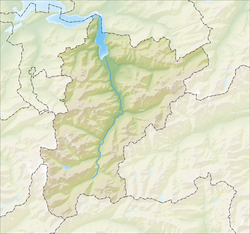
The municipality is located above the Reuss along the Gotthard rail line. It consists of the village sections of Dorf, Wiler, Intschi, Arni as well as part of the area on the left side of the Reuss near Amsteg and Silenen.

Demographics

Gurtnellen has a population (as of 31 December 2020) of 512. [6] As of 2007, 4.4% of the population was made up of foreign nationals. Over the last 10 years the population has decreased at a rate of -8.7%. Most of the population (as of 2000) speaks German (97.3%), with Portuguese being second most common ( 1.6%) and French being third ( 0.5%). [4] As of 2007 the gender distribution of the population was 50.0% male and 50.0% female. [7]

In the 2007 federal election the FDP party received 90.6% of the vote. [4]

The entire Swiss population is generally well educated. In Gurtnellen about 43.9% of the population (between age 25-64) have completed either non-mandatory upper secondary education or additional higher education (either university or a Fachhochschule ). [4]

Gurtnellen has an unemployment rate of 0.65%. As of 2005, there were 82 people employed in the primary economic sector and about 38 businesses involved in this sector. 64 people are employed in the secondary sector and there are 3 businesses in this sector. 168 people are employed in the tertiary sector, with 21 businesses in this sector. [4]

The historical population is given in the following table: [3] [8]

yearpopulation
1837615
1850675
18801,541 a
19001,112
19201,631 b
19501,132
19701,048
1980813
1990688
2000631
2005640
2007638
^a Population increase due to construction of the Gotthard rail tunnel.
^b Population increase due to bridge construction and electrification of the Gotthard rail tunnel.

Related Research Articles

<span class="mw-page-title-main">Göschenen</span> Municipality in Uri, Switzerland

Göschenenlocally[ɡɔʊʃɛnɛn] is a village and municipality in the canton of Uri in Switzerland. It sits at the northern end of the Gotthard tunnel. The Göschenen riots (1875) saw Urner troops opening fire on Italian miners demonstrating for better working conditions and wages on the tunnel's construction site.

<span class="mw-page-title-main">Andermatt</span> Municipality in Uri, Switzerland

Andermatt is a mountain village and municipality in the canton of Uri in Switzerland. At an elevation of 1,437 meters (4,715 ft) above sea level, Andermatt is located at the center of the Saint-Gotthard Massif and the historical center cross of north-south and east-west traverses of Switzerland. It is some 28 km (17 mi) south of Altdorf, the capital of Uri.

<span class="mw-page-title-main">Isenthal</span> Municipality in Uri, Switzerland

Isenthal is a municipality in the canton of Uri in Switzerland.

<span class="mw-page-title-main">Sisikon</span> Municipality in Uri, Switzerland

Sisikon is a municipality in the canton of Uri in Switzerland. It is situated on the shore of Lake Lucerne.

<span class="mw-page-title-main">Attinghausen</span> Municipality in Uri, Switzerland

Attinghausen is a village and a municipality in the canton of Uri in Switzerland.

<span class="mw-page-title-main">Bürglen, Uri</span> Municipality in Uri, Switzerland

Bürglen is a municipality in the canton of Uri in Switzerland.

Buchrain is a municipality in the district of Lucerne in the canton of Lucerne in Switzerland.

<span class="mw-page-title-main">Mühlau</span> Municipality in Aargau, Switzerland

Mühlau is a municipality in the district of Muri in the canton of Aargau in Switzerland.

<span class="mw-page-title-main">Rottenschwil</span> Municipality in Aargau, Switzerland

Rottenschwil is a municipality in the district of Muri in the canton of Aargau in Switzerland.

<span class="mw-page-title-main">Erstfeld</span> Municipality in Uri, Switzerland

Erstfeld is a municipality in the canton of Uri in Switzerland.

<span class="mw-page-title-main">Flüelen</span> Municipality in Uri, Switzerland

Flüelen is a municipality in the canton of Uri in Switzerland.

<span class="mw-page-title-main">Hospental</span> Municipality in Uri, Switzerland

Hospental is a municipality in the canton of Uri in Switzerland.

<span class="mw-page-title-main">Realp</span> Municipality in Uri, Switzerland

Realp is a municipality in the canton of Uri in Switzerland.

<span class="mw-page-title-main">Schattdorf</span> Municipality in Uri, Switzerland

Schattdorf is a village and a municipality in the canton of Uri in Switzerland.

<span class="mw-page-title-main">Seelisberg</span> Municipality in Uri, Switzerland

Seelisberg is a municipality in the canton of Uri in Switzerland.

<span class="mw-page-title-main">Silenen</span> Municipality in Uri, Switzerland

Silenen is a municipality in the canton of Uri in Switzerland.

<span class="mw-page-title-main">Spiringen</span> Municipality in Uri, Switzerland

Spiringen is a village and a municipality in the canton of Uri in Switzerland. The municipality comprises two disjoint areas, separated by the municipality of Unterschächen and the Klausen Pass. The western area includes the village of Spiringen in the Schächen Valley, whilst the eastern area includes the Urner Boden alp above Linthal and the canton of Glarus.

<span class="mw-page-title-main">Unterschächen</span> Municipality in Uri, Switzerland

Unterschächen is a municipality in the canton of Uri in Switzerland, situated in the upper Schächental.

<span class="mw-page-title-main">Wassen</span> Municipality in Uri, Switzerland

Wassen is a municipality in the canton of Uri in Switzerland.

<span class="mw-page-title-main">Inwil</span> Municipality in Lucerne, Switzerland

Inwil is a municipality in the district of Hochdorf in the canton of Lucerne in Switzerland.

References

  1. "Arealstatistik Standard - Gemeinden nach 4 Hauptbereichen". Federal Statistical Office. Retrieved 13 January 2019.
  2. "Ständige Wohnbevölkerung nach Staatsangehörigkeitskategorie Geschlecht und Gemeinde; Provisorische Jahresergebnisse; 2018". Federal Statistical Office. 9 April 2019. Retrieved 11 April 2019.
  3. 1 2 Gurtnellen in German , French and Italian in the online Historical Dictionary of Switzerland .
  4. 1 2 3 4 5 Swiss Federal Statistical Office accessed 09-Sep-2009
  5. Canton Uri - Ground use statistics Archived 2011-07-07 at the Wayback Machine (in German) accessed 8 September 2009
  6. "Ständige und nichtständige Wohnbevölkerung nach institutionellen Gliederungen, Geburtsort und Staatsangehörigkeit". bfs.admin.ch (in German). Swiss Federal Statistical Office - STAT-TAB. 31 December 2020. Retrieved 21 September 2021.
  7. Uri Population statistics Archived 2011-07-07 at the Wayback Machine (in German) accessed 8 September 2009
  8. Uri in Numbers 2009/10 edition Archived 2011-07-07 at the Wayback Machine (in German) accessed 8 September 2009