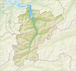
Silenen municipality comprises the villages of Silenen (divided into three parts, Dörfli, Russ, Rusli), Amsteg, and Acherli, besides numerous smaller hamlets or dispersed settlements, including Schützen, Buechholz, Öfibach, Dägerlohn, Frentschenberg, Ried (Vorderried, Hinterried), Maderanerthal valley (St. Anton = Vorderbristen, Bristen = Hinterbristen, Cholplatz, Hälteli, Steinmatte, Schattigmatt etc.), Hofstetten, Silblen, and the Golzeren plateau (Egg, Hüseren, Seewen, etc.)
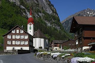
Chärstelenbach Bridge near Amsteg
Silenen has an area, as of 2006[update], of 144.8km2 (55.9sqmi). Of this area, 12.8% is used for agricultural purposes (mostly alpine pastures), while 18.3% is forested. Of the rest of the land, 0.7% is settled (buildings or roads) and the remainder (68.1%) is non-productive (mostly mountainous).[3][4]
Silenen has a population (as of 31 December 2020) of 1,951.[6]As of 2007[update], 11.7% of the population was made up of foreign nationals. Over the last 10 years the population has grown at a rate of 4.5%. Most of the population (as of 2000[update]) speaks German (98.1%), with Italian being second most common ( 0.2%) and Serbo-Croatian being third ( 0.2%).[3]As of 2007[update] the gender distribution of the population was 55.3% male and 44.7% female.[7]
In Silenen about 52.8% of the population (between age 25-64) have completed either non-mandatory upper secondary education or additional higher education (either university or a Fachhochschule).[3]
Silenen has an unemployment rate of 1.22%. As of 2005[update], there were 141 people employed in the primary economic sector and about 60 businesses involved in this sector. 117 people are employed in the secondary sector and there are 16 businesses in this sector. 241 people are employed in the tertiary sector, with 50 businesses in this sector.[3]
The historical population is given in the following table:[8]
year
population
1970
2,338
1980
2,115
1990
2,054
2000
2,068
2005
2,282
2007
2,232
Related Research Articles
Kerns is a village in the canton of Obwalden in Switzerland.
Göschenenlocally[ɡɔʊʃɛnɛn] is a village and municipality in the canton of Uri in Switzerland. It sits at the northern end of the Gotthard tunnel. The Göschenen riots (1875) saw Urner troops opening fire on Italian miners demonstrating for better working conditions and wages on the tunnel's construction site.
Densbüren is a municipality in the Aarau District of the canton of Aargau in Switzerland.
Isenthal is a municipality in the canton of Uri in Switzerland.
Sisikon is a municipality in the canton of Uri in Switzerland. It is situated on the shore of Lake Lucerne.
Attinghausen is a village and a municipality in the canton of Uri in Switzerland.
Bürglen is a municipality in the canton of Uri in Switzerland.
Heimenhausen is a municipality in the Oberaargau administrative district in the canton of Bern in Switzerland.
Riemenstalden is a municipality in Schwyz District in the canton of Schwyz in Switzerland. The villages can be reached by road from Sisikon.
Erstfeld is a municipality in the canton of Uri in Switzerland.
Flüelen is a municipality in the canton of Uri in Switzerland.
Gurtnellen is a village and a municipality in the canton of Uri in Switzerland.
Hospental is a municipality in the canton of Uri in Switzerland.
Realp is a municipality in the canton of Uri in Switzerland.
Schattdorf is a village and a municipality in the canton of Uri in Switzerland.
Seelisberg is a municipality in the canton of Uri in Switzerland.
Spiringen is a village and a municipality in the canton of Uri in Switzerland. The municipality comprises two disjoint areas, separated by the municipality of Unterschächen and the Klausen Pass. The western area includes the village of Spiringen in the Schächen Valley, whilst the eastern area includes the Urner Boden alp above Linthal and the canton of Glarus.
Unterschächen is a municipality in the canton of Uri in Switzerland, situated in the upper Schächental.
Isérables is a municipality in the district of Martigny in the canton of Valais in Switzerland.
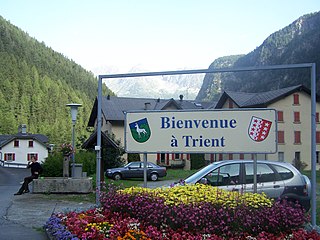
Trient is a municipality in the district of Martigny in the canton of Valais in Switzerland.
↑ W. Meyer et al., Die bösen Türnli: Archäologische Beiträge zur Burgenforschung in der Urschweiz, Schweizer Beiträge zur Kulturgeschichte und Archäologie des Mittelalters, vol. 11, Schweizerischer Burgenverein, Olten / Freiburg i.Br., 1984. W. Meyer (ed), Burgen der Schweiz, vol. 1, Zürich, 1981.
This page is based on this Wikipedia article Text is available under the CC BY-SA 4.0 license; additional terms may apply. Images, videos and audio are available under their respective licenses.