
Peninsula Township, locally known as The Peninsula, is a civil township of Grand Traverse County in the U.S. state of Michigan. As of the 2010 census, the township population was 5,433, up from 5,265 at the 2000 census. The township is coterminous with the Old Mission Peninsula, which projects into the Grand Traverse Bay of Lake Michigan. The Old Mission Point Lighthouse is located at the northern end of the peninsula. The peninsula is included in the Old Mission Peninsula AVA, an American Viticultural Area known for its Michigan wine. The Grand Traverse region has two of Michigan's four federally recognized wine growing areas.

Scugog is a township in the Regional Municipality of Durham, south-central Ontario, Canada. It is northeast of Toronto and just north of Oshawa. Due to its location in the Greater Toronto Area, many residents commute to Toronto for work on a daily basis. The anchor and largest population base of the township is Port Perry. The township has a population of roughly 22,500. A smaller Scugog Township was also a historic municipality and geographic township prior to the amalgamation that formed the current municipality.
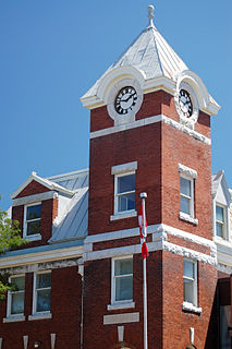
Port Perry is a community located in Scugog, Ontario, Canada. The town is located 84 kilometres (52 mi) northeast of central Toronto and north of Oshawa and Whitby. Due to its location in the Greater Toronto Area, many residents commute to Toronto for work. Port Perry has a population of 9,453 as of 2016.

Lake Scugog is an artificially flooded lake in Scugog, Regional Municipality of Durham and the unitary city of Kawartha Lakes in central Ontario, Canada. It lies between the communities of Port Perry and Lindsay. The lake has been raised and lowered several times over its history. Though not technically part of the Kawartha lakes due to its shallow depths, it is often geographically linked to them. Its sole outflow, the Scugog River, connects to Sturgeon Lake. Lake Scugog is in the Great Lakes Basin and forms part of the Trent–Severn Waterway.
Ontario County was the name of two historic counties in the Canadian province of Ontario.
Durham County is a historic county in Ontario, Canada. It was named for the English County Durham and city of Durham. The County was created in 1792 although was later merged Northumberland County to form the United Counties of Northumberland and Durham. In 1974, the two counties were split and reorganized, with the former portions of Durham County reorganized into the Regional Municipality of Durham.

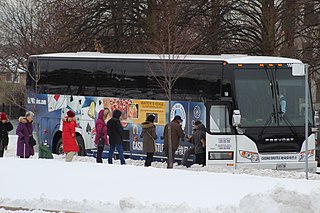
Durham Region Transit (DRT) is the regional public transit operator in Durham Region, Ontario, Canada, east of Toronto. Its headquarters are at 605 Rossland Rd East in Whitby, Ontario, and there are regional centres in Ajax, Whitby, and Oshawa. It was formed by the merger of Ajax/Pickering Transit, Whitby Transit, Oshawa Transit, and Clarington Transit.

Durham is a federal electoral district in Ontario, Canada, that has been represented in the House of Commons of Canada from 1904 to 1968 and since 1988.
Ontario was a federal electoral district represented in the House of Commons of Canada from 1925 to 1997. It was located in the province of Ontario. This riding was created in 1924 from Ontario South riding.
The Great Blue Heron Casino is located on Scugog Island, just east of the community of Port Perry, Ontario, and northeast of Toronto. Both the Casino and the land on which it is built are owned by the Mississaugas of Scugog Island First Nation. The First Nation theme is carried throughout the facility, in the interior art and is especially noticeable in the signature red, blue and cream colour roof.
Durham is a provincial electoral district in Ontario, Canada, that has been represented in the Legislative Assembly of Ontario since 1999 and from 1926 to 1975.

Curve Lake First Nation is a Mississauga Ojibway First Nation located in Peterborough County of Ontario. Curve Lake First Nation occupies three reserves; Curve Lake First Nation 35, Curve Lake 35A, and Islands in the Trent Waters Indian Reserve 36A. The last of these reserves is shared with the Hiawatha First Nation and the Scugog First Nation. Curve Lake First Nation has a registered membership of 2,415 as of October 2019 with 793 registered band members living in Curve Lake and an additional 1,622 registered band members living off-reserve.
The united Townships of Laxton, Digby and Longford were a municipality in the northern part of what is now Kawartha Lakes in the Canadian province of Ontario. In 1993, Canada's centre of population fell in the area, despite the lack of any population centers with over 1000 residents.

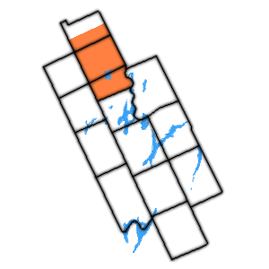
The Township of Mariposa was a municipality located in the southwest corner of the former Victoria County, now the city of Kawartha Lakes, in the Canadian province of Ontario. The other municipal neighbours of Mariposa are Ops and Fenelon on the east, Eldon on the north, Brock on the west, and Scugog on the south, with the latter two located in the Durham Regional Municipality. The former township includes the communities of Little Britain, Manilla, Mariposa, Valentia, and Oakwood. Today, most of the former township is represented in the City of Kawartha Lakes by the Ward 8 Councillor, John Pollard, and Ward 4 Councillor Andrew Veale.

The Township of Verulam was a rural municipality within the former Victoria County, now the city of Kawartha Lakes. It was bounded on the north by the geographic township of Somerville, the south by the geographic township of Emily, the west by the geographic township of Fenelon, and the east by the County of Peterborough. For the purposes of government, land suryeying and reference, it is now properly referred to as the "Geographic Township of Verulam".
King's Highway 7A, commonly referred to as Highway 7A, is a provincially maintained highway in the Canadian province of Ontario that serves as a bypass of Highway 7. The highway begins in the community of Manchester, where Highway 7 is concurrent with Highway 12, and travels east through Port Perry, Nestleton Station, Bethany and Cavan, ending at Highway 115 southwest of Peterborough. From there, Highway 7 can be reached via Highway 115 northbound. Near its midpoint the route is concurrent with Highway 35 for 1.5 kilometres (0.93 mi).
Valentia is a small community founded in 1807, located in the city of Kawartha Lakes, just south of the town of Lindsay on County Road 18 northeast of Lake Scugog. During its bicentennial celebrations in August 2007, it held its first Valentia Heritage Rodeo.

Alderville First Nation is a band of Mississaugas, a sub-nation of the Ojibways. The Alderville and Sugar Island 37A reserves belong to that First Nation band government.
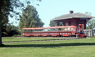
View Lake is a small village located in Ontario, Canada. It is situated on the boundary of the Regional Municipality of Durham and the city of Kawartha Lakes, on the southern shores of Lake Scugog. The village was unincorporated in Victoria County prior to the formation of the city of Kawartha Lakes in 2001, and continues to have a very small population. It contains two small parks, and in the past, contained a train stop near its general store.
Morrisburg is an unincorporated community in the Municipality of South Dundas, located in Eastern Ontario, Canada.
