Related Research Articles
Haltemprice is an area in the East Riding of Yorkshire, England, directly to the west of Hull. Originally an extra-parochial area, it became a civil parish in 1858, in 1935 it was expanded by the combination of the urban districts of Cottingham, Anlaby, and Sculcoates to form a new urban district; the district included the villages of Anlaby, Cottingham, Hessle, Kirk Ella, Skidby, West Ella and Willerby. Urban districts were abolished 1974.
Dagenham was a local government district in south west Essex, England from 1926 to 1965 covering the parish of Dagenham. Initially created as an urban district, it was incorporated as a municipal borough in 1938. It was established to deal with the increase in population and the change from rural to urban area caused by the building of the Becontree estate by the London County Council and the subsequent movement of people from Inner London. Peripheral to London, the district formed part of the Metropolitan Police District and London Traffic Area. It now forms the eastern sections of the London Borough of Barking and Dagenham and the London Borough of Redbridge in Greater London.

Kingston-upon-Thames was a local government district in north east Surrey, England from 1835 to 1965 around the town now known as Kingston upon Thames. It was alternatively known as Kingston on Thames. It was a municipal borough and also held the rarer status of Royal borough. The district was abolished in 1965 and was replaced with the larger London Borough of Kingston upon Thames in Greater London, with the Royal borough status passed to the new district.
Malden and Coombe was a local government district in Surrey, England from 1866 to 1965.
Bridlington was a rural district in the East Riding of Yorkshire in England from 1894 to 1974. It covered a coastal area, and surrounded the municipal borough of Bridlington on its land borders. The district covered Flamborough and Flamborough Head.
Escrick was a rural district in the East Riding of Yorkshire from 1894 to 1935.
Howden was a rural district in the East Riding of Yorkshire, England from 1894 to 1974.
Holderness was a rural district in the East Riding of Yorkshire from 1935 to 1974. It covered the southern part of the East Riding's North Sea coast.
Sefton was a rural district in Lancashire, England from 1894 to 1932.
Goole was a rural district in the West Riding of Yorkshire, England from 1894 to 1974.

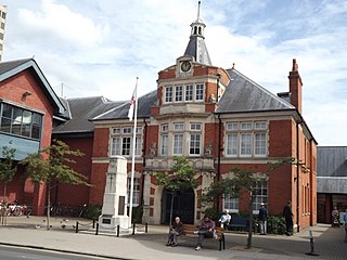
The Municipal Borough of Leigh was, from 1899 to 1974, a local government district of the administrative county of Lancashire, England, consisting of the townships of Pennington, Westleigh, Bedford and part of the township of Atherton and named after the ancient ecclesiastical parish. The area contained the market town of Leigh that served as its administrative centre until its dissolution in 1974. The borough council built Leigh Town Hall which was completed in 1907.
Beverley was a rural district in the East Riding of Yorkshire, England from 1894 to 1974.
Driffield was a rural district in the East Riding of Yorkshire in England from 1894 to 1974. It surrounded the municipal borough of Driffield.

Patrington was a rural district in the East Riding of Yorkshire, England, from 1894 to 1935.
Pocklington was a rural district in the East Riding of Yorkshire, England from 1894 to 1974.
Skirlaugh was a rural district in the East Riding of Yorkshire, England from 1894 to 1935.
The East Riding of Yorkshire is a local government district with unitary authority status, and is a ceremonial county of England. It is named after the historic East Riding of Yorkshire which was one of three ridings alongside the North Riding and West Riding, which were constituent parts a Yorkshire ceremonial and administrative county until 1974. From 1974 to 1996 the area of the modern East Riding of Yorkshire constituted the northern part of Humberside.

Buxton was an Urban District from 1894 to 1917 and a Municipal Borough from 1917 to 1974 in Derbyshire, England.
Chorley Rural District was a rural district in the administrative county of Lancashire, England from 1894 to 1974.

Thetford Rural District was a rural district in Norfolk, England from 1894 to 1935.