Related Research Articles

Liberia, officially the Republic of Liberia, is a country on the West African coast. It is bordered by Sierra Leone to its northwest, Guinea to its north, Ivory Coast to its east, and the Atlantic Ocean to its south-southwest. It covers an area of 111,369 square kilometres (43,000 sq mi) and has a population of around 4,900,000. English is the official language, but over 20 indigenous languages are spoken, representing the numerous ethnic groups who make up more than 95% of the population. The country's capital and largest city is Monrovia.

Monrovia is the capital city of the West African country of Liberia. Located on the Atlantic Coast at Cape Mesurado, Monrovia had a population of 1,010,970 as of the 2008 census. With 29% of the total population of Liberia, Monrovia is the country's most populous city.

Montserrado County is a county in the northwestern portion of the West African nation of Liberia. One of 15 counties that comprise the first-level of administrative division in the nation, it is composed of Seventeen districts. As of the 2008 Census, it had a population of 1,118,241, making it the most populous county in Liberia. The area of the county measures 1,912.7 square kilometres (738.5 sq mi), the smallest in the country. Bensonville serves as the capital.
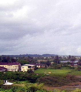
Greenville is the capital of Sinoe County in southeastern Liberia and lies on a lagoon near the Sinoe River and the Atlantic Ocean. It is located about 150 miles southeast of Monrovia. As of the 2008 national census, the population stood at 16,434.
Harper, situated on Cape Palmas, is the capital of Maryland County in Liberia. It is a coastal town situated between the Atlantic Ocean and the Hoffman River. Harper is Liberia's 11th largest town, with a population of 17,837.

Gbarnga is the capital city of Bong County, Liberia, lying north east of Monrovia. During the First Liberian Civil War, it was the base for Charles Taylor's National Patriotic Front of Liberia. Cuttington College, a private, Episcopal-affiliated institution, is located near the town. Its campus was once home to the Africana Museum, which was destroyed during the civil war.
Paynesville is a suburb east of Monrovia, Liberia. It is geographically larger than the city of Monrovia and is expanding eastward along the Robertsfield Highway and northeastward beyond Red Light Market, one of the largest market areas in Liberia. Paynesville is often considered a part of the Greater Monrovia area. It was the location of the Paynesville Omega Transmitter, the highest structure of Africa, until the tower's demolition in 2011. The Liberia Broadcasting System is also located in Paynesville. The Liberian Judo Federation is based in Paynesville.
The College of West Africa is a Methodist high school in Monrovia, Liberia. The school was opened in 1839, making it one of the oldest European-style schools in Africa. It has produced many of Liberia's leaders. Alumni include Liberian President Ellen Johnson Sirleaf, the first woman elected as president in an African state, and Liberian Vice President Joseph Boakai.
Greater Monrovia is one of four districts located in Montserrado County, Liberia. It contains the country's capital Monrovia. It recorded a population of 970,824 in the 2008 census.
The University of Liberia is a publicly funded institution of higher learning located in Monrovia, Liberia. Authorized by the national government in 1851, the University opened in 1862 as Liberia College. UL has four campuses; including the Capitol Hill Campus in Monrovia, Fendell campus in Louisiana, outside Monrovia, the Medical School Campus in Congo Town and the Straz-Sinje Campus located in Sinje Grand Cape Mount County. The University enrolls approximately 18,000 students and is one of the oldest institutions of higher learning in West Africa. It is accredited by the Liberian Commission on Higher Education.

On June 22, 1951, Pan Am Flight 151, flown by the Lockheed L-049 Constellation propliner Clipper Great Republic crashed into a West African hill at an elevation of 1,050 ft (320 m) near the village of Sanoyie in Bong County, Liberia. All 31 passengers and nine crew on board were killed.

The Saint Paul River is a river of western Africa. Its headwaters are in southeastern Guinea. Its upper portion in Guinea is known as the Diani River or Niandi River, and forms part of the boundary between Guinea and Liberia.
Klay is a town in Bomi County, Liberia, located about 35 km (22 mi) to the north of the nation's capital city of Monrovia. In 2002, this town was attacked by LURD rebels, causing refugees to flee south and leave the town deserted.

Cape Mesurado, also called Cape Montserrado, is a headland on the coast of Liberia near the capital Monrovia and the mouth of the Saint Paul River. It was named Cape Mesurado by Portuguese sailors in the 1560s. It is the promontory on which African American settlers established the city now called Monrovia on 25 April 1822.

West Point is a township of the Liberian capital city of Monrovia, located on a peninsula which juts out into the Atlantic Ocean between the Mesurado and Saint Paul rivers. Home to approximately 75,000 people, West Point is one of Monrovia's most densely populated slums.
New Georgia is a township in Montserrado County, Liberia that was first settled by Africans who had been taken from slave ships seized or wrecked near the United States and then sent to Liberia after several years had passed.
On March 2010, the Freeport of Monrovia became ISPS Compliant and moved from Security Level 2 to Security Level 1 in July 2010. The Freeport of Monrovia awarded Operations Contract to APM Terminal to handle port operations, which includes container handling, cargo handling, and marine.

The Ministry of Foreign Affairs is the government ministry of Liberia responsible for directing Liberia's external relations and the management of its international diplomatic missions. The ministry is located in Monrovia, Liberia's capital.
Oro Valley Country Club is a private country club in Oro Valley, Arizona, a suburb located 6 miles (9.7 km) north of Tucson. The club was founded in 1959 and designed by Robert Bruce Harris. Oro Valley Country Club is situated on the banks of the Cañada del Oro, at the base of Pusch Ridge in the Santa Catalina Mountains. The Town of Oro Valley, incorporated in 1974, takes its name from Oro Valley Country Club.

An epidemic of Ebola virus disease occurred in Liberia from 2014 to 2015, along with the neighbouring countries of Guinea and Sierra Leone. The first cases of virus were reported by late March 2014. The Ebola virus, a biosafety level four pathogen, is an RNA virus discovered in 1976.
References
- ↑ Leroy M. Sonpon, III (3 July 2009). "Monrovia Breweries Puts L$112,000.00 up for Grabs in upcoming 162nd Independence Golf Open". Liberian Observer . Retrieved 28 April 2012.Italic or bold markup not allowed in:
|publisher=(help)
Coordinates: 6°23′23″N10°47′44″W / 6.38972°N 10.79556°W
| This article about a building or structure in Liberia is a stub. You can help Wikipedia by expanding it. |
| This golf club or course-related article is a stub. You can help Wikipedia by expanding it. |