Sowliny was an independent village in Poland.

Przenosza is a village in the administrative district of Gmina Dobra, within Limanowa County, Lesser Poland Voivodeship, in southern Poland. It lies approximately 9 kilometres (6 mi) north-west of Dobra, 21 km (13 mi) west of Limanowa, and 37 km (23 mi) south-east of the regional capital Kraków.

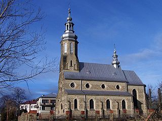
Góra Świętego Jana is a village in the administrative district of Gmina Jodłownik, within Limanowa County, Lesser Poland Voivodeship, in southern Poland.
Krasne-Lasocice is a village in the administrative district of Gmina Jodłownik, within Limanowa County, Lesser Poland Voivodeship, in southern Poland. It lies approximately 5 kilometres (3 mi) north of Jodłownik, 19 km (12 mi) north-west of Limanowa, and 35 km (22 mi) south-east of the regional capital Kraków.

Zalesie is a village in the administrative district of Gmina Kamienica, within Limanowa County, Lesser Poland Voivodeship, in southern Poland. It lies approximately 6 kilometres (4 mi) north of Kamienica, 11 km (7 mi) south-west of Limanowa, and 57 km (35 mi) south-east of the regional capital Kraków.
Jaworzna is a village in the administrative district of Gmina Laskowa, within Limanowa County, Lesser Poland Voivodeship, in southern Poland.

Kamionka Mała is a village in the administrative district of Gmina Laskowa, within Limanowa County, Lesser Poland Voivodeship, in southern Poland. It lies approximately 5 kilometres (3 mi) north-east of Laskowa, 11 km (7 mi) north-east of Limanowa, and 51 km (32 mi) south-east of the regional capital Kraków.
Kobyłczyna is a village in the administrative district of Gmina Laskowa, within Limanowa County, Lesser Poland Voivodeship, in southern Poland. It lies approximately 9 kilometres (6 mi) east of Laskowa, 12 km (7 mi) north-east of Limanowa, and 57 km (35 mi) south-east of the regional capital Kraków.

Laskowa is a village in Limanowa County, Lesser Poland Voivodeship, in southern Poland. She is the seat of the gmina called Gmina Laskowa. She is located approximately 8 kilometres (5 mi) north of Limanowa and 50 km (31 mi) south-east of the regional capital Kraków.
Strzeszyce is a village in the administrative district of Gmina Laskowa, within Limanowa County, Lesser Poland Voivodeship, in southern Poland. It lies approximately 6 kilometres (4 mi) east of Laskowa, 11 km (7 mi) north-east of Limanowa, and 54 km (34 mi) south-east of the regional capital Kraków.
Ujanowice is a village in the administrative district of Gmina Laskowa, within Limanowa County, Lesser Poland Voivodeship, in southern Poland. It lies approximately 8 kilometres (5 mi) east of Laskowa, 11 km (7 mi) north-east of Limanowa, and 57 km (35 mi) south-east of the regional capital Kraków.
Żmiąca is a village in the administrative district of Gmina Laskowa, within Limanowa County, Lesser Poland Voivodeship, in southern Poland. It lies approximately 5 kilometres (3 mi) east of Laskowa, 9 km (6 mi) north-east of Limanowa, and 54 km (34 mi) south-east of the regional capital Kraków.
Kłodne is a village in the administrative district of Gmina Limanowa, within Limanowa County, Lesser Poland Voivodeship, in southern Poland. It lies approximately 11 kilometres (7 mi) east of Limanowa and 62 km (39 mi) south-east of the regional capital Kraków.
Lipowe is a village in the administrative district of Gmina Limanowa, within Limanowa County, Lesser Poland Voivodeship, in southern Poland. It lies approximately 3 kilometres (2 mi) west of Limanowa and 51 km (32 mi) south-east of the regional capital Kraków.
Mordarka is a village in the administrative district of Gmina Limanowa, within Limanowa County, Lesser Poland Voivodeship, in southern Poland. It lies approximately 3 kilometres (2 mi) east of Limanowa and 56 km (35 mi) south-east of the regional capital Kraków.
Pasierbiec is a village in the administrative district of Gmina Limanowa, within Limanowa County, Lesser Poland Voivodeship, in southern Poland. It lies approximately 8 kilometres (5 mi) north-west of Limanowa and 46 km (29 mi) south-east of the regional capital Kraków.
Jadamwola is a village in the administrative district of Gmina Łukowica, within Limanowa County, Lesser Poland Voivodeship, in southern Poland. It lies approximately 4 kilometres (2 mi) south of Łukowica, 14 km (9 mi) south of Limanowa, and 66 km (41 mi) south-east of the regional capital Kraków.
Krosna is a village in the administrative district of Gmina Laskowa, within Limanowa County, Lesser Poland Voivodeship, in southern Poland. It lies approximately 7 kilometres (4 mi) east of Laskowa, 12 km (7 mi) north-east of Limanowa, and 53 km (33 mi) south-east of the regional capital Kraków.
Kanina is a village in the administrative district of Gmina Limanowa, within Limanowa County, Lesser Poland Voivodeship, in southern Poland. It lies approximately 7 kilometres (4 mi) south-east of Limanowa and 60 km (37 mi) south-east of the regional capital Kraków.


