
Thebes, known to the ancient Egyptians as Waset, was an ancient Egyptian city located along the Nile about 800 kilometers (500 mi) south of the Mediterranean. Its ruins lie within the modern Egyptian city of Luxor. Thebes was the main city of the fourth Upper Egyptian nome and was the capital of Egypt for long periods during the Middle Kingdom and New Kingdom eras. It was close to Nubia and the Eastern Desert, with its valuable mineral resources and trade routes. It was a cult center and the most venerated city during many periods of ancient Egyptian history. The site of Thebes includes areas on both the eastern bank of the Nile, where the temples of Karnak and Luxor stand and where the city proper was situated; and the western bank, where a necropolis of large private and royal cemeteries and funerary complexes can be found.
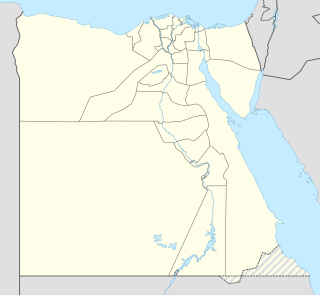
Mendes, the Greek name of the ancient Egyptian city of Djedet, also known in ancient Egypt as Per-Banebdjedet and Anpet, is known today as Tell El-Ruba.

Lower Egypt is the northernmost region of Egypt, which consists of the fertile Nile Delta between Upper Egypt and the Mediterranean Sea, from El Aiyat, south of modern-day Cairo, and Dahshur. Historically, the Nile River split into seven branches of the delta in Lower Egypt. Lower Egypt was divided into nomes and began to advance as a civilization after 3600 BC. Today, it contains two major channels that flow through the delta of the Nile River.
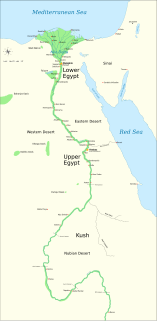
The First Intermediate Period, described as a 'dark period' in ancient Egyptian history, spanned approximately one hundred and twenty-five years, from c. 2181–2055 BC, after the end of the Old Kingdom. It comprises the Seventh, Eighth, Ninth, Tenth, and part of the Eleventh Dynasties. The concept of a "First Intermediate Period" was coined in 1926 by Egyptologists Georg Steindorff and Henri Frankfort.

The Middle Kingdom of Egypt is the period in the history of ancient Egypt following a period of political division known as the First Intermediate Period. The Middle Kingdom lasted from approximately 2040 to 1782 BCE, stretching from the reunification of Egypt under the reign of Mentuhotep II in the Eleventh Dynasty to the end of the Twelfth Dynasty. The kings of the Eleventh Dynasty ruled from Thebes and the kings of the Twelfth Dynasty ruled from el-Lisht.

Wahankh Intef II was the third ruler of the Eleventh Dynasty of Egypt during the First Intermediate Period. He reigned for almost fifty years from 2112 BC to 2063 BC. His capital was located at Thebes. In his time, Egypt was split between several local dynasties. He was buried in a saff tomb at El-Tarif.
Intef III was the third pharaoh of the Eleventh Dynasty of Egypt during the late First Intermediate Period in the 21st century BC, at a time when Egypt was divided in two kingdoms. The son of his predecessor Intef II and father of his successor Mentuhotep II, Intef III reigned for 8 years over Upper Egypt and extended his domain North against the 10th Dynasty state, perhaps as far north as the 17th nome. He undertook some building activity on Elephantine. Intef III is buried in a large saff tomb at El-Tarif known as Saff el-Barqa.

Beni Hasan is an ancient Egyptian cemetery. It is located approximately 20 kilometers (12 mi) to the south of modern-day Minya in the region known as Middle Egypt, the area between Asyut and Memphis.

Thinis was the capital city of the first dynasties of ancient Egypt. Thinis is, as yet, undiscovered but well attested by ancient writers, including the classical historian Manetho, who cites it as the centre of the Thinite Confederacy, a tribal confederation whose leader, Menes, united Egypt and was its first pharaoh. Thinis began a steep decline in importance from Dynasty III, when the capital was relocated to Memphis, which was thought to be the first true and stable capital after unification of old Egypt by Menes. Thinis's location on the border of the competing Heracleopolitan and Theban dynasties of the First Intermediate Period and its proximity to certain oases of possible military importance ensured Thinis some continued significance in the Old and New Kingdoms. This was a brief respite and Thinis eventually lost its position as a regional administrative centre by the Roman period.
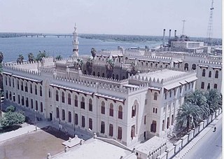
Asyut is the capital of the modern Asyut Governorate in Egypt. It was built close to the ancient city of the same name, which is situated nearby. The modern city is located at 27°11′00″N31°10′00″E, while the ancient city is located at 27°10′00″N31°08′00″E. The city is home to one of the largest Coptic Catholic churches in the country.

El Mo'alla is a town in Upper Egypt located about 35 km south of Luxor, on the east bank of the Nile.
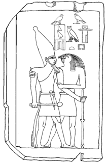
Qahedjet could be the Horus name of an ancient Egyptian king (pharaoh), who may have ruled during the 3rd Dynasty or could be a voluntarily archaistic representation of Thutmose III. Since the only artifact attesting to the ruler and his name is a small stela made of polished limestone of uncertain origin and authenticity, Egyptologists are discussing the chronological position and historical figure of Qahedjet.
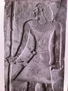
Ankhtifi was a nomarch of Hierakonpolis and a supporter of the pharaoh in Herakleopolis Magna, which was locked in a conflict with the Theban based 11th Dynasty kingdom for control of Egypt. Hence, Ankhtifi was possibly a rival to the Theban rulers Mentuhotep I and Intef I. He lived during the First Intermediate Period, after the Egyptian Old Kingdom state had collapsed, and at a time when economic hardship, political instability, and foreign invasion challenged the fabric of Egyptian society.

Minya is the capital of the Minya Governorate in Upper Egypt. It is located approximately 245 km (152 mi) south of Cairo on the western bank of the Nile River, which flows north through the city. The name of the city is derived from its ancient Egyptian name Men'at Khufu, meaning the nursing city of Khufu, linking it to the Pharaoh Khufu or Cheops, builder of the Great Pyramid at Giza.

El Kab is an Upper Egyptian site on the east bank of the Nile at the mouth of the Wadi Hillal about 80 kilometres (50 mi) south of Luxor. El Kab was called Nekheb in the Egyptian language, a name that refers to Nekhbet, the goddess depicted as a white vulture. In Greek it was called Eileithyias polis, "city of the goddess Eileithyia".

Shemay was an ancient Egyptian official and later vizier toward the end of the 8th Dynasty during the First Intermediate Period, mainly known for being the beneficiary of most of the Coptos Decrees. His career has been interpreted as a glaring sign of the extreme weakness of the central power, forced to bestow great privileges to maintain the loyalty of powerful local governors. Shemay is buried in a mudbrick mastaba just south of Coptos.

The Oryx nome was one of the 42 nomoi in ancient Egypt. More precisely, it was the 16th nome of Upper Egypt. It was named after the Scimitar oryx, and was roughly located in the territories surrounding the modern city of Minya in Middle Egypt.
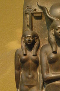
The Hare nome, also called the Hermopolite nome was one of the 42 nomoi in ancient Egypt; more precisely, it was the 15th nome of Upper Egypt.
Jeanne Marie Thérèse Vandier d'Abbadie (1899–1977) was a French Egyptologist.


