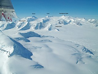
Sehested Fjord

Last updated
Sehested Fjord
Umminanak Fjord
Greenland edcp relief location map.jpg
Red pog.svg
Sehested Fjord
Location in Greenland
Location Arctic (SE Greenland)
Coordinates 63°3′N42°0′W / 63.050°N 42.000°W / 63.050; -42.000 Coordinates: 63°3′N42°0′W / 63.050°N 42.000°W / 63.050; -42.000
Native nameUummannap Kangertiva  (Greenlandic)
Ocean/sea sources North Atlantic Ocean
Basin  countries Greenland
Max. length50 km (31 mi)
Max. width4.5 km (2.8 mi)
Sehested Fjord (Umang Fjord) in a 1944 map of the area around Skjoldungen. Skjoldungen v2-ed.jpg
Sehested Fjord (Umang Fjord) in a 1944 map of the area around Skjoldungen.

Sehested Fjord (Greenlandic : Uummannap Kangertiva) [1] ) is a fjord of the King Frederick VI Coast in the Sermersooq municipality, southeastern Greenland.

Contents

This fjord was named in 1829 by Lieutenant W. A. Graah after Danish Admiral Christen Thomesen Sehested.

Geography

Sehested Fjord is located north of Timmiarmiut Fjord. To the east it opens into the North Atlantic Ocean with Uiivaq and the entrance of Kattertooq Fjord on the northern side of its mouth and Griffenfeld Island on the southern side. Annat Fjord, with Tasiusaq Bay on its western side, is an inlet on the northern shore of the fjord located 17 km from its mouth. Sikuijuitsoq is another small tributary fjord branching from the Sehested Fjord on the southern shore opposite Annat Fjord. [2]

This fjord has large, active glaciers at its head. The Rimfaxe, Guldfaxe and Ygdrasil glaciers have their confluence shortly before their terminus at the northwestern end of the fjord. Flowing from the west, the Garm glacier has two branches near its terminus, one flowing southwards into the Ernineq Fjord of the Timmiarmiut fjord system and the other eastwards into the Sikuijuitsoq, the southern branch of the Sehested Fjord. [3]

Mountains

There are high mountains on both sides of the fjord. 1,539 m (5,049 ft) high Peberbøssen, a prominent peak, rises on the King Dan Peninsula (Kong Dan Halvø) on the northern side near the entrance. [2] Further inland a 2,004 m (6,575 ft) high summit rises in the north at 63°18′25″N42°12′37″W / 63.30694°N 42.21028°W / 63.30694; -42.21028 . In the western side, a 1,832 m (6,010 ft) high summit rises at 63°7′58″N42°14′57″W / 63.13278°N 42.24917°W / 63.13278; -42.24917 . The Skirnir Mountains (Skirners Bjerge) are a nunatak group rising at 63°2′N42°40′W / 63.033°N 42.667°W / 63.033; -42.667 between the Heimdal and Garm glaciers in the inner part of the fjord. [4]

See also

Related Research Articles

Watkins Range Range in Greenland

The Watkins Range is Greenland's highest mountain range. It is located in King Christian IX Land, Sermersooq municipality.

Vestfjord

Vestfjord, meaning "West Fjord" in the Danish language, is a fjord in King Christian X Land, eastern Greenland. This fjord is part of the Scoresby Sound system in the area of Sermersooq municipality.

Lindenow Fjord

Lindenow Fjord or Kangerlussuatsiaq, is a fjord in the King Frederick VI Coast, Kujalleq municipality, southern Greenland.
Waltershausen Glacier

Waltershausen Glacier is one of the major glaciers in Greenland. It has its terminus on the east coast of the Greenland ice sheet.

Timmiarmiut Fjord

Timmiarmiut Fjord ) is a fjord of the King Frederick VI Coast in the Sermersooq municipality, southeastern Greenland.

Thorland

Thorland is a peninsula in the King Frederick VI Coast, southeastern Greenland. It is a part of the Sermersooq municipality.

Iluileq Fjord

Iluileq is a fjord in the King Frederick VI Coast, Kujalleq municipality, southern Greenland.

Kangerluluk

Kangerluluk, meaning 'the awful fjord', is a fjord in the King Frederick VI Coast, Kujalleq municipality, southern Greenland.

Sikuijivitteq

Sikuijivitteq, also known as Kangerdlugsuatsiak, is a fjord of the King Frederick VI Coast in the Kujalleq municipality, southeastern Greenland. The name 'Mogens Heinesen' is based on Magnus Heinason, a 16th-century Faroese naval hero.

Garm (glacier)

Garm is a glacier of the King Frederick VI Coast in the Sermersooq municipality, southeastern Greenland.

Kattertooq

Kattertooq, meaning 'where there is much blue ice' in the Greenlandic language,) is a fjord of the King Frederick VI Coast in the Sermersooq municipality, southeastern Greenland.

Ingolf Fjord

Ingolf Fjord, also known as Ingolf Sound, is a fjord of Greenland's northeastern coast in northern King Frederick VIII Land.

Princess Caroline-Mathilde Alps

The Princess Caroline-Mathilde Alps are a mountain range system in the Holm Land Peninsula, King Frederick VIII Land, northeastern Greenland. Administratively this range is part of the Northeast Greenland National Park zone.

Odinland

Odinland, also Odinsland in the Defense Mapping Agency Greenland Navigation charts, is a peninsula in the King Frederick VI Coast, southeastern Greenland. It is a part of the Sermersooq municipality.

Inglefield Gulf Fjord in northwestern Greenland

Inglefield Gulf or Inglefield Fjord is a fjord in northwestern Greenland. To the west, the fjord opens into the Baffin Bay. Administratively it belongs to the Avannaata municipality.

A. Harmsworth Glacier Glacier in northern Greenland

A. Harmsworth Glacier or Alfred Harmsworth Glacier is a glacier in northern Greenland. Administratively it belongs to the Northeast Greenland National Park.
Dickson Fjord

Dickson Fjord is a fjord in King Christian X Land, eastern Greenland.
Muskox Fjord

Muskox Fjord is a fjord in King Christian X Land, East Greenland. Administratively it lies in the Northeast Greenland National Park area. This fjord is part of the Kaiser Franz Joseph Fjord system.

Skirnir Mountains

Skirnir Mountains is a group of nunataks in the King Frederick VI Coast, Sermersooq municipality, SE Greenland. The range is named after Skírnir, the messenger of god Freyr in Norse mythology.

References

  1. Den grønlandske Lods - Geodatastyrelsen
  2. 1 2 "Sehested Fjord". Mapcarta. Retrieved 12 June 2016.
  3. "Garm". Mapcarta. Retrieved 12 June 2016.
  4. GoogleEarth