Related Research Articles

Geotechnical engineering, also known as geotechnics, is the branch of civil engineering concerned with the engineering behavior of earth materials. It uses the principles of soil mechanics and rock mechanics to solve its engineering problems. It also relies on knowledge of geology, hydrology, geophysics, and other related sciences.

Soil liquefaction occurs when a cohesionless saturated or partially saturated soil substantially loses strength and stiffness in response to an applied stress such as shaking during an earthquake or other sudden change in stress condition, in which material that is ordinarily a solid behaves like a liquid. In soil mechanics, the term "liquefied" was first used by Allen Hazen in reference to the 1918 failure of the Calaveras Dam in California. He described the mechanism of flow liquefaction of the embankment dam as:
If the pressure of the water in the pores is great enough to carry all the load, it will have the effect of holding the particles apart and of producing a condition that is practically equivalent to that of quicksand... the initial movement of some part of the material might result in accumulating pressure, first on one point, and then on another, successively, as the early points of concentration were liquefied.

Engineering geology is the application of geology to engineering study for the purpose of assuring that the geological factors regarding the location, design, construction, operation and maintenance of engineering works are recognized and accounted for. Engineering geologists provide geological and geotechnical recommendations, analysis, and design associated with human development and various types of structures. The realm of the engineering geologist is essentially in the area of earth-structure interactions, or investigation of how the earth or earth processes impact human made structures and human activities.

Geosynthetics are synthetic products used to stabilize terrain. They are generally polymeric products used to solve civil engineering problems. This includes eight main product categories: geotextiles, geogrids, geonets, geomembranes, geosynthetic clay liners, geofoam, geocells and geocomposites. The polymeric nature of the products makes them suitable for use in the ground where high levels of durability are required. They can also be used in exposed applications. Geosynthetics are available in a wide range of forms and materials. These products have a wide range of applications and are currently used in many civil, geotechnical, transportation, geoenvironmental, hydraulic, and private development applications including roads, airfields, railroads, embankments, retaining structures, reservoirs, canals, dams, erosion control, sediment control, landfill liners, landfill covers, mining, aquaculture and agriculture.
Earthquake engineering is an interdisciplinary branch of engineering that designs and analyzes structures, such as buildings and bridges, with earthquakes in mind. Its overall goal is to make such structures more resistant to earthquakes. An earthquake engineer aims to construct structures that will not be damaged in minor shaking and will avoid serious damage or collapse in a major earthquake. A properly engineered structure does not necessarily have to be extremely strong or expensive. It has to be properly designed to withstand the seismic effects while sustaining an acceptable level of damage.

Geotextiles are versatile permeable fabrics that, when used in conjunction with soil, can effectively perform multiple functions, including separation, filtration, reinforcement, protection, and drainage. Typically crafted from polypropylene or polyester, geotextile fabrics are available in two primary forms: woven, which resembles traditional mail bag sacking, and nonwoven, which resembles felt.
Geomechanics is the study of the mechanical state of the Earth's crust and the processes occurring in it under the influence of natural physical factors. It involves the study of the mechanics of soil and rock.
A geomembrane is very low permeability synthetic membrane liner or barrier used with any geotechnical engineering related material so as to control fluid migration in a human-made project, structure, or system. Geomembranes are made from relatively thin continuous polymeric sheets, but they can also be made from the impregnation of geotextiles with asphalt, elastomer or polymer sprays, or as multilayered bitumen geocomposites. Continuous polymer sheet geomembranes are, by far, the most common.

A landfill liner, or composite liner, is intended to be a low permeable barrier, which is laid down under engineered landfill sites. Until it deteriorates, the liner retards migration of leachate, and its toxic constituents, into underlying aquifers or nearby rivers from causing potentially irreversible contamination of the local waterway and its sediments.
The George E. Brown, Jr. Network for Earthquake Engineering Simulation (NEES) was created by the National Science Foundation (NSF) to improve infrastructure design and construction practices to prevent or minimize damage during an earthquake or tsunami. Its headquarters were at Purdue University in West Lafayette, Indiana as part of cooperative agreement #CMMI-0927178, and it ran from 2009 till 2014. The mission of NEES is to accelerate improvements in seismic design and performance by serving as a collaboratory for discovery and innovation.

National Center for Research on Earthquake Engineering is an organisation in Da'an District, Taipei, Taiwan.

Cellular confinement systems (CCS)—also known as geocells—are widely used in construction for erosion control, soil stabilization on flat ground and steep slopes, channel protection, and structural reinforcement for load support and earth retention. Typical cellular confinement systems are geosynthetics made with ultrasonically welded high-density polyethylene (HDPE) strips or novel polymeric alloy (NPA)—and expanded on-site to form a honeycomb-like structure—and filled with sand, soil, rock, gravel or concrete.

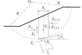
Slope stability analysis is a static or dynamic, analytical or empirical method to evaluate the stability of slopes of soil- and rock-fill dams, embankments, excavated slopes, and natural slopes in soil and rock. It is performed to assess the safe design of a human-made or natural slopes and the equilibrium conditions. Slope stability is the resistance of inclined surface to failure by sliding or collapsing. The main objectives of slope stability analysis are finding endangered areas, investigation of potential failure mechanisms, determination of the slope sensitivity to different triggering mechanisms, designing of optimal slopes with regard to safety, reliability and economics, and designing possible remedial measures, e.g. barriers and stabilization.
SVSLOPE is a slope stability analysis program developed by SoilVision Systems Ltd.. The software is designed to analyze slopes using both the classic "method of slices" as well as newer stress-based methods. The program is used in the field of civil engineering to analyze levees, earth dams, natural slopes, tailings dams, heap leach piles, waste rock piles, and anywhere there is concern for mass wasting. SVSLOPE finds the factor of safety or the probability of failure for the slope. The software makes use of advanced searching methods to determine the critical failure surface.
Final cover is a multilayered system of various materials which are primarily used to reduce the amount of storm water that will enter a landfill after closing. Proper final cover systems will also minimize the surface water on the liner system, resist erosion due to wind or runoff, control the migrations of landfill gases, and improve aesthetics.
Sarada Kanta Sarma is a geotechnical engineer, emeritus reader of engineering seismology and senior research investigator at Imperial College London. He has developed a method of seismic slope stability analysis which is named after him, the Sarma method.
The Newmark's sliding block analysis method is an engineering that calculates permanent displacements of soil slopes during seismic loading. Newmark analysis does not calculate actual displacement, but rather is an index value that can be used to provide an indication of the structures likelihood of failure during a seismic event. It is also simply called Newmark's analysis or Sliding block method of slope stability analysis.
The Sarma method is a method used primarily to assess the stability of soil slopes under seismic conditions. Using appropriate assumptions the method can also be employed for static slope stability analysis. It was proposed by Sarada K. Sarma in the early 1970s as an improvement over the other conventional methods of analysis which had adopted numerous simplifying assumptions.

Geotechnical centrifuge modeling is a technique for testing physical scale models of geotechnical engineering systems such as natural and man-made slopes and earth retaining structures and building or bridge foundations.

Jean-Pierre Giroud is a French geotechnical engineer and a pioneer of geosynthetics since 1970. In 1977, he coined the words "geotextile" and "geomembrane", thus initiating the "geo-terminology". He is also a past president of the International Geosynthetics Society, member of the US National Academies, and Chevalier de la Légion d'Honneur.
References
- ↑ Thusyanthan, N.I.; Madabhushi, S.P.G.; Singh, S. (2007) "Tension in Geomembranes on Landfill slopes Under Static and Earthquake Loading – Centrifuge Study" Geotextiles and Geomembranes V. 25: 78–95.
- ↑ Matasovic, N.; Kavazanjian Jr., E. (2006) "Seismic Response of a Composite Landfill Cover" Journal of Geotechnical and Geoenvironmental Engineering V. 132(4): 448–455.
- 1 2 3 Bray, J.D.; Augello, A.J.; Leonards, G.A.; Repetto, P.C.; Byrne, R.J. (1995) "Seismic Stability Procedures for Solid-Waste Landfills" Journal of Geotechnical Engineering V. 121(2): 139–151.
- 1 2 Choudhury, D.;Savoikar, P. (2009) "Simplified Method to Characterize Municipal Solid Waste Properties Under Seismic Conditions" Waste Management V. 29(2):924–933.
- 1 2 Krinitzsky, E.L.;Hynes, M.E;Franklin, A.G (1997) "Earthquake Safety Evaluation of Sanitary Landfills" Engineering Geology V. 46(2): 143–156.