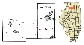
Lee is a village in DeKalb County, Illinois and Lee County, Illinois. The population was 337 at the 2010 census, up from 313 at the 2000 census.
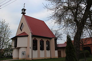
Paniowice is a village in the administrative district of Gmina Oborniki Śląskie, within Trzebnica County, Lower Silesian Voivodeship, in south-western Poland. Prior to 1945 it was in Germany.

Hatsik is a town in the Armavir Province of Armenia. The town was founded in 1933. It was named in honor of Kliment Voroshilov, a Soviet politician, and later called Nairi from 1963 to 1991.

Madina, is a village in the Gegharkunik Province of Armenia, founded in 1922. Just west of town is Mount Armaghan, an extinct volcano that rises 450 meters higher than the surrounding plain with a small crater lake at its center.

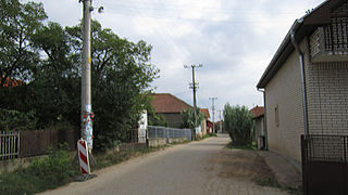
Legbąd is a village in the administrative district of Gmina Tuchola, within Tuchola County, Kuyavian-Pomeranian Voivodeship, in north-central Poland. It lies approximately 14 kilometres (9 mi) north-east of Tuchola and 66 km (41 mi) north of Bydgoszcz.
Urbańszczyzna is a village in the administrative district of Gmina Łowicz, within Łowicz County, Łódź Voivodeship, in central Poland. It lies approximately 4 kilometres (2 mi) south of Łowicz and 46 km (29 mi) north-east of the regional capital Łódź.
Ślęcin is a village in the administrative district of Gmina Nagłowice, within Jędrzejów County, Świętokrzyskie Voivodeship, in south-central Poland. It lies approximately 3 kilometres (2 mi) south-west of Nagłowice, 16 km (10 mi) west of Jędrzejów, and 45 km (28 mi) south-west of the regional capital Kielce.
Podgórze is a village in the administrative district of Gmina Bodzentyn, within Kielce County, Świętokrzyskie Voivodeship, in south-central Poland. It lies approximately 2 kilometres (1 mi) south-west of Bodzentyn and 24 km (15 mi) east of the regional capital Kielce.
Stężyca is a village in the administrative district of Gmina Gostyń, within Gostyń County, Greater Poland Voivodeship, in west-central Poland. It lies approximately 8 kilometres (5 mi) north-west of Gostyń and 52 km (32 mi) south of the regional capital Poznań.
Dankowice-Piaski is a village in the administrative district of Gmina Krzepice, within Kłobuck County, Silesian Voivodeship, in southern Poland. It lies approximately 6 kilometres (4 mi) south-west of Krzepice, 19 km (12 mi) west of Kłobuck, and 81 km (50 mi) north of the regional capital Katowice.
Kętrzyno is a village in the administrative district of Gmina Linia, within Wejherowo County, Pomeranian Voivodeship, in northern Poland. It lies approximately 5 kilometres (3 mi) north of Linia, 24 km (15 mi) south-west of Wejherowo, and 47 km (29 mi) west of the regional capital Gdańsk.

Isingiro is a town in the Western Region of Uganda. It is the main municipal, administrative, and commercial center of Isingiro District and the site of the district's headquarters.

Planitero is a mountain village in the municipal unit of Kleitoria, Achaea, Greece. It is situated in the southwestern part of the Chelmos (Aroania) mountains. Its population is 197 people. Its elevation is 700 m. Planiteri is 1.5 km north of Armpounas, 6 km northeast of Kleitoria and 12 km southeast of Kalavryta. The source of the river Aroanios is near Planitero.
Grdanica is a village in the municipality of Leskovac, Serbia. According to the 2002 census, the village has a population of 605 people.

Donji Podgradci is a village in the municipality of Gradiška, Republika Srpska, Bosnia and Herzegovina.

Hasanovići is a village in the municipality of Konjic, Bosnia and Herzegovina.
Orlovo Polje is a village in the municipality of Gradačac, Bosnia and Herzegovina.
Novo Selo is a village in the municipality of Kupres, Republika Srpska, Bosnia and Herzegovina.
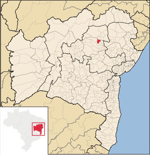
Saúde is a municipality in the state of Bahia in the North-East region of Brazil. Its population estimated in 2013 is 12,644.

Chiawuli Tak is both a census-designated place (CDP) as well as a populated place in Pima County, Arizona, United States. Chiawuli Tak means "the barrel cactus sits" in the O'odham language. It is also unofficially known as Geowic, Jeowic, or Tjeavolitak. The population was 78 at the 2010 census.


