Fontanka is a left branch of the river Neva, which flows through the whole of Central Saint Petersburg, Russia. It is 6.7 kilometres (4.2 mi) long; its width is up to 70 metres (230 ft), and its depth is up to 3.5 metres (11 ft). The Fontanka Embankment is lined with the former private residences of Russian nobility.
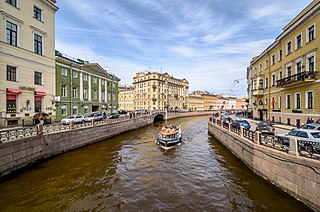
The Moyka River is a small river in Russia that encircles the central portion of Saint Petersburg, effectively making it an island. The river, originally known as Mya, derives its name from the Ingrian word for "slush" or "mire". It is 5 kilometres (3 mi) long and 40 metres (130 ft) wide.

Egyptian Bridge in St. Petersburg, Russia, carries Lermontovsky Avenue over the Fontanka River.

Trinity Bridge is a bascule bridge across the Neva in Saint Petersburg, Russia. It connects Kamennoostrovsky Prospect with Suvorovskaya Square. It was the third permanent bridge across the Neva, built between 1897 and 1903 by the French firm Société de Construction des Batignolles. It is 582 meters (1,909 ft) long and 23.6 meters (77 ft) wide.
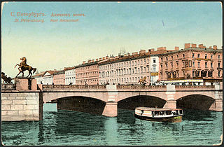
The Anichkov Bridge is the oldest and most famous bridge across the Fontanka River in Saint Petersburg, Russia. The current bridge, built in 1841-42 and reconstructed in 1906-08, combines a simple form with some spectacular decorations. As well as its four famous horse sculptures (1849–50), the bridge has some of the most celebrated ornate iron railings in Saint Petersburg. The structure is mentioned in the works of Pushkin, Gogol, and Dostoevsky.

The Alexander Nevsky Bridge in St Petersburg, Russia is named after the legendary Russian military commander and politician Alexander Nevsky. The bridge connects Alexander Nevsky Square and Zanevsky prospect thus linking the southern and the northern parts of the city. Until 2004, when the Big Obukhovsky Bridge was built, the Alexander Nevsky bridge was the longest bridge across the Neva River in Saint Petersburg. Its length is 905.7 meters, and it is 35 meters wide. The bridge was built from 1960 to 1965 under the working name of Old Neva Bridge. Designed by the group of architects - A. Zhuk, S. Mayofis and Y. Sinitsa - the bridge has complemented the look of adjacent buildings in surrounding area. The project was led by a team of engineers of the "Lengiprotransmost" institute. Proof-testing was done by means of a column of army tanks. On November 5, 1965 the bridge was open for traffic.
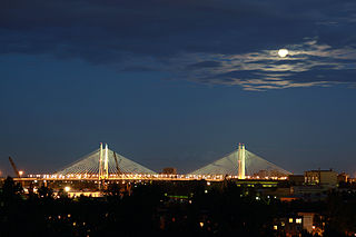
The Bolshoi Obukhovsky Bridge is the newest bridge across the Neva River in Saint Petersburg, Russia. It is also the only bridge across the Neva which is not a drawbridge.

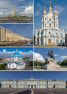
Saint Isaac's Square or Isaakiyevskaya Ploshchad, known as Vorovsky Square between 1923 and 1944, in Saint Petersburg, Russia is a major city square sprawling between the Mariinsky Palace and Saint Isaac's Cathedral, which separates it from Senate Square. The square is graced by the equestrian Monument to Nicholas I.

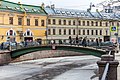
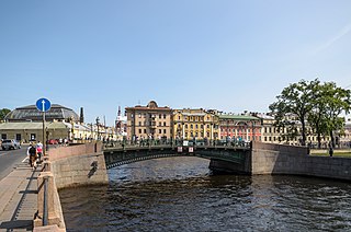
The Blue Bridge, is a 97.3-metre-wide (319 ft) bridge that spans the Moika River in Saint Petersburg, Russia. The Blue Bridge is the widest bridge in Saint Petersburg and is sometimes claimed to be the widest bridge in the world – a claim, however, that has not been recognized by international reference works, such as the Guinness World Records.

The Red Bridge, is a single-span bridge across the Moika River in Saint Petersburg, Russia. The bridge is a part of Gorokhovaya Street. The length of the bridge is 42 m; the width is 16.8 m.
The First Engineer Bridge is one of several bridges that span the Moika River in Saint Petersburg, Russia. The bridge is one of a group of four bridges located near the Mars Field, and opposite the main entrance to the Summer Garden, spanning the Moika River, the Fontanka River, and the Swan Canal in the historic center of the city. The First Engineer Bridge is one of the most decorative of Saint Petersburg's more than 500 bridges.
Smolensky Metro Bridge is a steel arch bridge that spans Moskva River in Dorogomilovo District of Moscow, Russia. It is the first bridge built for the Moscow Metro in 1935–1937, designed by N.P.Polikarpov, P.K.Antonov and Yakovlev brothers. It is one of two bridges over Moskva River that are used exclusively by Metro (subway) trains, while the other Metro bridges combine road and rail.

The Demidov Bridge is a bridge across the Griboyedov Canal in Saint Petersburg, Russia. It connects Kazansky and Spassky islands.

The Flour Bridge is a bridge across the Griboyedov Canal in Saint Petersburg, Russia.

The Kokushkin Bridge is a bridge across the Griboedov Canal in Saint Petersburg, Russia.

Voznesensky Prospekt is a 1.8 km long street in Admiralteysky District of Saint Petersburg, Russia. Crossing Saint Isaac's Square, the Moika and Griboyedov Canal, the street spans from Admiralteysky Prospekt to Izmaylovsky Bridge across Fontanka, where it turns into Izmaylovsky Prospekt. According to the city plan of 1737, the center of Saint Petersburg should develop along three radial axes meeting at the Admiralty's spire: Nevsky Prospekt, Gorokhovaya Street and Voznesensky Prospekt. In 1923-1991 the street was named Mayorov Prospekt after a prominent Bolshevik killed in the Russian Civil War.

Preobrazhenskiy Metro Bridge is the shortest of four rail bridges in Moscow, Russia. It is located in the Eastern Administrative Okrug of the city. It spans over Yauza River and is a part of the Sokolnicheskaya Line of Moscow Metro. It connects the stations Preobrazhenskaya Ploshchad and Sokolniki.

English Bridge is a pedestrian bridge across Fontanka River connecting Pokrovsky and Anonymous islands in Saint Petersburg, Russia.
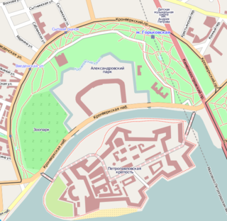
The Kronverksky Strait is a narrow channel separating Petrogradsky and Zayachy islands in Saint Petersburg, Russia. It forms an arc approximately 1 kilometre (0.6 mi) long, about 50 metres (160 ft) wide and 4 metres (13 ft) deep. To the south is Zayachy Island, which is dominated by the Sts. Peter and Paul Fortress, and to the north is the Kronverk on Petrogradsky Island. It is spanned by the Kronverksky Bridge to the east and the Ioannovsky Bridge to the west.

The Malo-Kalinkin Bridge is a bridge in Saint-Petersburg, which connects Kolomna Island and Pokrovsky Island, spanning the Griboyedov Canal. It was built in 1783 by engineer I. Borisov, at the same time that the granite embankments of the canal were being constructed.