Sephokong

Last updated
Sephokong
Community Council
Lesotho adm location map.svg
Red pog.svg
Sephokong
Geographic Center of Community
Coordinates: 28°48′23″S28°08′24″E / 28.80639°S 28.14000°E / -28.80639; 28.14000
CountryFlag of Lesotho.svg  Lesotho
District Leribe District
Elevation
[1]
5,295 ft (1,614 m)
Population
 (2006)
  Total19,199
Time zone UTC+2 (CAT)
Coordinates computed from Lesotho Villages file. [2]

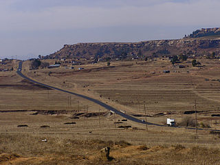
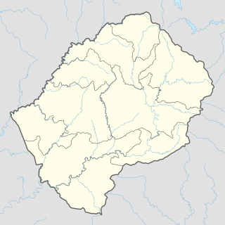
Sephokong is a community council located in the Leribe District of Lesotho. Its population in 2006 was 19,199. [3]

Contents

Villages

The community of Sephokong includes the villages of Boribeng, Chafo, Falatsa, Ha 'Mamokoaqo, Ha Au, Ha Au (Nqechane), Ha Bolofo, Ha Isaka, Ha Jakote (Boitelo), Ha Jonathane (Leribe-Moreneng), Ha Josefa (Phatsoe), Ha Kukame (Nqechane), Ha Lapisi (Nqechane), Ha Lehlaha, Ha Lelahla, Ha Letsola-Thebe, Ha Mamokoaqo, Ha Maraisane (Boribeng), Ha Matau (Lithabaneng), Ha Mohapi, Ha Mokhachane, Ha Mokhosi (Papalala), Ha Moshephe, Ha Mosisi, Ha Mosiuoa, Ha Mothetsi, Ha Mothibe, Ha Motseki, Ha Nkhasi (Matsoaing), Ha Phooko, Ha Popa, Ha Pulenyane (Phatsoe), Ha Ralefepo, Ha Ramabanta (Moneseng), Ha Sera, Ha Sera (Ha Mamanyatsa), Ha Setjeo (Pote), Ha Simone, Ha Thinyane, Ha Tlhako, Ha Topia (Nqechane), Ha Topisi, Ha Tota, Ha Tsielala, Levi's Nek, Likoting, Liphakoeng, Litlhokoaneng, Mabuleng, Machoaboleng, Maiseng, Manyakheng, Mohlomong, Mohobollo, Molikaliko (Ha Mothetsi), Mphokong (Ha Jonathane), Phahameng, Phelandaba, Tale, Tlokoeng (Nqechane) and Tsekong. [4]

Related Research Articles

Leribe District District in Lesotho

Leribè is a district of Lesotho. It has an area of 2,828 km² and a population in 2016 of approximately 337,500. Hlotse is the capital or camptown of the district. The district has one additional town, namely Maputsoe. In the west, Leribe borders on the Free State Province of South Africa. Domestically, it borders Butha-Buthe District in the north, Mokhotlong District in the east, Thaba-Tseka District in southeast and Berea District in southwest.

Pitseng Community Council in Leribe District, Lesotho

Pitseng is a community council located in the Leribe District of Lesotho. The population in 2006 was 18,948.

Lipelaneng Community Council in Butha-Buthe & Leribe, Lesotho

Lipelaneng is a community council located in the Butha-Buthe and Leribe Districts of Lesotho. Its population in 2006 was 30,320.

TsA-Le-Moleka Community Council in Butha-Buthe District, Lesotho

Ts'A-Le-Moleka is a community council located in the Butha-Buthe District of Lesotho. Its population in 2006 was 18,737.

Limamarela Community Council in Leribe District, Lesotho

Limamarela is a community council located in the Leribe District of Lesotho. Its population in 2006 was 8,733.

Linare Community Council in Leribe District, Lesotho

Linare is a community council located in the Leribe District of Lesotho. Its population in 2006 was 24,713.

Maisa-Phoka Community Council in Leribe District, Lesotho

Maisa-Phoka is a community council located in the Leribe District of Lesotho. Its population in 2006 was 12,630.

Malaoaneng Community Council in Leribe District, Lesotho

Malaoaneng is a community council located in the Leribe District of Lesotho. Its population in 2006 was 5,864.

Manka, Lesotho Community Council in Leribe District, Lesotho

Manka is a community council located in the Leribe District of Lesotho. Its population in 2006 was 20,693.

Matlameng Community Council in Leribe District, Lesotho

Matlameng is a community council located in the Leribe District of Lesotho. Its population in 2006 was 10,238.

Motati Community Council in Leribe District, Lesotho

Motati is a community council located in the Leribe District of Lesotho. Its population in 2006 was 10,080.

Mphorosane Community Council in Leribe District, Lesotho

Mphorosane is a community council located in the Leribe District of Lesotho. Its population in 2006 was 9,392.

Serupane Community Council in Leribe District, Lesotho

Serupane is a community council located in the Leribe District of Lesotho. Its population in 2006 was 11,328.

Seshote Community Council in Leribe District, Lesotho

Seshote is a community council located in the Leribe District of Lesotho. Its population in 2006 was 9,359.

Mohlakeng, Lesotho Community Council in Maseru District, Lesotho

Mohlakeng is a community council located in the Maseru District of Lesotho. Its population in 2006 was 18,906.

Nkau Community Council in Mohales Hoek District, Lesotho

Nkau is a community council located in the Mohale's Hoek District of Lesotho. Its population in 2006 was 9,092.

Mateanong Community Council in Mokhotlong District, Lesotho

Mateanong is a community council located in the Mokhotlong District of Lesotho. Its population in 2006 was 7,387.

Whitehill, Lesotho Community Council in Qachas Nek District, Lesotho

White-Hill is a community council located in the Qacha's Nek District of Lesotho. Its population in 2006 was 3,197.

Mokotjomela Community Council in Quthing District, Lesotho

Mokotjomela is a community council located in the Quthing District of Lesotho. Its population in 2006 was 12,340.

Senotong Community Council in Thaba-Tseka District, Lesotho

Senotong is a community council located in the Thaba-Tseka District of Lesotho. Its population in 2006 was 7,742.

References

  1. GTOPO30 via GeoNames. Retrieved 2010-08-24.
  2. Google Earth Download Site Retrieved 2010-07-21.
  3. Statoids.com
  4. Lesotho Bureau of Statistics, Village List, 2006.