Related Research Articles
The Amazon River in South America is the largest river by discharge volume of water in the world, and the disputed longest river system in the world in comparison to the Nile.

Amazonas is a state of Brazil, located in the North Region in the northwestern corner of the country. It is the largest Brazilian state by area and the 9th largest country subdivision in the world, and the largest in South America, being greater than the areas of Uruguay, Paraguay, and Chile combined. Mostly located in the Southern Hemisphere, it is the third largest country subdivision in the Southern Hemisphere after the Australian states of Western Australia and Queensland. Entirely in the Western Hemisphere, it is the fourth largest in the Western Hemisphere after Greenland, Nunavut and Alaska. It would be the sixteenth largest country in land area, slightly larger than Mongolia. Neighbouring states are Roraima, Pará, Mato Grosso, Rondônia, and Acre. It also borders the nations of Peru, Colombia and Venezuela. This includes the Departments of Amazonas, Vaupés and Guainía in Colombia, as well as the Amazonas state in Venezuela, and the Loreto Region in Peru.

Manaus is the capital and largest city of the Brazilian state of Amazonas. It is the seventh-largest city in Brazil, with an estimated 2020 population of 2,219,580 distributed over a land area of about 11,401 km2 (4,402 sq mi). Located at the east center of the state, the city is the center of the Manaus metropolitan area and the largest metropolitan area in the North Region of Brazil by urban landmass. It is situated near the confluence of the Negro and Solimões rivers. It is the only city in the Amazon Rainforest with a population over 1 million people.

Amazonas is a department of Southern Colombia in the south of the country. It is the largest department in area while also having the 3rd smallest population. Its capital is Leticia and its name comes from the Amazon River, which drains the department.

Amazonas State is one of the 23 states into which Venezuela is divided. It covers nearly a fifth of the area of Venezuela, but has less than 1% of Venezuela's population.

Classification of Indigenous peoples of the Americas is based upon cultural regions, geography, and linguistics. Anthropologists have named various cultural regions, with fluid boundaries, that are generally agreed upon with some variation. These cultural regions are broadly based upon the locations of Indigenous peoples of the Americas from early European and African contact beginning in the late 15th century. When Indigenous peoples have been forcibly removed by nation-states, they retain their original geographic classification. Some groups span multiple cultural regions.

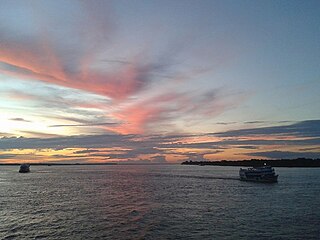
Solimões is the name often given to upper stretches of the Amazon River in Brazil from its confluence with the Rio Negro upstream to the border of Peru.

Haggetts Pond is the reservoir for the town of Andover, Massachusetts, United States. It is located in the western part of the town and also lends its name to a road. The Merrimack River is connected to the pond to add volume to the reservoir.
Hispasat is the operating company for a number of Spanish communications satellites that cover the Americas, Europe and North Africa from orbital positions 30.0° West and 61.0° West. It was formed in 1989 and its activities include provision of communication services in the commercial and government sectors. Hispasat's fleet of satellites broadcast more than 1250 television channels and radio stations to more than 30 million homes, as well as providing services such as broadband to mobile telephones and landlines.

Arawan is a family of languages spoken in western Brazil and Peru (Ucayali).

Time in Brazil is calculated using standard time, and the country is divided into four standard time zones: UTC−02:00, UTC−03:00, UTC−04:00 and UTC−05:00.
Vistula is an unincorporated community in York Township, Elkhart County, Indiana.

Kautz Creek is a tributary of the Nisqually River, flowing from the Kautz Glacier, with its watershed in the Mount Rainier National Park of Washington. It drains southwest from Mount Rainier for about 6 miles (9.7 km) before it joins the Nisqually River near Mount Rainier Highway. It is notable for being a severe flooding hazard due to the volume of summer glacier melt and its frequently changing course. The 400-foot (120 m) Kautz Creek Falls on the headwaters of the creek was formed by the retreat of the Kautz Glacier in the past 50 years.

Fort Seward is an unincorporated community in Humboldt County, California. It is located on the Eel River 3.5 miles (5.6 km) north-northwest of Alderpoint, at an elevation of 328 feet. The name honors William H. Seward, Secretary of State under President Abraham Lincoln.
Jufari River is a river forming part of the border between Amazonas and Roraima states in north-western Brazil.

Vaupés River is a tributary of the Rio Negro in South America. It rises in the Guaviare Department of Colombia, flowing east through Guaviare and Vaupés Departments. It forms part of the international border between the Vaupés department of Colombia and the Amazonas state of Brazil. On the border it merges with the Papurí River and becomes known as the Uaupés. In 1847 an explorer saw a rapid which hurled its waves 12 or 15 metres in the air, "as if great subaqueous explosions were taking place." The river continues on east through the Alto Rio Negro Indigenous Territory until it flows into the Rio Negro at São Joaquim, Amazonas. Vaupés is a blackwater river.
Crowell is an unincorporated community in Dodge County, Nebraska, United States.
The Pira-tapuya, or variations like Pira-Tapuia, Piratapuyo, etc., or Tapuya for short, are an indigenous people of the Amazon regions. They live along the Vaupés River in Colombia and in the state of Amazonas, Brazil.
References
Coordinates: 6°43′41″S61°38′36″W / 6.72806°S 61.64333°W