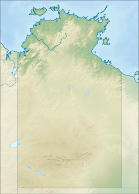
The protected areas of the Northern Territory consists of protected areas managed by the governments of the Northern Territory and Australia and private organisations with a reported total area of 335,527 square kilometres (129,548 sq mi) being 24.8% of the total area of the Northern Territory of Australia.

The Oxley Wild Rivers National Park is a protected national park that is located in the Northern Tablelands region of New South Wales, Australia in the Port Macquarie-Hastings City Council and Walcha Shire councils. The 145,223-hectare (358,850-acre) park is situated 445 kilometres (277 mi) north of Sydney and is named in memory of the Australian explorer John Oxley, who passed through the area in 1818 and is one of the largest national parks in New South Wales.

Finke Gorge National Park is a protected area in the Northern Territory of Australia located about 1,318 kilometres (819 mi) south of the territory capital of Darwin. The national park covers an area of 458 km2 (177 sq mi), and includes the impressive desert oasis Palm Valley, home to a diverse range of plant species, many of which are rare and unique to the area. There are good opportunities for bushwalking and bushcamping in the national park.

Litchfield National Park, covering approximately 1500 km2, is near the township of Batchelor, 100 km south-west of Darwin, in the Northern Territory of Australia. Each year the park attracts over 260,000 visitors.

Tjoritja /West MacDonnell is a national park in the Northern Territory (Australia) due west of Alice Springs and 1234 km south of Darwin. It extends along the MacDonnell Ranges west of Alice Springs.

The Heysen Trail is a long distance walking trail in South Australia. It runs from Parachilna Gorge, in the Flinders Ranges via the Adelaide Hills to Cape Jervis on the Fleurieu Peninsula and is approximately 1,200 kilometres (750 mi) in length.
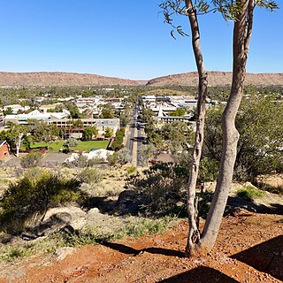
Alice Springs is the third-largest town in the Northern Territory of Australia. Known as Stuart until 31 August 1933, the name Alice Springs was given by surveyor William Whitfield Mills after Alice, Lady Todd, wife of the telegraph pioneer Sir Charles Todd. Now colloquially known as The Alice or simply Alice, the town is situated roughly in Australia's geographic centre. It is nearly equidistant from Adelaide and Darwin.
The Finke River, or Larapinta (Arrernte), is a river in central Australia, one of four main rivers of the Lake Eyre Basin and thought to be the oldest riverbed in the world. It flows for only a few days a year and when this happens, its water usually disappears into the sands of the Simpson Desert, rarely if ever reaching Lake Eyre.
The MacDonnell Ranges, or Tjoritja in Arrernte, is a mountain range and an interim Australian bioregion located in southern Northern Territory and has an area of 3,929,444 hectares. The range is a 644 km (400 mi) long series of mountains in central Australia, consisting of parallel ridges running to the east and west of Alice Springs. The mountain range contains many spectacular gaps and gorges as well as areas of Aboriginal significance.
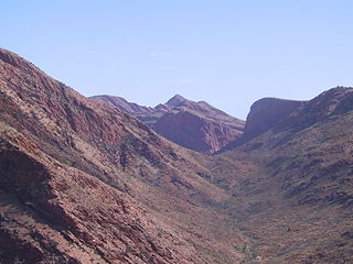
The Larapinta Trail is an extended walking track in the Northern Territory of Australia. Its total length covers 223 kilometres (139 mi) from east to west, with the eastern end at Alice Springs and the western end at Mount Sonder, one of the territory's highest mountains. It follows the West MacDonnell Ranges, sometimes along the ridge line, other times on the plain below, in the West MacDonnell National Park.

Ormiston Pound is a ring of mountains in the Northern Territory of Australia punctuating the MacDonnell Ranges, in the West MacDonnell National Park, approximately 135 kilometres (84 mi) west of Alice Springs. It lies at roughly the halfway point in the Larapinta Trail and has views from its circumference of Mount Sonder, Gosses Bluff crater and the surrounding range.
Mount Giles is one of the highest mountains in the Northern Territory, Australia, at 1,389 metres (4,557 ft) AHD . It lies along the MacDonnell Ranges, dominating Ormiston Pound, in the West MacDonnell National Park, approximately 80 kilometres (50 mi) west of Alice Springs. It can be visited via the celebrated Larapinta Trail and has views of Mount Sonder, Ormiston Gorge and Pound, and the surrounding range.
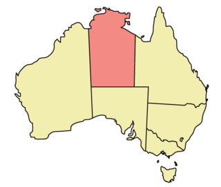
The Northern Territory (NT) occupies the north central part of the continent of Australia. The Northern Territory borders are to the west with Western Australia, the Western Australia border being near the 129° east longitude. The NT to the south with the South Australian border being the 26th parallel south latitude. To the east the NT with the Queensland border along the 138° east longitude.

Areyonga is a small town in the Northern Territory of Australia. It is located about 220 km (140 mi) west of Alice Springs. It has a population of about 195, most of whom are Aboriginal. The people are mostly Pitjantjatjara, with some Arrernte and Walpiri families. The town is governed by Areyonga Aboriginal Community.
Tourist Drives in Western Australia are routes through areas of scenic or historic significance, designated by route markers with white numbers on a brown shield. Tourist Drives were introduced into Western Australia while Eric Charlton was the state government Minister for Transport in the 1990s. The 28 numbered routes collectively traverse more than 2,000 kilometres (1,200 mi) across the state. In addition to the Tourist Drives, there are unnumbered routes such as the Golden Pipeline Heritage Trail, and local governments may designate and maintain local scenic drives, generally unnamed and unnumbered.

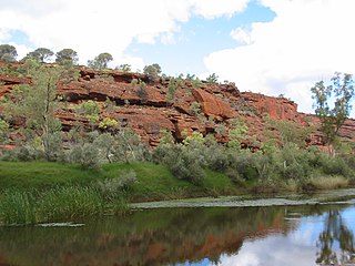
Trephina Gorge is a gorge in the Northern Territory of Australia located in the locality of Hart in the East MacDonnell Ranges about 85 kilometres (53 mi) east of Alice Springs.

N'Dhala Gorge Nature Park is a protected area in the Northern Territory of Australia consisting of an area of low sand dunes, rocky outcrops, about 90 kilometres (56 mi) east of Alice Springs. It is significant principally because of thousands of Indigenous rock carvings.

Lake Mackay is a locality in the Northern Territory of Australia located on the territory’s south-east adjoining the border with the state of Western Australia about 1,202 kilometres (747 mi) south of the territory capital of Darwin and about 458 kilometres (285 mi) west of the municipal seat in Alice Springs.
Ross Highway is a road in the Northern Territory of Australia located to the south of Alice Springs.