Settavarai

Last updated

Sethavarai
India location map.svg
Red pog.svg
Location in Tamil Nadu, India
Location Villuppuram, India
Coordinates 12°09′22″N79°14′57″E / 12.15606°N 79.249106°E / 12.15606; 79.249106
TypeCultural
State PartyFlag of India.svg  India

Sethavarai is a small village in Gingee taluk in Villuppuram district in the Indiain state of Tamil Nadu. The major occupation of the inhabitants is agriculture. In 2017 it had a population of 1100(apex). [1]

Gingee Town Panchayat in Tamil Nadu, India

Gingee (Senji) is a panchayat town in Villupuram district in the Indian state of Tamil Nadu. The nearest town with a railway station is Tindivanam, 28 km away and Thiruvannamalai, 29 km. Gingee is located between three hills covering a perimeter of 3 km.

India Country in South Asia

India is a country in South Asia. It is the seventh-largest country by area, the second-most populous country, and the most populous democracy in the world. Bounded by the Indian Ocean on the south, the Arabian Sea on the southwest, and the Bay of Bengal on the southeast, it shares land borders with Pakistan to the west; China, Nepal, and Bhutan to the north; and Bangladesh and Myanmar to the east. In the Indian Ocean, India is in the vicinity of Sri Lanka and the Maldives; its Andaman and Nicobar Islands share a maritime border with Thailand and Indonesia.

Tamil Nadu State in Southern India

Tamil Nadu, is one of the 29 states of India. Its capital and largest city is Chennai. Tamil Nadu lies in the southernmost part of the Indian subcontinent and is bordered by the union territory of Puducherry and the South Indian states of Kerala, Karnataka, and Andhra Pradesh. It is bounded by the Eastern Ghats on the north, by the Nilgiri Mountains, the Meghamalai Hills, and Kerala on the west, by the Bay of Bengal in the east, by the Gulf of Mannar and the Palk Strait on the southeast, and by the Indian Ocean on the south. The state shares a maritime border with the nation of Sri Lanka.

Contents

Location

Sethavarai is wonderful lovely nature location of Villupuram District. It is the lovely and silent location of Tamil Nadu the sethavarai in six hills one is missing for the Elumalaiyan temple located 50 kilometres (31 mi) northwest of Villupuram, 28 kilometres (17 mi) southeast of Thiruvannaamalai, 26 kilometres (16 mi) southeast of Gingee . Another importantant rock art site of Tamil Nadu, Kilvalai, is located 18 km southeast of Settavarai.

Kilvalai village in Tamil Nadu, India

Kilvalai or Kizhvalai, is a hamlet in Tirukkoyilur taluk in Villuppuram district in the Indian state of Tamil Nadu. The major occupation of the people living at this place is agriculture. In 2011 it had a population of 700.

Transportation (via Sethavarai)

T13-Gingee ~ Thadagam, T15-Thirukovilur ~ Nallan Pillai Petral, 122N-Thirukovilur ~ Chennai, 122F-Gingee to vettavalam to Chennai, 122Gt-Gingee to Thirukovilur to Chennai, DEEN MOTORS-Devikapuran ~ Vettavalam.

About the village

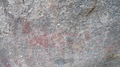
Sethavarai village has a 3000-year heritage. The historical importance of the village is the presence of 1000 B.C.E. rock paintings. The Sethavarai rock paintings consist mainly of animal images.

Rock paintings

Globally, the study of rock art and their interpretations has gained momentum in the field of archaeology. Archeologists not only denoted the artistic skill of the people who had painted them, also their beliefs and their daily activities. The paintings on the rock shelters mostly depict hunting scenes and human activities. [2]

Sethavarai Rock paintings

deer image Settavarai image 1.JPG
deer image

The paintings are found in the rock shelters of a hillock called Ayyanarmalai. Animals like deer, wild boar, buffalo, tiger, fish and many images of human palms with fingers are found at the top of the hill. Among these paintings, a deer and a fish are depicted in large size. The outlines for these two figures are drawn in red ochre while the inner portion is painted white. The figure of a buffalo is drawn completely in red. The form of another buffalo is drawn in thick ochre while the back half is painted showing the bones and other inner organs. These type of paintings are called x-ray paintings.

One significant scene is found in front of the deer. A small amount of flesh is found fried in the fire with the help of long pole. This scene confirms that the authors of these paintings were well aware of eating fried flesh and fish.

Only one human figure is found in this large scene of animals. The nose of the human is drawn in the same style as seen in Kilvalai rock paintings, but without a dagger. Based on the execution of paintings and the style of the figures, the date of these paintings is estimated at 1500 B.C.E. [3]

See also

Related Research Articles

Cave painting Paintings, often prehistoric, on cave walls and ceilings

Cave paintings are a type of parietal art, found on the wall or ceilings of caves. The term usually implies prehistoric origin, but cave paintings can also be of recent production: In the Gabarnmung cave of northern Australia, the oldest paintings certainly predate 28,000 years ago, while the most recent ones were made less than a century ago.

Tamil Jain

Tamil Jains are Tamils from Tamil Nadu, India, who practice Digambara Jainism. The Jains microcommunity of around 85,000, including both Tamil Jains and north indian Jains settled in Tamilnadu. They Tamil Jains are predominantly scattered in northern Tamil Nadu, largely in the districts of Madurai, Viluppuram, Kanchipuram, Vellore, Tiruvannamalai, Cuddalore and Thanjavur. Early Tamil-Brahmi inscriptions in Tamil Nadu date to the 3rd century BCE and describe the livelihoods of Tamil Jains. Camaṇar wrote much Tamil literature, including the important Sangam literature, such as the Nālaṭiyār, the Silappatikaram, the Manimekalai and the Cīvaka Cintāmaṇi. Three of the five great epics of Tamil literature are attributed to Jains.

Tamil Nadu Veterinary and Animal Sciences University (TANUVAS) is a veterinary university founded in 1989 in Madhavaram Milk Colony, Chennai, India. It is composed of the Madras Veterinary College, Veterinary College and Research Institute, Namakkal, Veterinary College and Research Institute, Tirunelveli ; Veterinary College and Research Institute, Orathanadu and the Institute of Food and Dairy Technology, Koduvalli, Chennai-52. Research farms are for leprosy bacteria, for prawn and edible fish culture, and for animal feed safety.

Pulicat Lake brackish water

Pulicat Lagoon is the second largest brackish water lagoon in India, after Chilika Lake. Pulicat Lagoon is considered to be the second largest brackish water body in India measuring 759* km2. The Lagoon is one of the three important wetlands to attract North-East Monsoon rain clouds during October to December season to Tamil Nadu. The lagoon comprises the following regions, which adds up 759 km2 according to Andhra Pradesh Forest Department*: 1) Pulicat Lake 2) Marshy/Wetland Land Region (AP) 3) Venadu Reserve Forest (AP) 4) Pernadu Reserve Forest (AP) The lagoon was cut across in the middle the Sriharikota Link Road, which divided the water body into lake and marshy land. The lake encompasses the Pulicat Lake Bird Sanctuary. The barrier island of Sriharikota separates the lake from the Bay of Bengal and is home to the Satish Dhawan Space Centre. Major part of the lake comes under Nellore district of Andhra pradesh.

Gingee Fort fort

Gingee Fort or Senji Fort in Tamil Nadu, India is one of the surviving forts in Tamil Nadu, India. It lies in Villupuram District, 160 kilometres (99 mi) from the state capital, Chennai, and is close to the Union Territory of Puducherry. The fort is so fortified, that Shivaji, the Maratha king, ranked it as the "most impregnable fortress in India" and it was called the "Troy of the East" by the British. The nearest town with a railway station is Tindivanam and the nearest airport is Chennai (Madras), located 150 kilometres (93 mi) away.

Aarani, Tiruvannamalai Municipality in Tamil Nadu, India

Arni is a town and a municipality in Tiruvanamalai district in the state of Tamil Nadu, India. The name comes from the word Aranyam which means a place surrounded by forest.

Viluppuram district District in Tamil Nadu, India

Viluppuram is one of the 37 districts that make up the state of Tamil Nadu, India. It was founded on 30 September 1993, prior to which it was part of the Cuddalore district district. Viluppuram district lies between the national highways of Tiruchirappalli and Chennai, and contains some historical landmarks, such as the Gingee Fort that is over 500 years old.

Viluppuram Town in Tamil Nadu, India

Viluppuram(pronunciation ) is a Municipality and the administrative headquarters of Viluppuram district, the largest district in the state of Tamil Nadu, India.

Avur is a small town situated in Tiruvannamalai District, Tamil Nadu, India. Previously it was part of the North Arcot district. For administrative purposes it comes under the Kilpennathur Revenue Union. The town has existed since the Cheran and Pandian dynasties and was then ruled by the Arcot Nawabs.

Anniyur, Viluppuram Village in Tamil Nadu, India

Anniyur is a village located in the District of Viluppuram in the southern state of Tamil Nadu under the Union of India. It lies 25 kilometres from Gingee, Vilupuram

Vellar is a river which originates in the Shevaroy Hills and runs through the districts of Salem, Perambalur and Cuddalore in the northern part of the Indian state of Tamil Nadu before draining into the Bay of Bengal near Parangipettai.

South Arcot District (Madras Presidency)

South Arcot District was a district in the Madras Presidency of British India. It covered the area of the present-day districts of Cuddalore, Kallakurichi, Viluppuram and Thiruvannamalai in the Indian state of Tamil Nadu. The district was divided into eight taluks and covered a total area of 13,510 square kilometres (5,217 sq mi). The administrative headquarters was the town of Cuddalore.

The Sankaraparani River originates on the western slope of Gingee Hill in Viluppuram District of the State of Tamil Nadu. It has two sources, one in the Pakkammalai hills and one in the mountains of Melmalayanur. They join near Thenpalai village to form the main river. Sankaraparani is also known as Varahanadi or Gingee River.

Ennayiram village in Tamil Nadu, India

Ennayiram is a village in Vikravandi taluk in Villuppuram district in the Indian state of Tamil Nadu. The major occupation of the people living at this place is agriculture.

Nehanurpatti village in Tamil Nadu, India

Neganur Patti is a 1 sq. kilometre village in Gingee taluk in Villuppuram district in the Indian state of Tamil Nadu. The major occupation of the people living at this place is agriculture. In 2012 it had a population of 3000 people.

Kanchiyur village in Tamil Nadu, India

Kanjur or Kanchiyur is a hamlet in Gingee taluk in Villuppuram district in the Indian state of Tamil Nadu. The major occupation of the people living at this place is agriculture. In 2011 it had a population of 400.

Neganur

Neganur Village is a 6.5 square kilometres (2.5 sq mi) village in Gingee taluk, Villupuram District in the India state of Tamil Nadu. The main activity is cultivating agricultural crops such as rice, groundnut, etc.

Tiruvannamalai is predominantly connected by road to other major cities in the state including Chennai, Bengaluru, Vellore, Trichy, Tiruppur, Salem, Thanjavur, Coimbatore, Shimoga and Kanchipuram. And also other state major cities such as Hyderabad, Tirupati, Puducherry and Mangaluru. Tiruvannamalai serves as one of the important Road junction of Tamil Nadu and north roadways Zone. The nearest domestic airport is Vellore, which has a no daily chartered flights. The nearest international airports are Chennai and Tiruchirappalli.

Ambadevi rock shelters Caves and archaeological site in India

The Ambadevi rock shelters is an archaeological site exhibiting the earliest traces of human life in the central province of the Indian subcontinent. The site is located near the Dharul village in the Betul District of the Indian state of Madhya Pradesh, on the border of the Amravati district of Maharashtra. According to studies of various rock paintings and petroglyphs, the Ambadevi rock shelters were inhabited over 20,000 years ago by early human settlers. The cluster of rock shelters was first discovered by Dr. Vijay Ingole and his colleagues on 27 January 2007 and was named the Ambadevi rock shelters because of their proximity to the ancient Ambadevi cave temple. The site has also been referred to as the Satpura-Tapti valley and Gavilgarh-Betul rock shelters. It is one of the most important discoveries of the 21st Century in India, following the discovery of Bhimbetka rock shelters during the 20th Century.

References

  1. http://www.indiamapped.com/tamil-nadu/viluppuram/gingee/settavarai/
  2. S. Vasanthi, "KALVETTU", Vol no:75, page no:40 (2008), State department of Archaeology, Chennai
  3. "Archived copy". Archived from the original on 27 December 2014. Retrieved 28 February 2012.CS1 maint: archived copy as title (link)