Related Research Articles

The Hereford Inlet Light is a historic lighthouse located in North Wildwood in Cape May County, New Jersey, United States, situated on the southwestern shore of Hereford Inlet at the north end of Five Mile Beach. Its construction was completed and it became operational in 1874.
Ocean Drive is a series of local roads in southern New Jersey, connecting Atlantic City to Cape May along barrier islands on the Atlantic Ocean. It consists of several roads and includes all five toll bridges owned by the Cape May County Bridge Commission.

Absecon Island is a barrier island located on the Jersey Shore of the Atlantic Ocean in Atlantic County, New Jersey. On the island from north to south are the resort communities of Atlantic City, Ventnor, Margate, and Longport. The island ends at Absecon Inlet to the north and Great Egg Harbor Inlet to the south.
Brigantine Island is an island off the Atlantic Ocean coast of New Jersey, located northeast of Atlantic City. It is 6 miles (9.7 km) long. The resort community of Brigantine is located on the island.
Ludlam Island is a barrier island in southern New Jersey, on which Sea Isle City, and Strathmere, a part of Upper Township are located.
Little Beach is a barrier island along the coast of New Jersey. It is believed to be the last uninhabited barrier island left on the U.S. Atlantic coast. It is part of Galloway Township, in Atlantic County, New Jersey.
Corson Inlet is a narrow strait on the southern coast of New Jersey in the United States.
Peters Beach or Peter Beach is a former barrier island located on the Jersey Shore of the Atlantic Ocean in Atlantic County, New Jersey, United States. It is now a part of Brigantine Island.
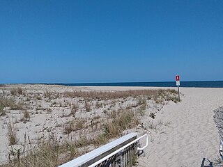
Poverty Beach or Sewell Point is a barrier spit, approximately 2.5 miles (4 km) in length entirely within the City of Cape May, along the Atlantic Ocean coast of eastern New Jersey in the United States. It is the southernmost barrier island in New Jersey.
Wardell's Beach is the historic name of a barrier spit located on the Jersey Shore of the Atlantic Ocean in Monmouth County, New Jersey, United States. It takes its name from Eliakim Wardell, an early owner, and his descendants. Since the 19th century it has been joined physically to Sandy Hook, and contains the boroughs of Monmouth Beach and Sea Bright.
Squan Beach is the historic name of a barrier spit located on the Jersey Shore of the Atlantic Ocean in Ocean County, New Jersey, United States. Since the closing of Cranberry Inlet around 1812, it has been joined physically to Island Beach, and is a major component of the Barnegat Peninsula.
Island Beach is a barrier spit located on the Jersey Shore of the Atlantic Ocean in Ocean County, New Jersey. Since the closing of Cranberry Inlet about 1812 (approximately at the boundary between Ortley Beach and Seaside Heights), it has been joined physically to Squan Beach, and is a major component of the Barnegat Peninsula.
Pecks Beach or Peck's Beach is a barrier island located on the Jersey Shore in Cape May County, New Jersey.
Five Mile Beach or Holly Beach is the name of a barrier island on the Jersey Shore in Cape May County. The popular resort area collectively known as The Wildwoods are on Five Mile Beach and adjacent islands.
Two Mile Beach is a barrier island on the Jersey Shore in Cape May County, since 1922 connected to Five Mile Beach.
Brigantine Inlet is an inlet connecting Little Bay with the Atlantic Ocean in Atlantic County, New Jersey.
Townsends Inlet is an inlet connecting Townsend Sound with the Atlantic Ocean in Cape May County, New Jersey.
Hereford Inlet is an inlet in Cape May County, New Jersey.
Cape May Inlet is an inlet in southeastern Cape May County, New Jersey.

Turtle Gut Inlet was an inlet located in what is now Wildwood Crest, in Cape May County, New Jersey, United States.
References
- ↑ Gordon, Thomas Francis (1834). A Gazetteer of the State of New Jersey - Thomas F. Gordon - Google Books . Retrieved October 14, 2018.
- ↑ Historical and Biographical Atlas of the New Jersey Coast, Woolman and Rose, Philadelphia, 1878; p. 20
Coordinates: 39°04′32″N74°44′20″W / 39.07551°N 74.738789°W
| | This Cape May County, New Jersey state location article is a stub. You can help Wikipedia by expanding it. |