Related Research Articles

Demographics of the population of Belize include population density, ethnicity, education level, health of the populace, economic status, religious affiliations and other aspects.

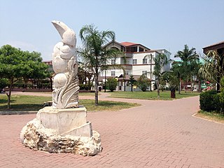
Punta Gorda, known locally as P.G., is the capital and largest town of Toledo District in southern Belize. Punta Gorda is the southernmost sizable town in the nation, with a population of about 5,000 people. Although the town bears a Spanish name, its inhabitants are mostly Kriol/English-speaking and are primarily of Garifuna, East Indian, Kriol, and Maya descent.

Corozal Town is a town in Belize, capital of Corozal District. Corozal Town is located about 84 miles north of Belize City, and 9 miles from the border with Mexico. The population of Corozal Town, according to the main results of the 2010 census, is 9,871.

Orange Walk Town is the fourth largest town in Belize, with a population of about 13,400. It is the capital of the Orange Walk District. Orange Walk Town is located on the left bank of the New River, 53 miles (85 km) north of Belize City and 30 miles (48 km) south of Corozal Town. Despite the English name of the city, its residents are primarily Spanish-speaking mestizos. The city is in a very low-lying area of Belize, though the police station sits atop a buried Mayan pyramid at 49 m (161 ft) tall.

Toledo District is the southernmost and least populated district in Belize. Punta Gorda is the District capital. According to the Human Development Index (HDI), it is the second most developed region in the country. The district has a diverse topography which features rainforests, extensive cave networks, coastal lowland plains, and offshore cays. Toledo is home to a wide range of cultures such as Mopan, Kekchi Maya, Creole, Garifuna, East Indians, Mennonites, Mestizos, and descendants of US Confederate settlers.

San Ignacio and Santa Elena are towns in western Belize. San Ignacio serves as the cultural-economic hub of Cayo District. It got its start from mahogany and chicle production during British colonisation. Over time it attracted people from the surrounding areas, which led to the diverse population of the town today. San Ignacio is the largest settlement in Cayo District and the second largest in the country, after Belize City.

Placencia is a small village located in the Stann Creek District of Belize.

Consejo is a village in the north of Corozal District, Belize. Consejo is located on a point of land where the bays of Corozal and Chetumal meet. Consejo is about 8 miles from the district capital of Corozal Town, and 2 miles (3.2 km) across the water from Chetumal, Mexico.

Caye Caulker is a small limestone coral island off the coast of Belize in the Caribbean Sea measuring about 5 miles (8.0 km) by less than 1 mile (1.6 km). The town on the island is known by the name Caye Caulker Village. The population of Caye Caulker is approximately 2,000 people today and still growing.

Actun Tunichil Muknal, also known locally as ATM, is a cave in Belize, near San Ignacio, Cayo District, notable as a Maya archaeological site that includes skeletons, ceramics, and stoneware. There are several areas with skeletal remains in the main chamber. The best known is "The Crystal Maiden", the skeleton of what is believed to be a 17-year-old boy, possibly a sacrifice victim, whose bones have been calcified to a sparkling, crystallized appearance.

Sarteneja is the largest fishing community and the second largest village in Belize. It recorded a population of 3,500 according to a 2016 estimate. The name Sarteneja is a Castilian distortion of its original Mayan name Tza-ten-a-ha, which means 'give me water'.
Gardenia is a village in Belize District, Belize located about 20 miles (32 km) north of Belize City.
Armenia is a village in the Cayo District of Belize, along the nation's Hummingbird Highway south of the capitol, Belmopan.
Blackman Eddy is a village located on the banks of the Belize River in the Cayo District, Belize. The George Price Highway runs through the middle of the village.
Burrell Boom is on the Belize River twenty miles above Belize City, Belize. Tourists pass through this historic village on their way to the Community Baboon Sanctuary, where the population of black howler monkeys has grown to over 2,000.

Bullet Tree Falls is a village located along the Mopan River in Cayo District, Belize. It lies approximately five kilometers northwest of San Ignacio. According to the 2010 census, Bullet Tree Falls has a population of 2,124 people in 426 households. The population consists mainly of Spanish-speaking mestizos, along with a smaller number of Yucatec Maya and Creoles.

San Antonio is a village in the Toledo District of Belize. It is the largest Maya settlement in Belize, with a population of approximately 1,000 people, predominantly Mopan Maya. About 88% of the inhabitants are Catholic, with 8% belonging to other Christian denominations, and 4% being non-denominational. Along with 29 other mission parishes in the Toledo District, it is pastored by Jesuits from St. Peter Claver church in Punta Gorda.
Seine Bight is a village on the Placencia Peninsula located in the Stann Creek District of Belize. It is located 2 and a half miles south of Maya Beach Village and North of the village of Placencia. This small village has roughly 1,000 inhabitants, mostly Garifuna people who subsist on fishing, hunting, and homegrown vegetables. The early settlers named their village for their favored fishing tackle, Seine fishing and a bight, a bend or curve in a coastline.
Ontario is a village in the Cayo District of central interior Belize. The village is in an agricultural region with the most frequent crops being citrus and banana. It is one of 192 municipalities administered at the village level in the country for census taking purposes.
References
- ↑ "Census Data".
- ↑ "Administrative Division of Belize".
- ↑ Population & Housing Census