Related Research Articles

Nelson is a city on the eastern shores of Tasman Bay. Nelson is the oldest city in the South Island and the second-oldest settled city in New Zealand – it was established in 1841 and was proclaimed a city by royal charter in 1858.

Nance County is a county in the U.S. state of Nebraska. As of the 2010 census, the population was 3,735. Its county seat is Fullerton.

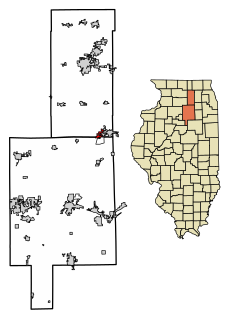
Frankfort is a village in Will County, Illinois, United States, with a small portion in Cook County. The population was 17,782 at the 2010 census, up from 10,391 in 2000. According to Forbes.com, in 2007 the village ranked as the 36th fastest growing suburb in the United States.

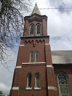
Somonauk is a village in DeKalb and LaSalle Counties in the U.S. state of Illinois. The population was 1,893 at the 2010 Census.

Bloomsdale is a city in Ste. Genevieve County, Missouri, United States. The population was 521 at the 2010 census.

Shickshinny is a borough in Luzerne County, Pennsylvania, United States. The population was 838 at the 2010 census.

Sugar Creek is a city in Clay and Jackson counties in the U.S. state of Missouri. The population was 3,345 at the 2010 census. It is part of the Kansas City metropolitan area.

Tasman Bay / Te Tai-o-Aorere, originally known as Blind Bay, is a large V-shaped bay at the north end of New Zealand's South Island. Located in the centre of the island's northern coast, it stretches along 120 kilometres (75 mi) of coastline and is 70 kilometres (43 mi) across at its widest point. It is an arm of the Tasman Sea, lying on the western approach to Cook Strait.
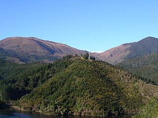
Maungatapu is a mountain in New Zealand included in both the Nelson, New Zealand and Marlborough Regions. It lies in the Bryant Range. The mountain is 1014 meters high. Maungatapu is a Māori language word meaning "sacred mountain". The mountain was the location of the infamous Maungatapu murders.

The Mahitahi River is a river of the southwest of New Zealand's South Island. It flows northwest from the Hooker Range, part of the Southern Alps, reaching the Tasman Sea at Bruce Bay.

The Maitai / Mahitahi River is an awa (river) of the northwest of New Zealand's South Island. It flows westwards through hill country west of the Bryant Range before passing through the city of Nelson, reaching Tasman Bay at Nelson Haven. Major tributaries of the Maitai River include The Brook, Te Wairepo / York Stream and Sharland Creek.
The Wakapuaka River is a river of the Nelson Region of New Zealand's South Island. It flows generally north from its origins in the north of the Bryant Range 14 kilometres (8.7 mi) east of Nelson city centre to reach Delaware Bay, an indentation in the northeast coast of Tasman Bay.
The Whangamoa River is a river of the Nelson Region of New Zealand's South Island. It flows generally northeast from its origins in the northern Bryant Range 15 kilometres (9 mi) northeast of Nelson city centre to reach Tasman Bay close to the northeastern end of Delaware Bay.
Maitai is an inner suburb of Nelson, New Zealand. It lies at the western edge of Nelson city centre, immediately to the south of The Wood, on the northern bank of the Maitai River. A monument representing the location of the geographic centre of New Zealand is located in Maitai.
Nelson East is an inner suburb of Nelson, New Zealand. As its name suggests, it lies to the east of Nelson city centre, along the banks of the Maitai River between the city centre and Maitai. Notable features of Nelson East include Queen's Gardens and the Nelson Marlborough Institute of Technology.
Te Wairepo / York Stream is a major tributary of the Maitai / Mahitahi River in Nelson, South Island, New Zealand. The maori name Te Wairepo means "water running through a swamp". Before the valley was drained and houses built by early European settlers, stands of flax covered the low-lying areas through which Te Wairepo flowed.
Brook Stream, or Waimarama, is a major tributary of the Maitai / Mahitahi River in Nelson, South Island, New Zealand.
Groom Creek, which flows northwards from Fringed Hill then past Tantragee Saddle, is a tributary of the Maitai / Mahitahi River in Nelson, South Island, New Zealand.

The Dun Mountain-Maitai Terrane comprises the Dun Mountain Ophiolite Belt, Maitai Group and Patuki Mélange. The Dun Mountain Ophiolite is an ophiolite of Permian age located in New Zealand's South Island. Prehistorically this ophiolite was quarried by Māori for both metasomatized argillite and pounamu (jade) which was used in the production of tools and jewellery.
Hanby Park is a suburb of Nelson, New Zealand.
References
- ↑ LINZ file reference GES-N15-01-07/1670
- ↑ LINZ file reference GES-N15-01-07/1670
- ↑ Sharland, Ellen (2009). "The first Sharland". The Prow.
Coordinates: 41°16′34″S173°19′42″E / 41.2761°S 173.3284°E
| This article about a river in the Nelson Region is a stub. You can help Wikipedia by expanding it. |