Modoc County is a county located in the far northeast corner of the U.S. state of California. Its population is 8,700 as of the 2020 census, down from 9,686 from the 2010 census. This makes it California's third-least-populous county. The county seat and only incorporated city is Alturas. Previous County seats include Lake City and Centerville. The county borders Nevada and Oregon. Much of Modoc County is federal land. Several federal agencies, including the United States Forest Service, Bureau of Land Management, National Park Service, Bureau of Indian Affairs, and the United States Fish and Wildlife Service, have employees assigned to the area, and their operations are a significant part of its economy and services. The county's official slogans include "The last best place" and "Where the West still lives".

Shasta County, officially the County of Shasta, is a county located in the northern portion of the U.S. state of California. Its population is 182,155 as of the 2020 census, up from 177,223 from the 2010 census. The county seat is Redding.

Siskiyou County is a county located in the northwestern part of the U.S. state of California. As of the 2020 census, the population was 44,076. Its county seat is Yreka and its highest point is Mount Shasta. It falls within the Cascadia bioregion.

Northern California is a geographic and cultural region that generally comprises the northern portion of the U.S. state of California, spanning the northernmost 48 of the state's 58 counties. Northern California in its largest definition is determined by dividing the state into two regions, the other being Southern California. The main northern population centers include the San Francisco Bay Area, the Greater Sacramento area, the Redding, California, area south of the Cascade Range, and the Metropolitan Fresno area. Northern California also contains redwood forests, along with most of the Sierra Nevada, including Yosemite Valley and part of Lake Tahoe, Mount Shasta, and most of the Central Valley, one of the world's most productive agricultural regions. Northern California is also home to Silicon Valley, the global headquarters for some of the most powerful tech and Internet-related companies in the world, including Meta, Apple, Google, and Nvidia.

The Shasta Cascade region of California is located in the northeastern and north-central sections of the state bordering Oregon and Nevada, including far northern parts of the Central Valley and the Sierra Nevada mountain range.

The Pit River is a major river draining from northeastern California into the state's Central Valley. The Pit, the Klamath and the Columbia are the only three rivers in the U.S. that cross the Cascade Range.

State Route 299 is an east–west state highway in the U.S. state of California that runs across the northern part of the state. At 305.777 miles (492.100 km), it is the third longest California state route, after Route 1 and Route 99, and the longest east-west route. Route 299's western terminus is at US 101 at the northern edge of Arcata, and its eastern terminus is at the Nevada state line at a point east of Cedarville. Between Arcata and Redding, Route 299 intersects with State Route 96, and is briefly co-signed with State Route 3. In Redding, it intersects with State Route 273, State Route 44, and Interstate 5. East of Redding, it intersects with State Route 89, and a section is co-signed with State Route 139 before reaching Alturas. It is then co-signed with U.S. Route 395 northeast of Alturas, and then runs east through Cedarville and to the border with Nevada. A ghost town, Vya, Nevada, can be reached via this route, which after the border becomes a dirt road, which was formerly Nevada State Route 8A. The segment of SR 299 between Arcata and Redding is the Trinity Scenic Byway, a National Forest Scenic Byway.

The Trinity Alps are a mountain range in Trinity County and Siskiyou County in Northern California. They are a subrange of the Klamath Mountains located to the north of Weaverville.

Castle Crags is a dramatic and well-known rock formation in Northern California. Elevations range from 2,000 feet (610 m) along the Sacramento River near the base of the crags, to over 6,500 feet (2,000 m) at the summit of the tallest crag.

The Shasta–Trinity National Forest is a federally designated forest in northern California, United States. It is the largest National Forest in California and is managed by the U.S. Forest Service. The 2,210,485 acre forest encompasses five wilderness areas, hundreds of mountain lakes and 6,278 miles (10,103 km) of streams and rivers. Major features include Shasta Lake, the largest man-made lake in California and Mount Shasta, elevation 14,179 feet (4,322 m).

Area code 530 is a telephone area code in the North American Numbering Plan (NANP) in northeastern and Northern California. It was created in 1997 in an area code split of 916.

The Whiskeytown–Shasta–Trinity National Recreation Area is a United States National Recreation Area in northern California. The recreation area was authorized in 1965 by the United States Congress. Recreational activities available include swimming, fishing, boating, camping, and hiking.

Shasta is a census-designated place (CDP) in Shasta County, California, United States. Shasta sits at an elevation of 843 feet (257 m). Its population is 1,043 as of the 2020 census, down from 1,771 from the 2010 census.

The Klamath Basin is the region in the U.S. states of Oregon and California drained by the Klamath River. It contains most of Klamath County and parts of Lake and Jackson counties in Oregon, and parts of Del Norte, Humboldt, Modoc, Siskiyou, and Trinity counties in California. The 15,751-square-mile (40,790 km2) drainage basin is 35% in Oregon and 65% in California. In Oregon, the watershed typically lies east of the Cascade Range, while California contains most of the river's segment that passes through the mountains. In the Oregon-far northern California segment of the river, the watershed is semi-desert at lower elevations and dry alpine in the upper elevations. In the western part of the basin, in California, however, the climate is more of temperate rainforest, and the Trinity River watershed consists of a more typical alpine climate.
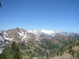
The South Warner Wilderness is a federally designated wilderness area 12 miles (19 km) east of Alturas, California, United States. It encompasses more than 70,000 acres (283 km2) of the Warner Mountains. It is within the Modoc National Forest and managed by the US Forest Service. Elevations range from 5,000 feet (1,500 m) to 9,895 feet at Eagle Peak.

The Castle Crags Wilderness is a 12,232-acre (49.50 km2) wilderness area in the Castle Crags rock formations of the Trinity Mountains, and within the Shasta-Trinity National Forest, in northwestern California. It is located in Siskiyou County and Shasta County, 40 miles (64 km) north of Redding and south of Mount Shasta City.
The Evergreen League is a high school sports league based in Northern California. It serves schools in Lassen, Modoc, Shasta, Siskiyou and Trinity Counties and its athletic teams are members of the Northern Section of the California Interscholastic Federation.

The Lookout Rancheria is a federal Indian reservation belonging to the Pit River Tribe, a federally recognized tribe of indigenous people of California. The ranchería is located in Modoc County in northern California.

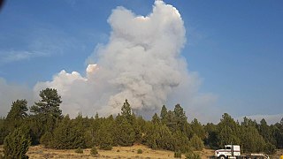
The Parker 2 Fire was a wildfire in the Modoc National Forest in Modoc County, California in the United States. The fire, which was reported on August 3, 2017, burned a total of 7,697 acres (31 km2). It was fully contained by August 28. The cause for the fire was lightning.


