
The River Don is a river in South Yorkshire and the East Riding of Yorkshire, England. It rises in the Pennines, west of Dunford Bridge, and flows for 69 miles (111 km) eastwards, through the Don Valley, via Penistone, Sheffield, Rotherham, Mexborough, Conisbrough, Doncaster and Stainforth. It originally joined the Trent, but was re-engineered by Cornelius Vermuyden as the Dutch River in the 1620s, and now joins the River Ouse at Goole. Don Valley is a UK parliamentary constituency near the Doncaster stretch of the river.

The William Jolly Bridge is a heritage-listed road bridge over the Brisbane River between North Quay in the Brisbane central business district and Grey Street in South Brisbane, within City of Brisbane, Queensland, Australia. It was designed by Harding Frew and built from 1928 to 1932 by MR Hornibrook.
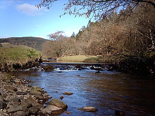
Kip Water, also known as the River Kip, is a short river in Inverclyde, Scotland which gives the village of Inverkip its name. It originates at Cornalees in the hills between Inverkip and Greenock and runs through Shielhill Glen, Dunrod Glen and the Kip Valley before entering the Firth of Clyde at Kip Marina in Inverkip.

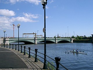
The M3 is an urban motorway 0.8 miles (1.3 km) in length owned by Siac Construction and Cintra, S.A. that connects the M2 in north Belfast, Northern Ireland to the A2 Sydenham Bypass in east Belfast. It is the shortest motorway in Northern Ireland, and one of the busiest, carrying 60,000 vehicles per day as of 2005. It has a permanent speed limit of 50 mph (80 km/h).

Navigable aqueducts are bridge structures that carry navigable waterway canals over other rivers, valleys, railways or roads. They are primarily distinguished by their size, carrying a larger cross-section of water than most water-supply aqueducts. Roman aqueducts were used to transport water and were created in Ancient Rome. The 662-metre (2,172 ft) long steel Briare aqueduct carrying the Canal latéral à la Loire over the River Loire was built in 1896. It was ranked as the longest navigable aqueduct in the world for more than a century, until the Magdeburg Water Bridge in Germany took the title in the early 21st century.

The Belfast–Newry line operates from Lanyon Place station in County Antrim to Newry in County Down, Northern Ireland. The manager for this line is based at Portadown railway station, although the line extends to the border to include the Scarva and Poyntzpass halts and Newry. Newry is on the fringe of the network, being the last stop before the border with the Republic of Ireland. The line follows the route of the northern half of the main Dublin–Belfast line, with the exception of calling at Belfast Great Victoria Street.

Queen's Bridge is a B+ listed Victorian stone arch bridge in Belfast, Northern Ireland. It opened to traffic in 1843 and is named after Queen Victoria.
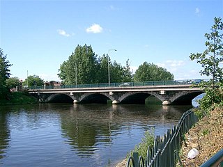
Albert Bridge is a bridge in Belfast, Northern Ireland. Its three flat arches span the River Lagan. It was completed in 1890 by Belfast city surveyor J C Bretland and is named after Prince Albert Victor. It is located close to the city centre between East Bridge Street and the Albertbridge Road.

The Medway Viaducts are three bridges or viaducts that cross the River Medway between Cuxton and Borstal in north Kent, England. The two road bridges carry the M2 motorway carriageways. The other viaduct carries the High Speed 1 railway line. All three bridges pass over the Medway Valley Line.
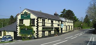
Tal-y-Cafn is a small settlement in Conwy county borough, north Wales, in the community of Eglwysbach.

The A55 road forms Belfast's outer-ring road.
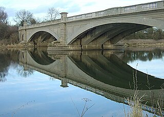
Gunthorpe Bridge is a bridge over the River Trent at Gunthorpe, Nottinghamshire.

Terras Bridge, also known as Terras Pill Bridge, is a road bridge near Morval in Cornwall, England. Built in c. 1825, the Grade II listed bridge crosses the tidal East Looe River, and is adjacent to the Liskeard and Looe Railway and the remains of the Liskeard and Looe Union Canal.

The Afon Cegin is a small river draining parts of North Wales and discharging to the Menai Strait at Porth Penrhyn. Its name means Kitchen River in English.

Lagan Railway Bridge is a railway and pedestrian bridge across the River Lagan in Belfast, slightly north of Belfast Central railway station. The next bridge upstream is the Albert Bridge, whilst the next downstream is Queen's Bridge.
The Ormeau Bridge is a road bridge in Belfast, roughly 80m long, carrying the A24 Ormeau Road across the River Lagan from Stranmillis Embankment to Ormeau Embankment.

King's Bridge is a road bridge across the River Lagan in South Belfast, Northern Ireland. It opened in 1912 and is named after King George V. Made of reinforced concrete, it is believed to be the first road bridge of this type in Ireland.

The Cooks River Sewage Aqueduct is a heritage-listed sewage aqueduct located at Pine Street, Earlwood, New South Wales, Australia. It crosses the Cooks River to Thornley Street, Marrickville. It was designed by Sewerage Construction Branch and NSW Department of Public Works and built during 1895 by J. F. Carson, contractor. The property is owned by Sydney Water, an agency of the Government of New South Wales. It was added to the New South Wales State Heritage Register on 18 November 1999.


