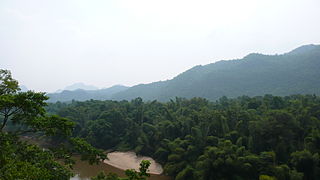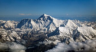
Myanmar is the northwestern-most country of mainland Southeast Asia. It lies along the Indian and Eurasian Plates, to the southeast of the Himalayas. To its west is the Bay of Bengal and to its south is the Andaman Sea. It is strategically located near major Indian Ocean shipping lanes.The neighboring countries are China, India, Bangladesh, Thailand and Laos.

Hkakabo Razi is believed to be Myanmar's highest mountain, and with its height of 5,881 metres (19,295 ft) the probable highest mountain in South East Asia. It is located in the northern Myanmar state of Kachin in an outlying subrange of the Greater Himalayan mountain system near the border tri-point with India and China. Its highest status has recently been challenged by Gamlang Razi, located about 6.6 kilometres (4.1 mi) WSW on the Chinese border.

The Pat-kai or Patkai Bum meaning "to cut (pat) chicken (Kai)" in Tai-Ahom language are the hills on India's north-eastern border with Burma or Myanmar. They were created by the same tectonic processes that resulted in the formation of the Himalayas in the Mesozoic.

Bumhpa Bum is the highest mountains of the Kachin Hills of Burma. It is in Kachin State, Burma.

The Shan Hills, also known as Shan Highland, is a vast mountainous zone that extends through Yunnan to Myanmar and Thailand. The whole region is made up of numerous mountain ranges separated mostly by narrow valleys as well as a few broader intermontane basins. The ranges in the area are aligned in such a way that they link to the foothills of the Himalayas further to the northwest.

Tenasserim Hills or Tenasserim Range is the geographical name of a roughly 1,700 km long mountain chain, part of the Indo-Malayan mountain system in Southeast Asia.

Sidoktaya, also Sitoktaya or Setoketaya is a town and seat of Sidoktaya Township in Minbu District of Magway Division, situated in middle west region of Burma. It is bordered with Salin township to the east, with Pwintbyu township to the south-east, with Ngape township to the south, with Minbya township to the west, with Kanpelek township to the north-west and with Saw township to the north. It is a hilly region of Rakhine. Mount Sun Taung, the highest mountain in Rakhine, 6,527 feet (1,989 m) high, is in Sidoktaya township.

The Daen Lao Range is a mountain range of the Shan Hills in eastern Burma and northern Thailand. Most of the range is in Shan State, with its northern limit close to the border with China, and runs southwards across the Thai border, at the northern end of Thailand.

Loi Pangnao is the highest mountain of the Daen Lao Range, a subrange of the Shan Hills. It is located near Mong Yawng in Shan State, Burma close to the border with China.

Loi Leng is the highest mountain of the Shan Hills. It is located in Shan State, Burma, 45 km to the southeast of Lashio.

Mong Ling Shan, also known as Möng Ling Shan, is one of the highest mountains of the Shan Hills. It is located in Shan State, Burma close to the border with China and 122 km to the ENE of Lashio.

Nattaung is the highest mountain of the Karen Hills. It is located in the border area between Kayin State and Kayah State, Burma, 72 km to the west from the border with Thailand.

Myinmoletkat Taung is the highest mountain of the Bilauktaung, Tenasserim Hills, Burma.
The China–Myanmar border is the international border that limits the territory of the People's Republic of China and Myanmar. The border begins at Hkakabo Razi, the highest mountain in Southeast Asia, passing through the mountain ranges of Jigongshan and Jiangaosh. It continues through mountainous areas and a small northern section of the Mekong River, before ending at the border with Laos.
Phonyin Razi is one of Burma's highest mountains, and with its height of 4,282 m and one of the highest mountains in South East Asia. It is located in the northern Myanmar state of Kachin in an outlying subrange of the Greater Himalayan mountain system near the border with India.
Phangran Razi is one of Burma's highest mountains, and with its height of 4,328 m and one of the highest mountains in South East Asia. It is located in the northern Myanmar state of Kachin in an outlying subrange of the Greater Himalayan mountain system near the border with India.
Dindaw Razi is one of Burma's highest mountains, and with its height of 5,464 m (17,927 ft) and one of the highest mountains in South East Asia. It is located in the northern Myanmar state of Kachin in an outlying subrange of the Greater Himalayan mountain system near the border with China.


