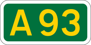
The A93 is a major road in Scotland and the highest public road in the United Kingdom. It runs north from Perth through Blairgowrie and Rattray, then through the Grampian Mountains by way of Glenshee, the Cairnwell Pass and Glen Clunie to Braemar in Aberdeenshire. At Braemar, the road then switches east down the strath of the River Dee before crossing the A90 and terminating in Aberdeen.

Glas Maol is the highest point in the Mounth hills, in the southeastern part of the Highlands of Scotland. The broad, flat summit is divided between the council area of Aberdeenshire, Angus and Perth and Kinross, though the highest point lies wholly within Angus; indeed Glas Maol is the highest point in that council area.
Clan MacThomas is a Highland Scottish clan and is a member of the Chattan Confederation.

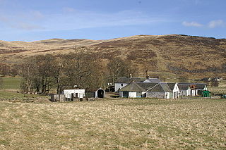
The Spittal of Glenshee lies at the head of Glenshee in the highlands of eastern Perth and Kinross, Scotland where the confluence of many small streams flowing south out of the Grampians form the Shee Water. For centuries, there has been a hostel or inn at the site and, in modern times, the small village has become a centre for travel, tourism and winter sports in the region, sited at a bend on the A93 trunk road which leads from Blairgowrie north past the Spittal to the Glenshee Ski Centre and on to Braemar.
Finegand is a farming hamlet located in eastern Perth and Kinross, Scotland and also refers historically to the portion of lands surrounding the hamlet. Finegand is located in Glen Shee and encompasses the lands east of the Shee Water adjacent to a burn which joins it about 4 miles below the Spittal and about 18 miles north of Blairgowrie.

Glen Shee is a glen in eastern Perthshire, Scotland. Shee Water flows through the glen. The head of the glen, where Gleann Taitneach and Glen Lochsie meet, is approximately 2 km north-west of the Spittal of Glenshee; it then runs south-east to Bridge of Cally where it merges with Strathardle to form Glen Ericht. Once known as the glen of the fairies it takes its name from the Gaelic "sith" meaning fairy and the old meeting place at the standing stone behind the present day church is called Dun Shith or Hill of the Fairies.

Glenshee Ski Centre is the largest ski resort in Scotland and is sometimes referred to as the Scottish three glens. It is located in Aberdeenshire and to the north of Spittal of Glenshee, on the A93 road between Blairgowrie and Braemar in the southern Highlands of Scotland. With 22 lifts, 36 runs and limited snowmaking capabilities, it is Britain's largest snowsports resort.

Morrone is a Scottish hill immediately southwest of the village of Braemar in Aberdeenshire.

The Cairnwell Pass is a mountain pass on the A93 road between Glen Shee, Perthshire, and Braemar, Aberdeenshire, in the Scottish Highlands. The border between the two counties crosses the summit of the pass. With a summit altitude of 670 m (2199 ft), the Cairnwell Pass is the highest main road in the United Kingdom, and at the summit is the Glenshee Ski Centre, Scotland's largest and oldest ski centre. Historically, the pass was a drover's route from the Lowlands to the Highlands. The road is often blocked by snow in the winter, with snow gates at Braemar, at the summit, and at the Spittal of Glenshee.

Kirkmichael is a village located in Strathardle, Perth and Kinross, Scotland. It is 13 miles NNW of Blairgowrie and 12 miles ENE of Pitlochry on the A924 from Bridge of Cally to Pitlochry road and is linked to the A93 Perth to Aberdeen road by the B950. The village is centred around the bridge over the River Ardle.

The Cairnwell is a mountain in the Eastern Highlands of Scotland, south of Braemar. It is often considered to be one of the most spoiled of the Munros, due to the Glenshee Ski Centre which covers the eastern slope of the mountain.

The Cateran Trail is a 103-kilometre (64 mi) circular long distance walking route in central Scotland. The trail has no official beginning or end and can be joined at any stage. The route was established, way-marked and is now maintained by, the Perth & Kinross Countryside Trust. A variety of terrain is covered by the trail including farmland, mountains and forest. The path itself follows old drovers' roads, minor paved roads and farm tracks and can be walked in 4 or 5 days. It is now designated as one of Scotland's Great Trails by Scottish Natural Heritage. As of 2018 it was estimated that around 8,000 people were using the trail each year.
Glas Tulaichean is a large, complex Scottish mountain located approximately 18 kilometres (11 mi) south of Braemar in Perth and Kinross. It is the highest of a group of domed hills which lie in remote land between the head of Glen Tilt and Glen Shee to the east. It is most commonly climbed from the Spittal of Glenshee via Glen Lochsie to the south.

Blair Athol Distillery is a distillery in Scotland that distills Blair Athol single malt whisky. It is used in Bell's whisky, and is also normally available in a 12-year-old bottling. The distillery is located on the south edge of Pitlochry in Perthshire, near the River Tummel.

The River Ardle is a tributary of the River Ericht. It runs for 10 miles (16 km) through Strathardle in Perthshire, Scotland. It is a salmon and trout river.

The River Brora is an east-flowing river in Sutherland in the Highlands of Scotland which is formed as its headwater streams, the Féith Osdail, Allt Gobhlach and Allt nan Con-uisge meet at Dalnessie before flow southeastwards down Strath Brora to Dalreavoch. The river turns briefly northeast then east and then southeastwrads once again to pass through the three distinct basins of Loch Brora to enter the Moray Firth on the North Sea at the town of Brora. Its one principal tributary is the Black Water which enters on its left bank at Balnacoil. The Black Water is itself fed by the River Skinsdale and the Coirefrois Burn.

The River Garry is a major tributary of the River Tummel, itself a tributary of the River Tay, in the traditional county of Perthshire in the Scottish Highlands. It emerges from the northeastern end of Loch Garry (56.8193°N 4.2311°W), just to the southeast of the Pass of Drumochter, and flows southeastwards and eastwards down Glen Garry to the narrow Pass of Killiecrankie beyond which it joins the Tummel (56.7182°N 3.7790°W).

Bridge of Cally is a small village in Kirkmichael parish, Perth and Kinross, Scotland. It sits at the junction of three glens, Glenshee, Strathardle and Glenericht and is centred round the bridge over the River Ardle 200m before it joins the Black Water to form the River Ericht. The A93 road from Perth to Aberdeen crosses the bridge where it forms a junction with the A924 road to Kirkmichael and Pitlochry. The village is on the Cateran Trail long distance path, and is popular in winter as it is near the Glen Shee skiing area.

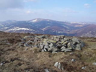
Cairn of Claise is a mountain in the Grampians of Scotland, located about three miles from the Glenshee Ski Center near Braemar.

Clunie Water is a river of Aberdeenshire, Scotland. It is a tributary of the River Dee, joining the river at Braemar, among grey stone buildings. Callater Burn is a tributary of the Clunie; the confluence is at Auchallater. The river flows alongside the A93 road.


